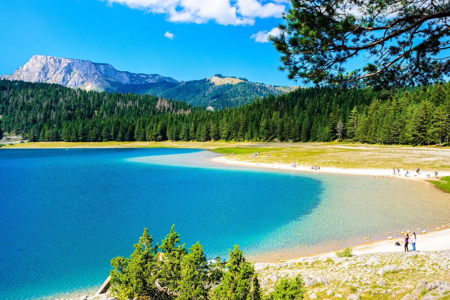
A leisurely circular walk along Crno jezero with a spring, viewpoint, and Čelina waterfall.
An easy circular trail, 3.4 km long, leading around Crno jezero in Durmitor National Park. The ascent is gentle (91 m), and the estimated duration without breaks is 1 h 5 min.
The trail starts and ends near Crno jezero, in Durmitor National Park. The circular route is 3.4 km long and is intended for a leisurely walk. The lowest point of the trail is at 1,422 m a.s.l., and the highest at 1,461 m a.s.l. The total ascent is 91 m and the total descent 95 m.
In the first section, at about 0.4 km from the start, you will find a spring and a viewpoint overlooking the surroundings. A little further along, between 1.2 and 1.5 km, the trail passes by the "Čelina" waterfall. The surface is mostly dirt and forest path (71%), and partly gravel road (26%).
The route is circular and easy. It is suitable for family walks and recreational hikers. The estimated duration of the walk without longer breaks is 1 h 5 min. The trail is marked.
Çfarë do të thotë kjo vështirësi
Shtigje të mirëmbajtura me pjerrësi të butë. Të përshtatshme për familje dhe për këdo që është mësuar të ecë disa orë.
Lëviz përgjatë profilit për ta ndjekur itinerarin në hartë; aktivizo 3D për relievin.
↑ 91 m · ↓ 95 m · pika më e lartë 1461 m
Gjatë rrugës
At 0.4 km from the start of the trail, there is a spring at 1,446 m a.s.l.
At 0.4 km from the start of the trail, there is a viewpoint at 1,464 m a.s.l.
The waterfall is located between 1.2 and 1.5 km from the start of the trail, at an altitude of approximately 1,455–1,456 m a.s.l.
Wear comfortable, closed footwear suitable for walking on dirt and gravel surfaces.
Bring enough water and a light snack, especially during the warmer months.
Set out early in the morning or in the late afternoon during July and August to avoid the strongest sun.
Follow the trail markers and stay on the marked path.
Check the weather forecast before setting out; in the mountains, the weather changes quickly.
In mountain conditions, the weather can change quickly; bring rain and wind protection. Stay on the marked trail and do not stray from the route. In case of an emergency, call 112.
Numri i emergjencës në Mal të Zi: 112.
Mirë të dihet
Sezoni më i mirë
The best months to visit are May, June, July, August, September, and October. Outside that period, at this altitude it can be wet and cold.
Si të shkosh
The trailhead is about 0.5 km from Crno jezero. Žabljak is about 2.3 km from the trail.
The circular trail is 3.4 km long.
The estimated duration without breaks is 1 h 5 min.
The trail is easy and suitable for recreational hikers.
The best months to visit are May, June, July, August, September, and October.
5,4 km↑ 76 m1½–2 orë
42,4 km↑ 1630 m2–3 ditë
4,4 km20–30 min
8,9 km↑ 1244 m5½–7½ orë
11,7 km↑ 1090 m5½–8 orë
0,9 km15–20 min
78,8 km↑ 2501 m3–5 ditë

143 km↑ 5436 m6–9 ditë
Kohët dhe shkallët e vështirësisë janë të përafërta. Kushtet ndryshojnë: kontrollo motin dhe informacionin vendor para se të nisesh.

Pyesni per Malin e Zi
Pyesni per destinacione, restorante ose aktivitete.
