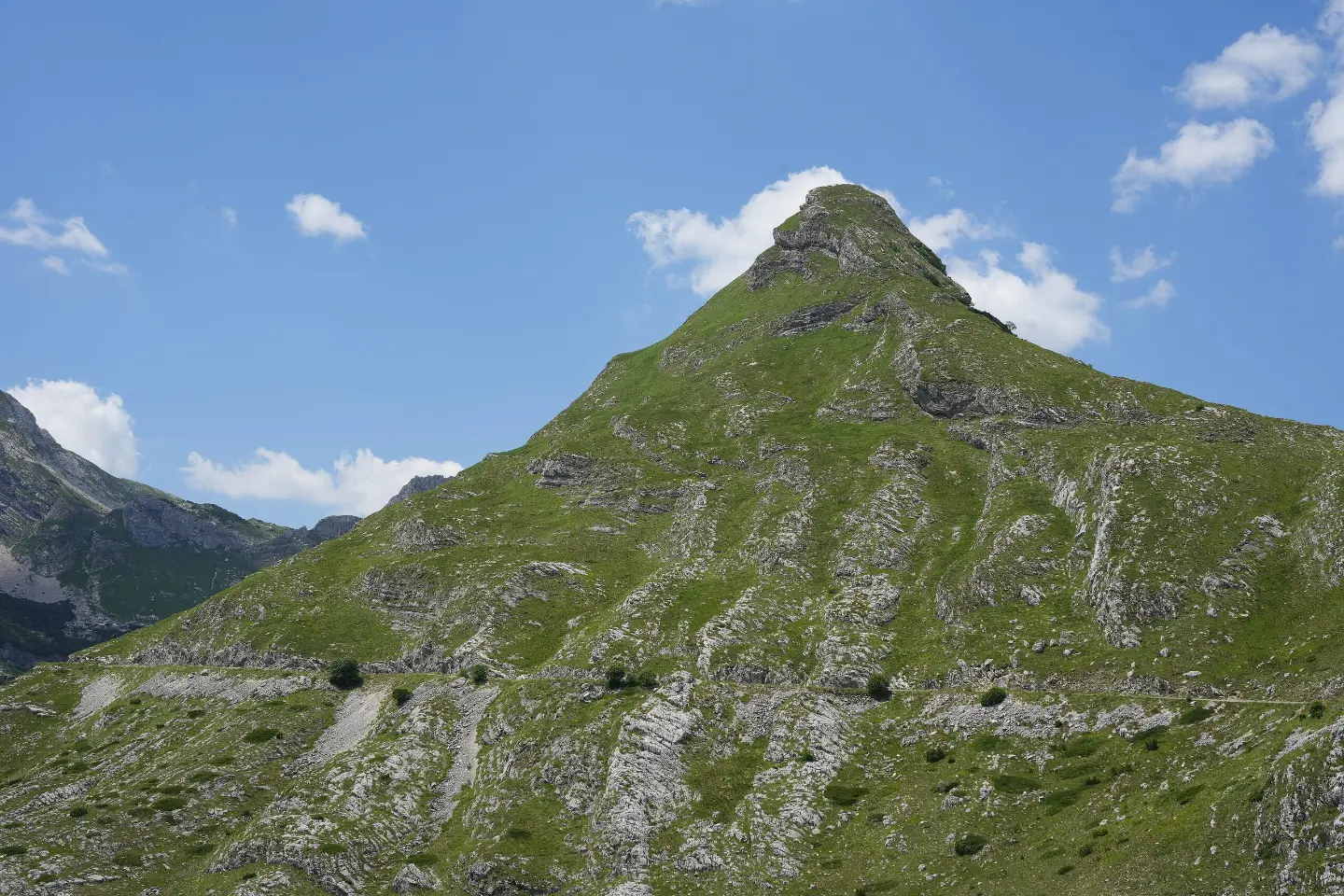
A demanding cycling tour through Durmitor National Park, with a mix of asphalt and gravel roads and numerous viewpoints.
The KR-DU cycling trail is 81.6 km long, with a total ascent of 2135 m and a descent of 2234 m. It passes through Durmitor National Park, along drinking fountains, springs, viewpoints and campsites; the estimated riding time without breaks is around 9 h 40 min.
The KR-DU trail is a demanding one-way cycling route, 81.6 km long. It starts near Vražje jezero in Durmitor National Park. The lowest point of the trail is at 672 m a.s.l., and the highest at 1908 m a.s.l. The total ascent is 2135 m, and the total descent 2234 m.
The estimated riding time without breaks is 9 hours and 40 minutes, so a multi-day tour is recommended. The surface is mostly asphalt or concrete (70 %), followed by gravel (24 %) and dirt or forest track (6 %).
Along the route there are drinking fountains and springs, a shelter at 1434 m a.s.l. (39.2 km) and several viewpoints. Among the notable points are the "Sedlo" pass at 1907 m a.s.l. (20.2 km) and a series of viewpoints at elevations ranging from 871 m to 1907 m a.s.l. Along the trail there are the "Etno Selo Katun" campsite (1558 m a.s.l., 13.8 km), "Torba" (1681 m a.s.l., 24.5 km) and "The Crossroads Preseka" (1035 m a.s.l., 76.3 km).
Due to the length and total ascent, the trail is suitable for well-prepared cyclists. Splitting the route over several days and careful planning of sections with regard to changes in elevation is recommended.
Was diese Schwierigkeit bedeutet
Lange Distanzen, große Anstiege oder technische Abschnitte. Für fitte, erfahrene Radfahrer.
Fahre über das Profil, um der Route auf der Karte zu folgen; schalte 3D für das Gelände ein.
↑ 2.135 m · ↓ 2.234 m · höchster Punkt 1.908 m
Unterwegs
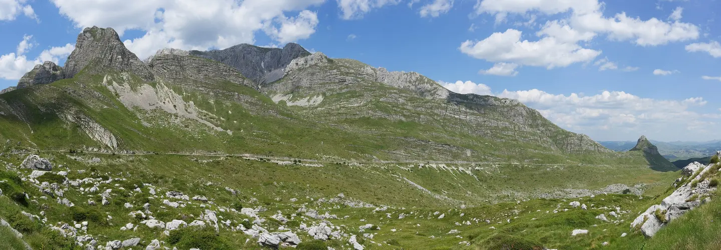
The "Sedlo" pass at 1907 m a.s.l. is located 20.2 km from the start of the trail and offers views from the highest point of the route.
Along the trail there is a drinking fountain at 1543 m a.s.l. (13.3 km) and springs, including the "Studenac" spring at 1807 m a.s.l. (18.6 km).
The shelter is located 39.2 km from the start of the trail, at an elevation of 1434 m a.s.l.
Along the trail are the "Etno Selo Katun" campsite (1558 m a.s.l., 13.8 km), the "Torba" campsite (1681 m a.s.l., 24.5 km) and the "The Crossroads Preseka" campsite (1035 m a.s.l., 76.3 km).
The trail passes through Durmitor National Park, in a mountain setting with an elevation range from 672 m to 1908 m a.s.l.
Bring enough water and food, even though there are drinking fountains and springs along the trail; do not rely on them alone.
Check the weather forecast before setting off; the trail reaches 1908 m a.s.l. and sudden weather changes are possible in the mountains.
Plan a multi-day ride or split the route into stages, as the estimated riding time without breaks is 9 hours and 40 minutes.
Carry basic tools and spare parts for your bike, as parts of the trail have gravel and dirt surfaces.
Start early in the morning, especially in the summer months, to avoid the hottest part of the day and to have enough daylight.
Be careful on gravel and dirt sections, especially at higher elevations.
The trail reaches an elevation of 1908 m a.s.l. In the mountains, sudden weather changes, fog and thunderstorms are possible. Monitor weather conditions and bring equipment for all conditions. In an emergency, call 112.
Notruf in Montenegro: 112.
Gut zu wissen
Beste Jahreszeit
Due to high points reaching 1908 m a.s.l., the best period for riding is from late spring to early autumn, when temperatures are moderate and the trails are passable. In winter and early spring, snow and ice can make riding difficult.
Anreise
The start of the trail is approximately 2.3 km from Vražje jezero in Durmitor National Park.
The trail is 81.6 km long.
The estimated ride duration without breaks is 9 hours and 40 minutes; a multi-day tour is recommended.
The trail is demanding according to our scale, with a total ascent of 2135 m and descent of 2234 m.
No, the trail is one-way; the start and end are not at the same location.

406 km↑ 10.191 m6–8 Tage
1,7 km↑ 10 m20–30 Min.

413 km↑ 8.566 m5–8 Tage

399 km↑ 9.352 m5–8 Tage
4,2 km↑ 91 m70–95 Min.
Rundtour
10,3 km↑ 143 m3½–4½ Std.
6,7 km↑ 808 m5½–8 Std.
5,8 km↑ 331 m2½–3½ Std.
Zeiten und Schwierigkeitsgrade sind Schätzungen. Die Bedingungen ändern sich: Prüfe vor dem Aufbruch das Wetter und lokale Informationen.

Fragen Sie über Montenegro
Fragen Sie mich über Reiseziele, Restaurants oder Aktivitäten.
