A short and demanding one-way hiking trail on rocky terrain: 2.2 km, descent 319 m.
Bioč is a one-way hiking trail 2.2 km long. It is demanding (T3) and leads over rocky terrain, with an ascent of 6 m and a descent of 319 m; the estimated walking time is 55 min.
The Bioč trail is a one-way hiking route 2.2 km long. It is mostly downhill: total ascent is 6 m and total descent is 319 m. The highest point of the trail is at 2,078 m a.s.l. and the lowest at 1,761 m a.s.l.
The terrain is 100% rocky. For this reason the trail is rated demanding on our scale and carries the designation T3 on the SAC hiking scale. A sure footing, sturdy hiking footwear and caution on the rocky sections are required.
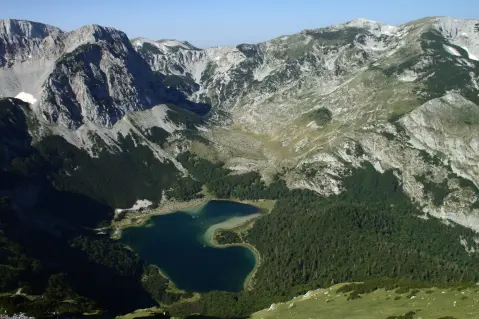
At 0.9 km from the start there is the spring Izvor (1,889 m a.s.l.). Nearby are also Trnovačko jezero, approximately 2.4 km from the start of the trail, and Stabanska jezera, approximately 5.3 km from the trail. The trail is marked with red circular markers with a white dot.
The estimated walking time without breaks is 55 min. Since the trail is one-way, logistics for the return or onward journey must be planned in advance.
Co oznacza ten poziom trudności
Strome, skaliste lub eksponowane fragmenty i długi dzień w terenie. Dla wysportowanych turystów z pewnym krokiem i doświadczeniem górskim.
Skala trudności SAC T3 (skala T1–T6).
Miejsca na trasie
Przesuwaj po profilu, by śledzić trasę na mapie; włącz 3D, aby zobaczyć ukształtowanie terenu.
↑ 6 m · ↓ 319 m · najwyższy punkt 2078 m
Po drodze
Located 0.9 km from the start of the trail, at 1,889 m a.s.l.
The nearest place to the start of the trail, approximately 2.4 km away.
Near the trail, approximately 5.3 km away.
Wear sturdy hiking footwear – the entire trail is rocky.
Bring enough water, especially during the warmer part of the year.
Check the weather forecast before setting out; mountain weather changes quickly.
Start early in the morning, especially during summer.
The trail is one-way – plan your return or transportation in advance.
The trail is demanding and passes over rocky terrain at altitudes of 1,761–2,078 m a.s.l. In the mountains, fog, wind and thunderstorms are possible, so monitor weather conditions and do not set out if conditions are poor. The emergency number in Montenegro is 112.
Numer alarmowy w Czarnogórze: 112.
Warto wiedzieć
Najlepsza pora
Due to the altitude (1,761–2,078 m a.s.l.), the most favourable periods for this trail are usually from late spring to early autumn. In winter and early spring the rocky terrain can be slippery or covered with snow.
Dojazd
The nearest place to the start of the trail is Trnovačko jezero, approximately 2.4 km away.
The length of the trail is 2.2 km.
The estimated duration without breaks is 55 minutes.
It is rated demanding on our scale and T3 on the SAC hiking scale. The terrain is 100% rocky.
Yes, the trail is marked with red circular signs with a white dot.
1,3 km↑ 69 m20–30 min
2,3 km↑ 69 m50–70 min
1,7 km↑ 225 m50–70 min
2,0 km↑ 456 m1½–2 godz.
23,1 km↑ 1562 m2–3 dni
1,2 km↑ 318 m65–90 min
4,2 km↑ 291 m1½–2 godz.
8,3 km↑ 1364 m5–7 godz.
Czasy i stopnie trudności są szacunkowe. Warunki się zmieniają: przed wyjściem sprawdź pogodę i lokalne informacje.

Zapytaj o Czarnogórę
Zapytaj mnie o destynacje, restauracje lub aktywności.
