Travel to Montenegro
Riblje jezero
Grčka strana, NP Durmitor

Riblje jezero

A glacial lake at 1,409 m in the heart of Durmitor, 10 km from Žabljak

Overview

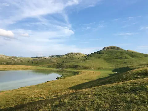
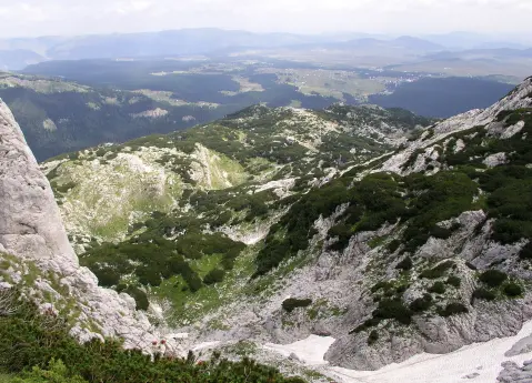
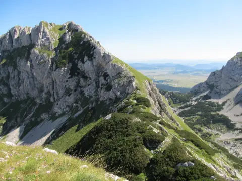
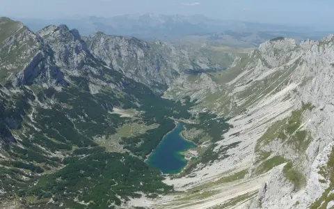
Riblje jezero is one of 18 glacial lakes in Durmitor National Park, situated at an elevation of 1,409 m in a valley known as Grčka strana.

It lies approximately 10 km from Žabljak and just 500 m from Vražje jezero, making it a natural destination for day trips. The lake is glacial in origin, formed by the accumulation of water in an inter-moraine depression, with a maximum depth of 5.5 m. It takes its name from its rich fish stock – particularly large specimens of brown trout. In the immediate vicinity of the lake are stećci protected by UNESCO, lending this area additional cultural and historical significance.

  • Glacial Lake
  • Durmitor
  • Fishing
  • UNESCO
  • Hiking
  • Nature
Highlights

Discover Riblje jezero

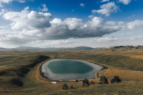
Fish Lake – Greek side

Fish Lake – Greek side

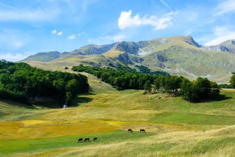
Situated in the valley known as Grčka strana, at an elevation of 1,409 m, this glacial lake was formed by the accumulation of water in an inter-moraine depression left behind after a glacier melted. The maximum depth is 5.5 m. Unlike most Durmitor lakes surrounded by coniferous forest, Riblje jezero lies on open mountain meadows that bloom with wildflowers in the summer months. It takes its name from the legend of large brown trout specimens that supposedly stretched from one end of the road to the other.
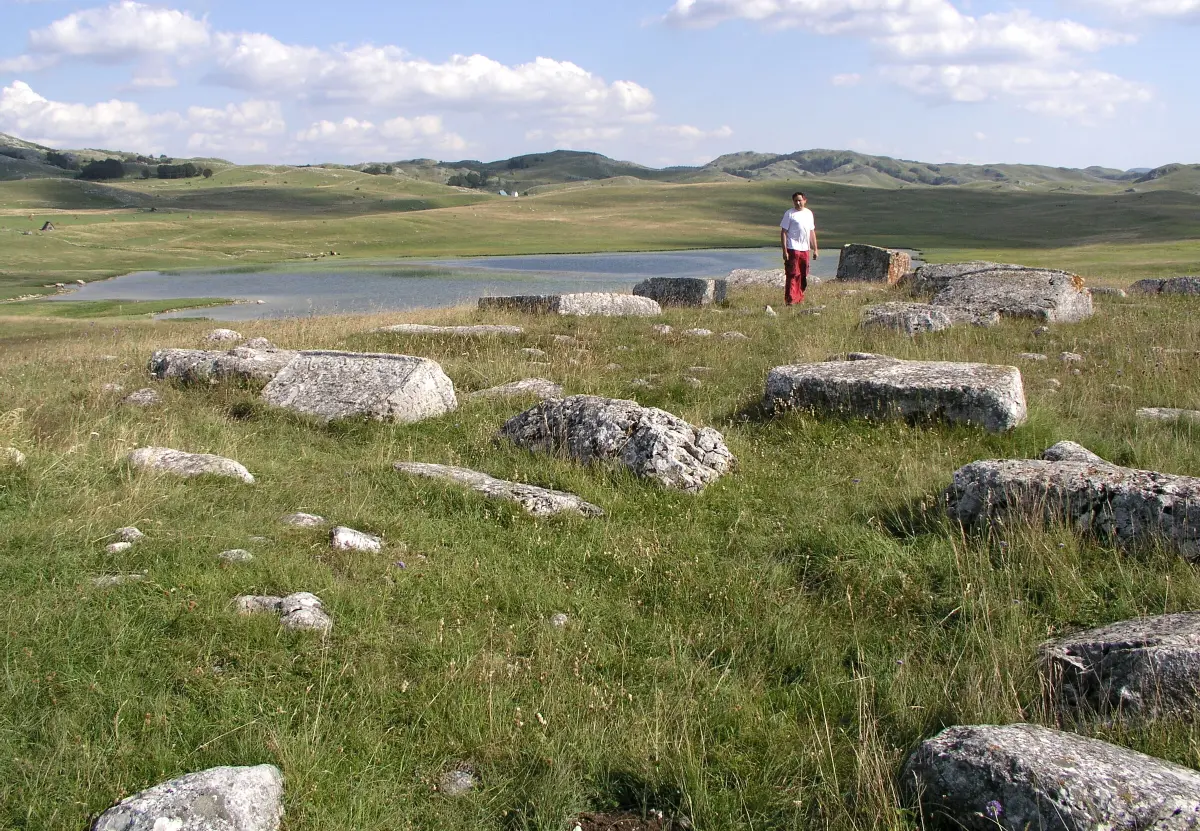
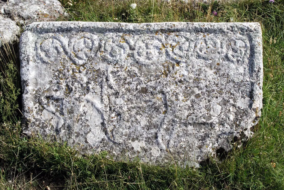
Stećci near Riblje jezero – UNESCO

Stećci near Riblje jezero – UNESCO

In the immediate vicinity of Riblje jezero are stećci, medieval tombstones inscribed on the UNESCO World Heritage List in 2017. This necropolis, known as Grčko groblje, is part of a wider network of Durmitor stećci that also includes the site at Bare Žugića. The stećci were created during the 14th and 15th centuries and are decorated with symbolic motifs. Visiting these monuments adds a historical and cultural dimension to a trip to Riblje jezero that is rarely found combined with a mountain lake landscape.

Vražje jezero – 500 m from Riblje jezero

Vražje jezero – 500 m from Riblje jezero

Just 500 metres from Riblje jezero lies Vražje jezero at an elevation of 1,411 m, one of the most attractive Durmitor lakes, known for its clear water and summer swimming. The lake is surrounded by the open meadows of Sinjajevina, and to its right there is a small rise offering a panoramic view popular for photography. Folk legends are associated with both lakes – according to one, the famous horse of Duke Momčilo, Jabučilo, bathed in Vražje jezero. A combined visit to both lakes is recommended as a single route that can be completed in under two hours.

Scenic road Žabljak–Šavnik

Scenic road Žabljak–Šavnik

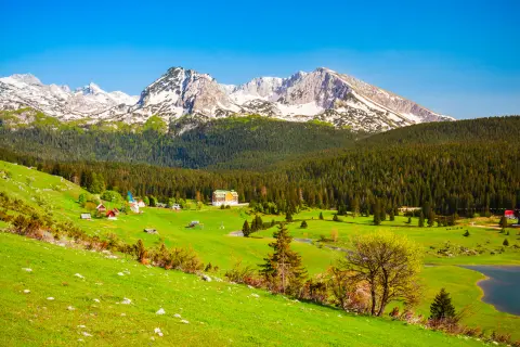
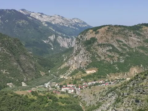
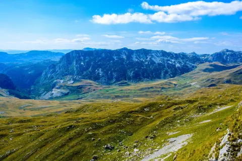
The road leading from Žabljak towards Šavnik, along which you pass to reach Riblje jezero, is a tourist attraction in its own right. It passes through Durmitor's lake plateau, also known as Drobnjačka površ – a gentle mountain area that stands in sharp contrast to the rocky alpine peaks for which Durmitor is renowned. Alongside the lake, the route passes flocks of sheep and cattle, rural homesteads, and unobstructed panoramas. From this route you can take in the expanse of Sinjajevina, one of the largest mountain plateaus in the Balkans, and understand why this part of Durmitor is so different from the one visitors see near Crno jezero.

What to do

Activities in Riblje jezero

  • Recreational Fishing

    Food & wine

    Recreational Fishing

    Fishing for brown trout on designated fishing days with catch limits.

  • Hiking

    Mountains

    Hiking

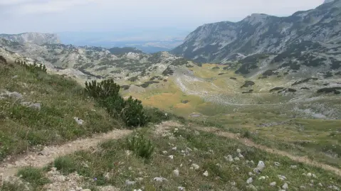
    Easy walking trails through the meadows of Grčka strana towards Vražje jezero and surrounding paths.

  • Photography

    Culture

    Photography

    Capturing open meadow landscapes, the lake, and panoramic views of the Durmitor massif without tree cover.

  • Visiting the Stećci

    Culture

    Visiting the Stećci

    Exploring the UNESCO stećci necropolis situated immediately beside Riblje jezero.

Around here

Nearby places

  1. Vražje jezero

    Vražje jezero

    Lake · 0.9 km

    A glacial lake on the Jezersko-Drobnjačka plateau, 630 m long, surrounded by open pastures along the old caravan route Nikšić–Pljevlja.

  2. Žabljak

    Žabljak

    City · 7.5 km

    Žabljak is a mountain town at 1,456m above sea level, the tourism hub of Durmitor and the starting point for 18 glacial lakes and the Tara Canyon.

  3. Crno Jezero

    Crno Jezero

    Lake · 7.6 km

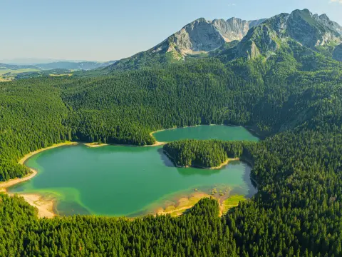
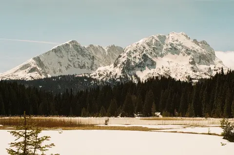
    The largest glacial lake of Durmitor, located 3 km from Žabljak at 1,418 m above sea level, surrounded by dense pine forest.

  4. Zminičko Lake

    Zminičko Lake

    Lake · 7.8 km

    A glacial lake at an altitude of 1,285 m, located near the village of Zminica at the foot of Mount Sinjajevina.

  5. Durmitor National Park

    Durmitor National Park

    National Park · 9.3 km

    Mountain massif in northwestern Montenegro with 48 peaks, 18 glacial lakes and one of the deepest canyons in Europe.

  6. Tara River Canyon

    Tara River Canyon

    Canyon · 13 km

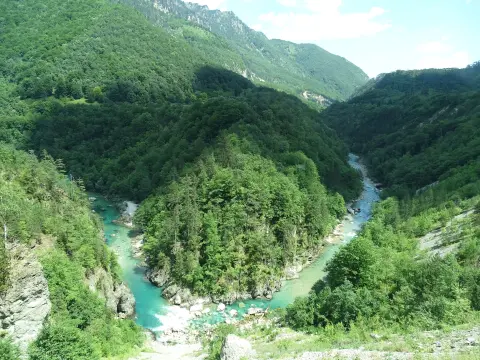
    The Tara canyon is 78 km long and up to about 1,300 m deep; the Đurđevića Tara bridge of 1940 spans it, and the river is run by raft.

  7. Nevidio Canyon

    Nevidio Canyon

    Canyon · 14 km

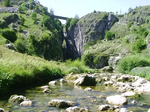
    A narrow gorge of the Komarnica river near Pošćenje, in Šavnik municipality. First passed in 1965, it is now visited only with licensed guides.

  8. Šavnik

    Šavnik

    City · 16 km

    Šavnik is a small mountain town in central Montenegro, known for the Nevidio canyon and the unique natural phenomenon of a double sunrise.

Plan Your Visit

Weather & Useful Info

When to come

Monthly averages – Žabljak.

  • Jan: Air (max) 0 °C
  • Feb: Air (max) 2 °C
  • Mar: Air (max) 3 °C
  • Apr: Air (max) 8 °C
  • May: Air (max) 14 °C
  • Jun: Air (max) 19 °C
  • Jul: Air (max) 22 °C
  • Aug: Air (max) 22 °C
  • Sep: Air (max) 16 °C
  • Oct: Air (max) 13 °C
  • Nov: Air (max) 6 °C
  • Dec: Air (max) 2 °C
Air (max)Best time to visit
Climate and weather – Žabljak
June to September is the optimal period – the roads are passable, the meadows are green, and the temperature is pleasant. Late June and July are particularly beautiful when the surrounding meadows are in full bloom. Fishing is permitted on designated days – check current fishing dates with the local fishing club.

Visitor tip

The lake is reached via the asphalt road Žabljak–Šavnik, turning left at the monument at Banske kuće. Set off in the morning – there is no shade on the open meadows. Bring a jacket as the temperature at 1,409 m is considerably lower than in the valley. Combine the visit with Vražje jezero (500 m away) and the nearby stećci – all are accessible on foot.

Good to know

Opening hours
Accessible all day; the national park may charge entry at certain entry points
Admission
Entry to Durmitor NP is charged at marked entry points (prices may vary by season – check zabljaktravel.me)
Parking
Informal parking along the road by the lake; no parking fees
Accessibility
The terrain around the lake is open and fairly flat, but not suitable for wheelchair users; the road to the lake is paved

Getting Here

By Plane

The nearest airport is Podgorica (TGD), about 145 km from Žabljak (about 2h 30min drive). Tivat Airport (TIV) on the coast is an alternative, with similar travel time.

By Car

From Žabljak, take the asphalt road towards Šavnik; the left turn is located at the monument at Banske kuće, approximately 15 km from the centre of Žabljak. The road can be driven in a standard car, but be prepared for encounters with flocks of sheep and cattle on the road.

By Bus

There are no direct bus connections to Riblje jezero. Žabljak is connected by bus to Podgorica, Nikšić, and Pljevlja. From Žabljak, you will need to use a car rental or taxi to continue.

Open in Google Maps
Day plan

Suggested Itineraries

Lakes of Grčka strana – one day

  1. Day 1 · Greek side, Durmitor National Park

    Vražje jezero, Riblje jezero and the stećci

    In the morning, set off from Žabljak along the asphalt road towards Šavnik – the left turn at Banske kuće leads to Grčka strana, approximately 15 km from the centre of Žabljak. The first stop is Vražje jezero (1,411 m), which is a popular swimming spot in summer and has a viewpoint offering views over the open meadows of Sinjajevina. From Vražje jezero, just 500 m on foot, you reach Riblje jezero at 1,409 m. This is an ideal spot for a short break, photography, and – if you have a licence and appropriate equipment – recreational fishing (brown trout, on designated fishing days). Pay particular attention to the stećci located immediately beside the lake – these form part of the UNESCO necropolis inscribed in 2017. There are no restaurants on site, so bring food and water from home, or get used to having breakfast and lunch in Žabljak – the Crno jezero restaurant or local cafés in the centre offer national cuisine. Return to Žabljak in the late afternoon. Insider tip: There is no shade on the open meadows – bring a hat and sunscreen even on a cloudy day.
FAQ

Frequently Asked Questions

Take the asphalt road towards Šavnik and turn left at the monument at Banske kuće, approximately 15 km from the centre of Žabljak. The road is passable by standard car, but it is narrow and you should expect livestock on the road.

Fishing is permitted on designated fishing days, with a valid fishing licence. The lake is rich in brown trout. Current dates and conditions should be checked with the local fishing club or the Žabljak tourist organisation.

Just 500 m from Riblje jezero is Vražje jezero, a popular summer swimming spot. The stećci – a UNESCO necropolis inscribed in 2017 – are also in the immediate vicinity. From Savina kuka, the cable car offers a panoramic view of both lakes.

Riblje jezero is one of 18 glacial lakes of Durmitor NP, although it territorially belongs to the Sinjajevina zone. Durmitor National Park has been on the UNESCO World Cultural and Natural Heritage List since 1980.

The period from June to September is most suitable – the roads are passable, the meadows are green, and the temperature at 1,409 m elevation is pleasant for walking. Late June and July are particularly attractive due to the flowering meadows around the lake.