Travel to Montenegro
Šiško Lake
Bjelasica, Berane Municipality

Šiško Lake

Glacial lake on Bjelasica, 1,660 m above sea level

Overview

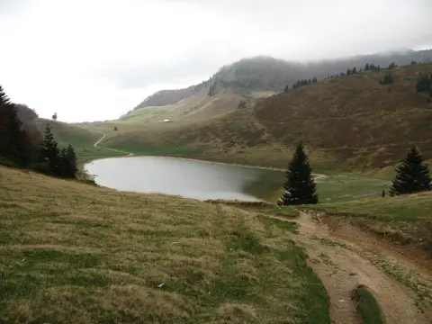
Veliko Šiško Lake is situated in the central part of Bjelasica mountain, in an area known as Šiška planina, at an elevation of 1,660 m above sea level.

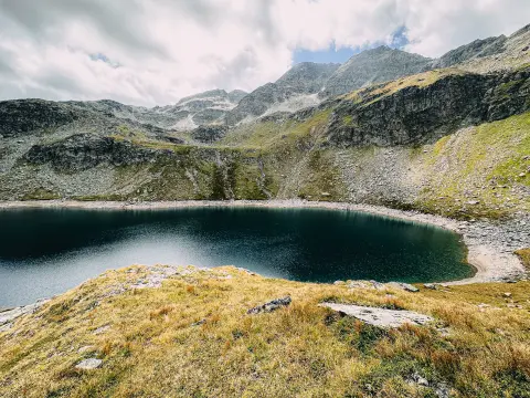
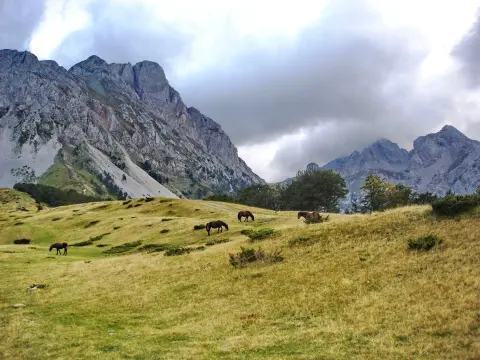
The lake is of glacial origin and receives water from snowmelt, atmospheric precipitation, and occasional tributaries. It is approximately 400 m long and 140 m wide, with a depth reaching 3 m at high water levels. It is surrounded by katuns and forest, and about 1 km to the south lies Malo Šiško Lake, known for its intensely green water. Šiško Lake is the starting point for hiking routes that connect all the glacial lakes of Bjelasica, including Biogradsko, Ursulovačka, and Ševarinsko lake.

  • Glacial Lake
  • Hiking
  • Bjelasica
  • Alpine Landscape
  • Nature
  • Photography
  • Montenegro
Highlights

Discover Šiško Lake

Veliko Šiško Lake

Veliko Šiško Lake

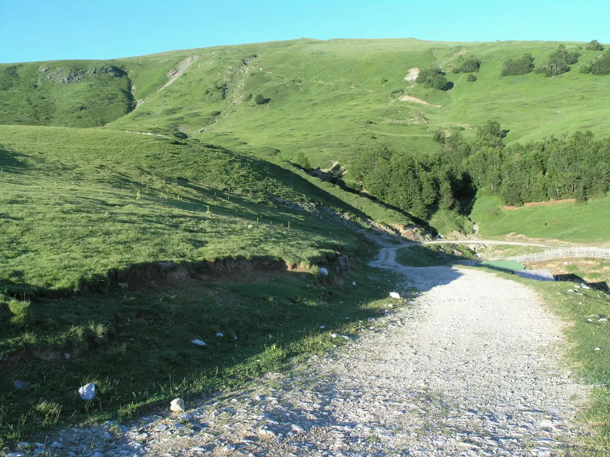
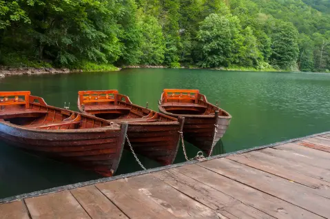
A lake of glacial origin situated at 1,660 m above sea level in the Šiška planina area, the central part of Bjelasica. It is approximately 400 m long and 140 m wide, with a maximum depth of 3 m. It is surrounded by mountain katuns and dense forest whose canopies take on spectacular colours in autumn. The water is fed by snowmelt and rainwater, and the level varies throughout the season. The lake is accessible by gravel road from the village of Kurikuće, making it one of the few glacial lakes in Bjelasica that can be reached by car.

Malo Šiško Lake

Malo Šiško Lake

Located 1 km to the south of Veliko Šiško Lake, at an elevation of 1,780 m, Malo Šiško Lake is known for its intensely green water colour that visually sets it apart from all other lakes on Bjelasica. It is more modest in size – approximately 105 m long and 65 m wide – but it is precisely this compactness and the lush vegetation along its shores that make it particularly striking. The area around the lake is covered with pasture vegetation, and the livestock shelters and katuns give it an authentic mountain atmosphere. It is easily reached on foot via a circular trail from Veliko Šiško Lake in about 30 minutes.

Šiška – Ursulovačka Lakes Circular Trail

Šiška – Ursulovačka Lakes Circular Trail

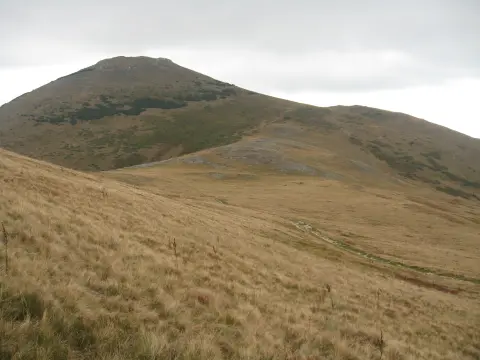
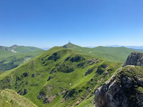
The marked circular trail, 9.2 km long, starts from the Šiška katun at 1,680 m and passes by Veliko and Malo Šiško lakes, ascends to Jusin brijeg at 1,956 m – the highest point of the trail – then descends to Ursulovačka jezera at 1,892 m and returns past Ševarinsko lake. The trail is rated as moderately difficult, with a total ascent of around 276 m, and the hike takes about 3 hours. From the trail you can see all the key peaks of Bjelasica: Crna glava (2,139 m), Zekova glava, Troglava and Strmenica. There are several drinking water springs along the trail, including a fountain at the Šiška katun at the very beginning.

  • Đurđevi stupovi Monastery – Berane

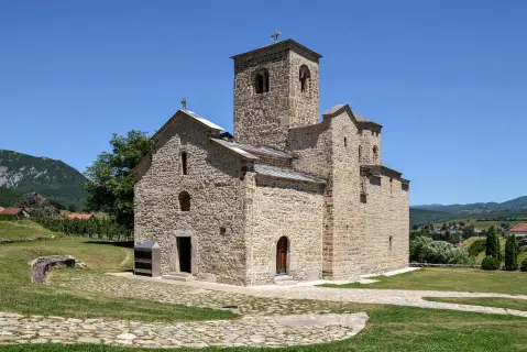
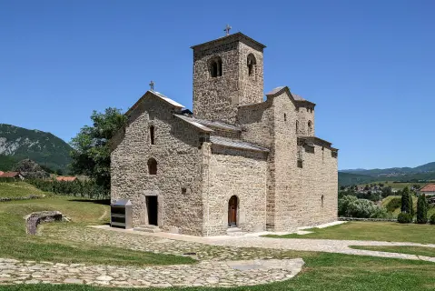
    Just 20 km from the starting point for Šiško Lake, in Berane itself, stands Manastir Đurđevi stupovi, built in the mid-13th century. This monastery is one of the finest and most significant preserved examples of medieval construction in Montenegro. The town of Berane lies on the banks of the river Lim, and its rich cultural and historical heritage justifies its epithet as a city resting on the Holy Waters of the Lim. Combining a visit to the monastery with a trip to Šiško Lake makes for an ideal full-day itinerary from Berane.

What to do

Activities in Šiško Lake

  • Hiking

    Mountains

    Hiking

    A 9.2 km circular trail from the katun Šiška connects Veliko and Malo Šiško Lake and takes about 3 hours.

  • Photography

    Culture

    Photography

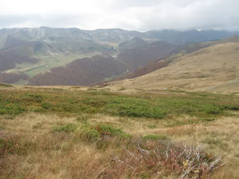
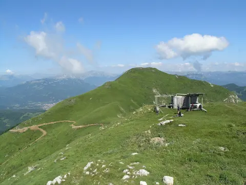
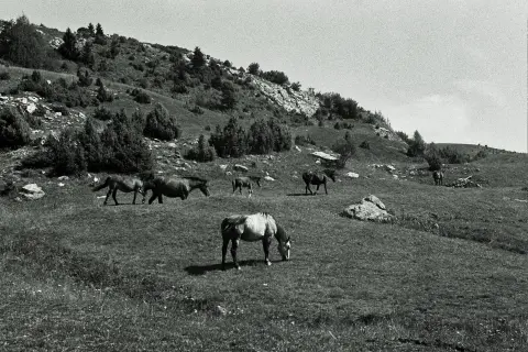
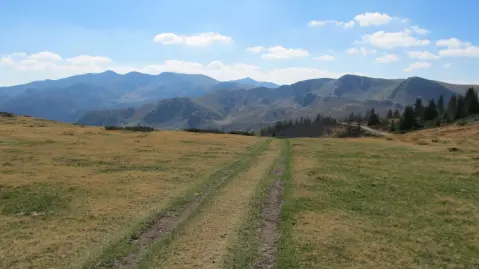
    From the rises on both sides of the lake, views open up over the alpine landscape of Bjelasica and the mountain peaks.

  • Nature watching

    Nature

    Nature watching

    The area around the lake is rich in mountain flora and fauna, and katun homesteads are located nearby.

  • Multi-day trekking

    Mountains

    Multi-day trekking

    Šiško Lake is a waypoint on transversal trails connecting Biogradsko, Ursulovačka, and Ševarinsko lake.

  • Camping

    Mountains

    Camping

    Overnight stays in authentic mountain cabins are possible at the surrounding katuns, with home-cooked food and drinking water at the spring.

Around here

Nearby places

  1. Biogradska Gora National Park

    Biogradska Gora National Park

    National Park · 3.1 km

    Montenegro's smallest national park preserves a primeval forest reserve up to 500 years old on Mount Bjelasica.

  2. Bjelasica

    Bjelasica

    Mountain · 4.3 km

    A mountain of volcanic origin in northern Montenegro, with Crna Glava (2,139 m), six glacial lakes, Biogradska Gora and the Kolašin 1450 and 1600 ski centres.

  3. Pešića Lake

    Pešića Lake

    Lake · 4.9 km

    Pešića Lake is a mountain lake near Berane, nestled on Bjelasica – the only Montenegrin mountain of volcanic origin.

  4. Mojkovac

    Mojkovac

    City · 10 km

    Mojkovac is a mountain town at 853 m above sea level, nestled in the valley of the Tara River between Bjelasica, Sinjajevina and two national parks.

  5. Kolašin

    Kolašin

    City · 15 km

    A mountain town in northern Montenegro, at the foot of Bjelasica, with 45 km of ski slopes and Biogradska gora National Park nearby.

  6. Đurđevi Stupovi Monastery

    Đurđevi Stupovi Monastery

    Religious Site · 16 km

    Đurđevi Stupovi Monastery is an endowment of Stefan Prvoslav from 1213, situated on a hill above the Lim River, about 2 km from the centre of Berane.

  7. Berane

    Berane

    City · 17 km

    Berane is a town at 670 m above sea level in the Lim valley, surrounded by Bjelasica and Cmiljevica, with a rich cultural and historical heritage.

  8. Komovi

    Komovi

    Mountain · 24 km

    A detached mountain massif in eastern Montenegro with three summits above 2,400 m – Kučki, Vasojevićki and Ljevorečki Kom – and the Štavna, Ljuban and Carine katuns.

Plan Your Visit

Weather & Useful Info

When to come

Monthly averages – Mojkovac.

  • Jan: Air (max) 4 °C
  • Feb: Air (max) 8 °C
  • Mar: Air (max) 10 °C
  • Apr: Air (max) 14 °C
  • May: Air (max) 19 °C
  • Jun: Air (max) 24 °C
  • Jul: Air (max) 28 °C
  • Aug: Air (max) 27 °C
  • Sep: Air (max) 21 °C
  • Oct: Air (max) 17 °C
  • Nov: Air (max) 11 °C
  • Dec: Air (max) 7 °C
Air (max)Best time to visit
Climate and weather – Mojkovac
June – October. The lake is most accessible from June to October, when the gravel roads are passable. Autumn (September – October) brings spectacular colours to the forests and katuns around the lake. Winter visits are not recommended due to possible snow and inaccessible roads.

Visitor tip

Head out from Berane towards Lubnice and follow the road along the Bistrica valley – the first 3 km from Lubnice is poor asphalt, the rest is good gravel road passable by regular cars. There is a mountain hut and a drinking water spring at the katun Suvodo. Wear hiking boots, as the terrain can be slippery. Avoid visiting in late October and November, when snow may fall. Summer and early autumn are the ideal periods.

Good to know

Opening hours
Accessible all year round; best access from June to October
Admission
The lake is in Biogradska Gora National Park: the daily park entrance fee is €4 per person, children up to 15 years do not pay (price list at nparkovi.me).
Parking
Informal parking at the Šiška katun (shepherds' settlement) and along the gravel road to the lake
Accessibility
Not suitable for people with reduced mobility – access only via hiking trails and a gravel road

Getting Here

By Plane

The nearest airport is Podgorica Airport (TGD), approximately 130 km from Berane. The drive from Podgorica to Berane takes about 2 hours via the motorway and main road heading north. Tivat Airport (TIV) is further away, approximately 170 km from Berane.

By Car

From Berane, head towards Andrijevica, then turn right towards the village of Lubnice. From Lubnice, the road follows the Suvodo stream to the village of Kurikuće, then continues on gravel road to the katun beneath Šiška planina and the lake. The total distance from Berane to the lake is 20 km. The first 3.2 km from Lubnice is poorer asphalt; the rest is good gravel road passable by regular passenger cars.

By Bus

There are no direct bus lines to the lake. You can take a bus to Berane from Podgorica, Bijelo Polje, or Kolašin, and from there continue by taxi or rented vehicle to Lubnice and the lake.

Open in Google Maps
Day plan

Suggested Itineraries

A Day at Šiško Lake from Berane

  1. Day 1 · Katun Šiška, Bjelasica

    Šiško and Malo Šiško Lake – circular trail

    In the morning, set out from Berane towards the village of Lubnice, following the road along the Bistrica valley. The first few kilometres are asphalt, then a good gravel road continues, passable by regular cars. At the katun Suvodo, fill your water bottles at the spring beside the mountain hut – this is the last reliable water source before the lake. The drive from Berane to Veliko Šiško Lake is 20 km. The lake suddenly opens up before you after the last switchbacks – it is about 400 m long, and in the summer months is surrounded by green katuns and forest filled with birdsong. Climb the rise on either side of the lake for a panoramic view of Bjelasica and the surrounding peaks – this is also the most popular spot for photography. Continue on foot southward along the circular trail to Malo Šiško Lake, approximately 1 km away. The smaller lake has a striking, intensely green colour, surrounded by pasture vegetation and livestock shelters. The 9.2 km circular trail takes about 3 hours. Bring homemade cheese and pršut from Berane for a break beside the lake. We recommend returning to Berane in the afternoon, while the gravel road is still clearly visible.
FAQ

Frequently Asked Questions

From Berane, head towards Andrijevica, then turn right towards the village of Lubnice. From Lubnice, the road continues to the village of Kurikuće, then via gravel road to the katun Šiška and the lake. The total distance from Berane to the lake is 20 km and the road is passable by regular passenger cars, noting that the last few kilometres are gravel.

The lake is most accessible from June to October, when the gravel roads are passable and safe to drive. Early autumn (September–October) is particularly favourable due to the autumn leaf colours. Winter and late-autumn visits are not recommended due to possible snow and inaccessible roads.

You can drive directly to the lake from Berane (20 km). The circular hiking trail from the katun Šiška, which takes in Veliko and Malo Šiško Lake, is 9.2 km long and takes about 3 hours. The trail is rated as moderately difficult.

Overnight stays in authentic mountain cabins are possible at the katuns surrounding Šiško Lake. There is also a mountain hut at the katun Suvodo. Hotel and guesthouse accommodation is available in Berane, 20 km from the lake.

Veliko Šiško Lake is situated at an elevation of 1,660 m above sea level. It is approximately 400 m long and 140 m wide, with a maximum depth of 3 m at high water levels. Malo Šiško Lake, located about 1 km to the south, sits at an elevation of 1,780 m.