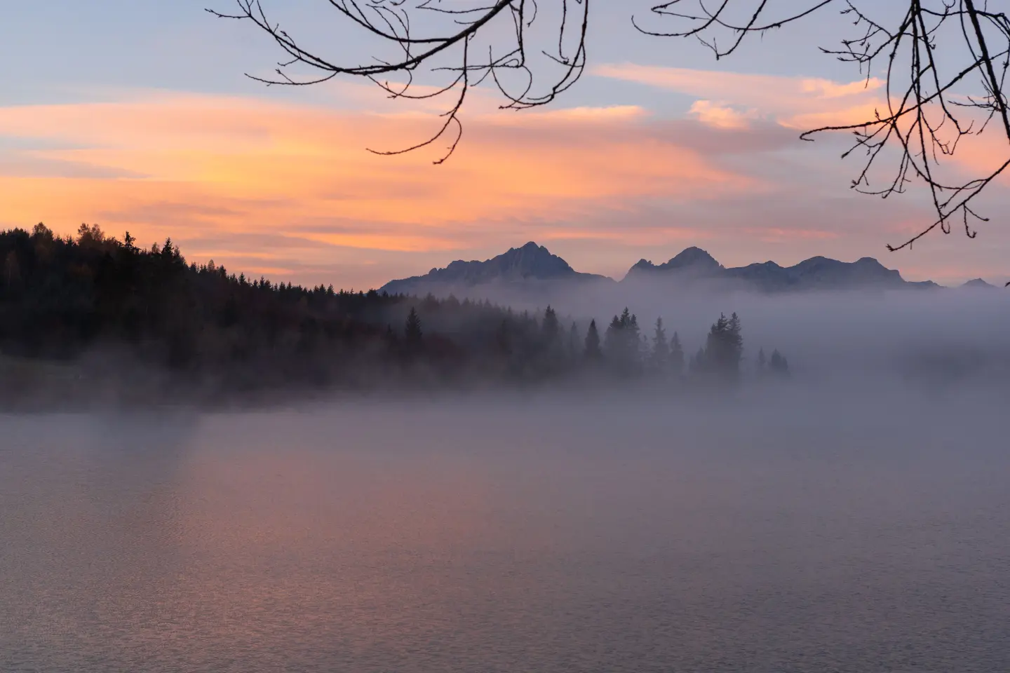
A heart-shaped glacial lake at 1,517 m, at the foot of Mount Maglić
Trnovačko Lake is one of the most recognisable mountain lakes in the Balkans, known for its heart-shaped form that is fully revealed only from the surrounding peaks. Situated at 1,517 metres above sea level, on the border between Montenegro and Bosnia and Herzegovina, the lake is part of the Piva Nature Park and the municipality of Plužine. Its water is blue-green and turquoise in colour, shifting with the time of day and the angle of the sun. There is no road access to the lake — the only way to arrive is on foot, which protects it from mass tourism. The lake is also the starting point for the ascent of Maglić (2,386 m), the highest peak in Bosnia and Herzegovina.
Location
Municipality of Plužine, Montenegro
Elevation
1,517 m
Lake dimensions
825 × 715 m
Protected area
Piva Nature Park
Water temperature (summer)
up to 18°C
Season
June — September
Highlights
Trnovačko Lake is the only mountain lake in the Balkans known for its heart-shaped form, which can only be seen in full from the surrounding mountain peaks rising above 2,000 metres — from Trnovački Durmitor, Vlasulja, or Maglić itself. From the shoreline, the shape can only be partly sensed. The water is blue-green and turquoise, and in the shallow sections near the bank it is almost transparent to the bottom. This contrast of colours, the heart-shaped form, and the dramatic backdrop of rock faces make it one of the most photographed natural sites in the region.
Trnovačko Lake sits directly at the foot of Maglić, which at 2,386 metres is also the highest peak in Bosnia and Herzegovina. From the lake begins one of the easiest marked trails to the summit — approximately 5 km long, with an ascent of nearly 900 metres taking 2 to 3 hours. From the summit of Maglić, a panoramic view opens up over the lake in its full heart-shaped form, the Piva canyon, and the expanses of Sutjeska National Park. The combination of lake + Maglić is considered one of the most attractive mountain tours in the Balkans.
A well-trodden and marked circular trail of 2,800 metres runs around the entire Trnovačko Lake, suitable for all fitness levels. The trail passes through various types of terrain — along the shore, through meadows, and beside rock faces — offering views of the lake from every angle, including the angle from which the heart-shaped form is most recognisable. On the northern side the lake opens towards the forested slopes of Vratnica, while to the south, east, and west it is bounded by sheer mountain rock faces. The circular walk takes between 45 minutes and an hour and a half, depending on pace and the number of stops for photographs.
Right on the shore of Trnovačko Lake, owned by the Piva Nature Park, stands a wooden log cabin with capacity for up to 9 people, equipped with bunks, a wood-burning stove, and basic cooking utensils. Accommodation is arranged by the lake warden who stays on site from late spring until the first winter. Next to the cabin there are also designated tent camping spots. The cabin has no electricity or mobile signal, which for many visitors is a deliberate attraction — a complete break from the digital world at a mountain lake surrounded by peaks.
What to do
A marked trail from Prijevor to the lake (~5 km, 1.5–2 hours) passes through forest and mountain pastures.
tap to closeThe lake is the starting point for the ascent of Maglić (2,386 m) — the trail from the lake to the summit is ~5 km and takes 2–3 hours.
tap to closeTent camping at designated spots beside the lake, or overnight stay in the Piva Nature Park log cabin by the lake.
tap to closeIn July and August the water warms up to 18°C, allowing a refreshing swim in the clear glacial lake.
tap to closeThe heart-shaped form of the lake is best captured from the surrounding peaks — Trnovački Durmitor and Vlasulja.
tap to closeGallery
Plan Your Visit
Dostupno tokom cijele sezone (jun–septembar); nema formalnog radnog vremena, ali preporučuje se dolazak za dnevne svjetlosti
Ulaz u Park prirode Piva se naplaćuje na licu mjesta kod čuvara jezera (cijena prema važećem cjenovniku Parka prirode Piva)
Besplatan parking na visoravni Prijevor (1.660 m nadmorske visine), BiH; prostrana zaravan za veći broj vozila
Nije dostupno osobama s ograničenom pokretljivošću — jedini pristup je pješačka staza minimalne dužine 5 km bez prilagođene infrastrukture
FAQ