A short but demanding hiking trail to the summit of Trzivka with an elevation gain of 225 m.
The ascent to Trzivka is a one-way hiking trail 1.7 km long. It covers 225 m of elevation gain and takes about 1 hour of walking without breaks, leading to the summit of Trzivka.
The ascent to Trzivka is a short but demanding one-way hiking trail. The trail is 1.7 km long and covers a total elevation gain of 225 m, with only 5 m of descent. It starts at 2,088 m above sea level and climbs to 2,319 m above sea level. The estimated walking time is about 1 hour without breaks.
The trail is entirely dirt or forest path. It is marked with red circular markers with a white dot. Due to its short length and high elevation, the ascent is intense and requires good physical fitness, although it is rated T2 on the SAC scale.
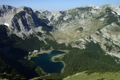
The destination of the trail is the summit of Trzivka (2,333 m above sea level), located 1.7 km from the start. Near the trail are Trnovačko jezero, approximately 2.5 km from the start of the trail, and Stabanska jezera, about 4.6 km from the trail.
What this difficulty means
Steep, rocky or exposed passages and a long day out. For fit, sure-footed hikers with mountain experience.
Mountain hiking grade SAC T2 (scale T1–T6).
Places on this route
Move along the profile to follow the route on the map; switch on 3D for the terrain.
↑ 225 m · ↓ 5 m · highest point 2,319 m
Along the way
The destination of the ascent at 2,333 m above sea level, 1.7 km from the trailhead.
The closest landmark to the trailhead, approximately 2.5 km away.
Located near the trail, about 4.6 km from it.
The entire route runs along a dirt or forest surface.
Bring enough water.
Check the weather forecast before setting off.
Due to the altitude above 2,000 m, bring layered clothing and wind protection.
Wear sturdy hiking boots.
Although the distance is short, expect a demanding ascent and significant elevation difference.
Start earlier in the morning for more stable conditions.
Due to the altitude above 2,000 m, weather can change quickly. Bring clothing for cold and wind, and in case of fog stay on the marked trail. In emergencies call 112.
Emergency number in Montenegro: 112.
Good to know
Best season
Due to the elevation of 2,088 to 2,319 m, snow can persist into the early summer season. The most suitable period is usually from July to September.
Getting there
The closest landmark to the trailhead is Trnovačko jezero, about 2.5 km away. Stabanska jezera are also near the trail, about 4.6 km away.
The trail is 1.7 km long and goes in one direction.
The estimated duration without breaks is about 1 hour.
On our scale it is demanding, and according to the SAC hiking scale T2.
Yes, it is marked with red circular markers with a white dot.
1.3 km↑ 69 m20–30 min
2.3 km↑ 69 m50–70 min
2.2 km45–65 min
2.0 km↑ 456 m1½–2 h
23.1 km↑ 1,562 m2–3 days
1.2 km↑ 318 m65–90 min
4.2 km↑ 291 m1½–2 h
8.3 km↑ 1,364 m5–7 h
Times and grades are estimates. Conditions change: check the weather and local information before you set out.

Ask about Montenegro
Ask me about destinations, restaurants or activities.
