Short and easy hiking section from the Bojanska vrata pass to the Trnovački Durmitor summit.
Easy hiking trail from Bojanska vrata to Trnovački Durmitor. Length is 1,0 km, with 98 m of ascent; it takes about 30 minutes of walking.
This short hiking section connects the Bojanska vrata pass (2133 m a.s.l.) and the Trnovački Durmitor summit (2242 m a.s.l.). The trail is 1,0 km long and runs in one direction, and it takes about 30 minutes of walking without breaks.
The ascent is 98 m, with a descent of 24 m. The lowest point of the trail is at 2134 m a.s.l., and the highest at 2215 m a.s.l. The entire route follows a dirt/forest trail, so the surface is natural and easy to walk on.
The trail is marked and is intended for hikers of all levels, especially beginners and those looking for a short high-mountain tour. Nearby are Trnovačko jezero (about 1,9 km from the start) and Stabanska jezera (about 4,0 km from the trail).
Because of the altitude above 2000 m, the weather can change quickly, so it is good to bring layered clothing. Also, when planning, account for mountain conditions and follow the trail markings.
What this difficulty means
Well-made paths with gentle gradients. Fine for families and anyone used to walking a few hours.
Places on this route
Move along the profile to follow the route on the map; switch on 3D for the terrain.
↑ 98 m · ↓ 24 m · highest point 2,215 m
Along the way
Pass at the start of the trail, at 2133 m a.s.l.
Summit at the end of the trail, at 2242 m a.s.l.
The nearest lake to the trailhead, about 1,9 km away.
Lakes near the trail, about 4,0 km away.
Bring enough water, as there are no reliable springs along the trail itself.
Wear hiking footwear and layered clothing, even in the summer months.
Check the weather forecast before setting out; in the mountains, weather changes quickly.
Due to the altitude above 2000 m, protect yourself from sun and wind.
Follow the trail markings, especially if fog comes down or the trail becomes less visible.
At altitudes above 2000 m, the weather can change quickly; bring layered clothing and sun protection. In case of fog or thunderstorms, do not stay in exposed sections and follow the trail markings. In an emergency, call 112.
Emergency number in Montenegro: 112.
Good to know
Best season
Due to the altitude above 2100 m, the most reliable period is from late June to September, when the trails are usually passable without snow. In spring and autumn, snow remnants and reduced passability are possible.
Getting there
The start of the trail is at the Bojanska vrata pass. The nearest place to the trailhead is Trnovačko jezero, about 1,9 km away.
The trail is 1,0 km long and runs in one direction.
The estimated duration is about 30 minutes of walking without breaks.
The trail is of easy difficulty, with a total ascent of 98 m and a descent of 24 m.
Yes, the trail is marked, so following the route is made easier.
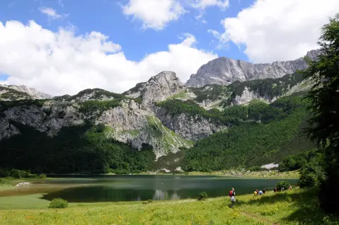
Hiking · Trnovačko Lake
Hiking · Trnovačko Lake
Hiking · Trnovačko Lake
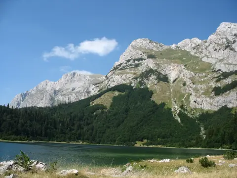
Hiking · Trnovačko Lake
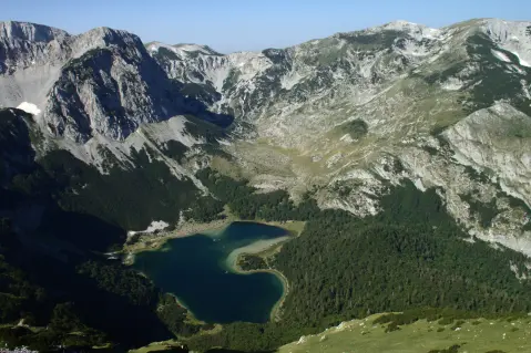
Hiking · Trnovačko Lake
Hiking · Trnovačko Lake
Hiking · Trnovačko Lake
Hiking · Trnovačko Lake
Times and grades are estimates. Conditions change: check the weather and local information before you set out. Map and data sources →

