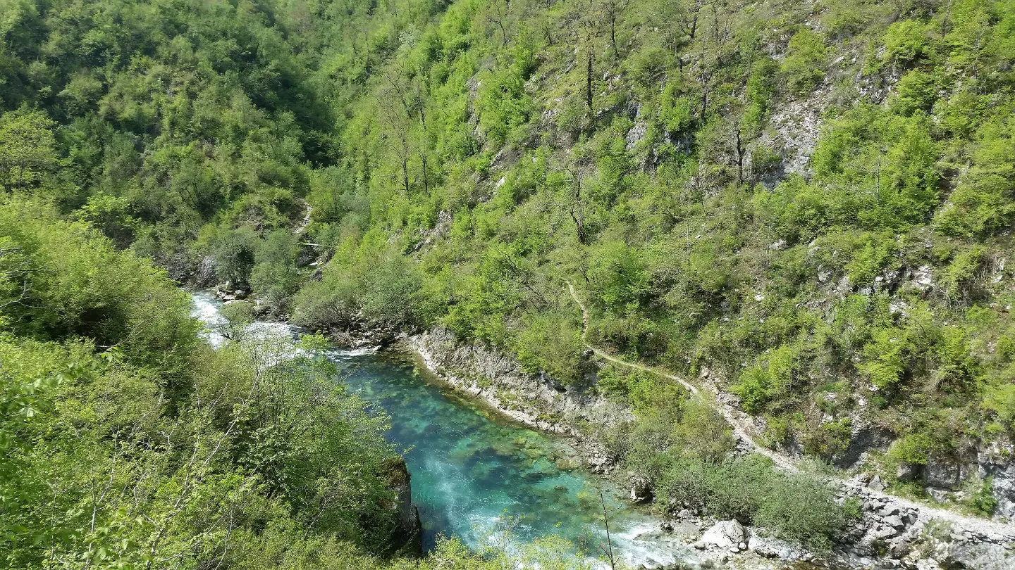
A long mountain descent from the Maganik massif through forests to a waterfall and an ethno camp in the valley.
A 13.0 km trail leads from high terrain (1582 m) down to the valley (235 m), passing a mountain hut, springs, viewpoints, and a waterfall. It is intended for experienced hikers due to its length, difficult terrain, and a total descent of 1368 m.
The trail starts at a high point of approximately 1582 m above sea level and descends almost entirely toward the valley — the total descent is 1368 m, while the ascent is only 25 m. Within the first kilometre it passes a viewpoint at 1546 m, and then two springs at elevations above 1480 m. At 3.0 km from the start is Planinarski Dom Maganik (1346 m), a convenient spot for a short rest.
After the mountain hut the trail continues descending through forested and rocky terrain. At 3.9 km there is another viewpoint (1278 m) with an open view of the surrounding landscape. Further on, the trail is predominantly dirt and forest path through lower vegetation zones.
At 9.8 km from the start there is a spring at 320 m above sea level, and at 11.3 km Ethno village Vodenica — a camp situated in the valley at 260 m. Just before the end, at 12.8 km, the trail passes a waterfall (203 m) and reaches the car park that marks the end of the route.
The trail is marked. The terrain is varied: 48% gravel road, 33% dirt/forest surface, and 17% rocky terrain. Due to the total descent, length, and rocky sections, this route is rated T4 (SAC scale) and is recommended for experienced hikers only.
What this difficulty means
Very long or alpine terrain where hands may be needed, with few ways out. Only for experienced mountaineers in stable weather.
Mountain hiking grade SAC T4 (scale T1–T6).
Move along the profile to follow the route on the map; switch on 3D for the terrain.
↑ 25 m · ↓ 1,368 m · highest point 1,582 m
Along the way
Just 0.9 km from the start of the trail, a viewpoint opens up at 1546 m above sea level — an ideal opportunity to catch your breath and take in the surrounding high-altitude terrain.
At 3.0 km from the start, at an elevation of 1346 m, there is a mountain hut that can serve as a resting point halfway through the elevated section of the route.
At 3.9 km from the start, another viewpoint offers a view toward the lower areas through which the trail continues.
At just 12.8 km from the start, right before the end of the route, the trail passes a waterfall at 203 m above sea level — a beautiful finale to a long descent.
A camp situated at 260 m above sea level, at 11.3 km from the start, offering the opportunity to rest or stay overnight in the valley after a demanding descent.
Bring enough water, especially for the upper section of the trail; springs are recorded along the route, but verify their reliability in advance.
Start early in the morning — the trail takes approximately 4 h 40 min of walking without breaks, and the midday summer heat can make the descent through the lower areas more difficult.
Wear hiking boots with good ankle support — 17% of the trail consists of rocky terrain, and the total descent of 1368 m puts strain on the knees.
The trail is one-way, so arrange transport to the starting point and from the end point (car park at 12.8 km from the start) in advance.
Bring a windbreaker and a warm layer — the start is at an elevation of approximately 1582 m where weather conditions can change quickly.
The trail is rated T4 (SAC scale) and is intended for experienced hikers; it is not suitable for beginners or children without mountain experience.
High-altitude terrain above 1500 m can be exposed to sudden weather changes, fog, and thunderstorms — monitor the forecast and postpone departure if necessary. Rocky sections require caution, especially on wet surfaces. In case of emergency, call the emergency number: 112.
Emergency number in Montenegro: 112.
Good to know
Best season
The trail is most suitable from late May to October, when the high-mountain section is free of snow. During winter months it is recommended only for hikers with appropriate equipment and experience in winter conditions.
Getting there
The end point of the trail has a car park at 12.8 km from the start (203 m above sea level), near the waterfall. As the trail is one-way, arrange transport to the starting point and from the final car park in advance.
The trail is 13.0 km long. The estimated walking time without breaks is 4 h 40 min.
The trail is rated as very demanding, corresponding to the SAC hiking scale T4. It is recommended exclusively for experienced hikers due to the large descent (1368 m) and rocky terrain.
Yes, the trail is marked.
Due to the starting point being above 1500 m above sea level, the trail is most suitable in late spring, summer and early autumn, when the high-mountain terrain is free of snow. Avoid hiking in conditions of fog or thunderstorms.
44.2 km↑ 463 m2–3 days
2.7 km↑ 444 m1½–2½ h
6.4 km↑ 725 m4–5½ h
Loop9.8 km↑ 1,370 m6–8½ h

399 km↑ 9,352 m5–8 days
38.7 km↑ 392 m2–3 days
12.7 km↑ 782 m4–5½ h

413 km↑ 8,566 m5–8 days
Times and grades are estimates. Conditions change: check the weather and local information before you set out.

Ask about Montenegro
Ask me about destinations, restaurants or activities.
