Unmarked and highly demanding hiking tour through rocky mountain terrain for experienced hikers.
The Velje Duboko – Poljana trail is 9.8 km long and covers 1,370 m of ascent. It is unmarked, has no clear path, and is predominantly rocky, making it suitable for experienced hikers only.
The tour begins in the Velje Duboko area and ends in the Poljana area. The trail length is 9.8 km, and a one-way crossing takes approximately 7 hours without breaks. The trail is unmarked and has no clear path, making navigation difficult.
The total ascent is 1,370 m and the descent is 602 m. The lowest point is at 815 m a.s.l. and the highest at 1,940 m a.s.l. The terrain is predominantly rocky (63%), while dirt and forest trail makes up 33%, requiring sure footing and experience.
At 7.9 km from the start there is a spring at 1,687 m a.s.l. Near the route are Manito jezero, approximately 4.3 km from the start, and Kapetanovo jezero, approximately 5.7 km from the trail.
This is a highly demanding tour for experienced hikers. Due to the lack of markings and the elevation difference, navigation equipment and good physical fitness are essential.
What this difficulty means
Very long or alpine terrain where hands may be needed, with few ways out. Only for experienced mountaineers in stable weather.
Mountain hiking grade SAC T4 (scale T1–T6).
Places on this route
Move along the profile to follow the route on the map; switch on 3D for the terrain.
↑ 1,370 m · ↓ 602 m · highest point 1,940 m
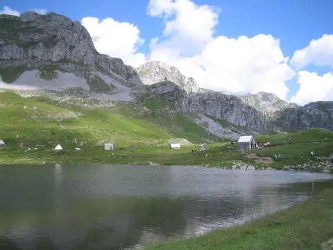
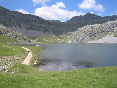
The lake closest to the start of the trail, approximately 4.3 km from the starting point.
The second lake in the vicinity, approximately 5.7 km from the trail.
A spring located 7.9 km from the start of the trail, suitable for refilling water.
The trail is unmarked and has no clear path — GPS navigation, a map, and a compass are essential.
Carry enough water; although a spring has been recorded at 7.9 km at 1,687 m a.s.l., do not rely on it alone.
Allow approximately 7 hours without breaks for the crossing and set out early.
Wear reliable hiking boots; 63% of the trail is rocky.
Check the weather forecast before setting out and be prepared for fog and thunderstorms.
The trail is unmarked and passes through high-mountain rocky terrain, making fog, thunderstorms, and loss of orientation real risks. Check the forecast before setting out and inform someone of your plan. In case of emergency, call 112.
Emergency number in Montenegro: 112.
Good to know
Best season
Due to the altitude of up to 1,940 m a.s.l., the most favourable period is summer and early autumn, from June to September. In spring and late autumn there may be snow and slippery terrain.
Getting there
The closest landmark to the start of the trail is Manito jezero, approximately 4.3 km away. Use this point for orientation and verify the exact access route before setting out.
The trail is 9.8 km long and goes in one direction.
The estimated duration without breaks is approximately 7 hours.
It is highly demanding and intended for experienced hikers; it is rated T4 on the SAC scale.
No, the trail is not marked and there is no clear path, so experience and navigation equipment are required.
8.5 km↑ 883 m3½–5 h
12.1 km↑ 976 m4½–6½ h
26.8 km↑ 1,160 m9–12½ h
6.0 km↑ 449 m2½–3½ h
10.3 km↑ 673 m4–5½ h
1.4 km↑ 138 m40–55 min
2.7 km↑ 444 m1½–2½ h
6.4 km↑ 725 m4–5½ h
LoopTimes and grades are estimates. Conditions change: check the weather and local information before you set out.

Ask about Montenegro
Ask me about destinations, restaurants or activities.
