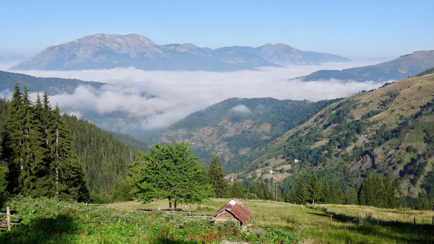
Marked hiking trail from Brezojevice to Visitor, 8.5 km long, with mountain huts, a viewpoint, and springs.
The Brezojevice – Visitor trail runs in one direction through forested mountain terrain for 8.5 km. With a total ascent of 181 m and descent of 1370 m, it is of moderate difficulty.
The Brezojevice – Visitor trail is 8.5 km long and runs in one direction. The highest point of the trail is at 2161 m a.s.l., and the lowest at 964 m a.s.l. The total ascent is 181 m, while the total descent is 1370 m, so the tour is more demanding in the downhill section. The surface is almost entirely earth and forest, and the trail is marked with a red round marker with a white dot.
In the starting area of the trail, the peak Bandera (Krivi smet) stands out at 2211 m a.s.l. Further on, you come across several mountain huts and shelters, including the Braće Rajković Mountain Hut at 1749 m a.s.l. and Žižina Hut at 1854 m a.s.l. At 3.5 km from the start there is a viewpoint at 1849 m a.s.l. Along the trail there are also several drinking water fountains.
The estimated walking time without breaks is 4 h 25 min, and the trail difficulty is moderate. Due to the long descent, the trail is suitable for hikers with basic fitness and sturdy footwear. The nearest place to the start of the trail is Plav Lake, about 3.8 km away, while Plav and Gusinje are nearby.
What this difficulty means
Longer or steeper sections and uneven ground. You need basic fitness, sturdy shoes and a little mountain experience.
Places on this route
Move along the profile to follow the route on the map; switch on 3D for the terrain.
↑ 181 m · ↓ 1,370 m · highest point 2,161 m
Along the way
It is located in the starting area of the trail, at 2211 m a.s.l.
There are several huts along the trail, including the Braće Rajković Mountain Hut at 1749 m a.s.l. and Žižina Hut at 1854 m a.s.l.
At 3.5 km from the start there is a viewpoint at 1849 m a.s.l.
At several points along the trail there are drinking water fountains, including those at 1.8 km, 3.2 km, 6.2 km and 7.3 km from the start.
Wear sturdy hiking footwear because the trail is mostly earthen and forested.
Bring enough water; drinking water fountains exist, but use them as a supplement.
Start earlier in the morning: the crossing without breaks takes about 4 h 25 min.
Prepare for the long 1370 m descent; hiking poles can help.
Check the weather forecast, especially because of altitudes above 2000 m a.s.l.
The trail reaches altitudes above 2000 m a.s.l., so fog and sudden weather changes are possible. Due to the long descent, watch out for slipping on the earthen surface. In case of an accident, call 112.
Emergency number in Montenegro: 112.
Good to know
Best season
The best period to visit is from late spring to early autumn. At altitudes above 2000 m a.s.l., snow can remain until late spring.
Getting there
The closest point to the start of the trail in Brezojevice is Plav Lake, about 3.8 km away. Plav is about 3.2 km from the trail, and Gusinje about 6.7 km.
The trail is 8.5 km long and runs in one direction.
The estimated walking time without breaks is 4 h 25 min.
The difficulty is moderate, with a total ascent of 181 m and total descent of 1370 m.
Yes, the trail is marked with a red round sign with a white dot.
Hiking · Lake Plav
Hiking · Andrijevica
Hiking · Andrijevica · Prokletije National Park
Cycling · Plav
Hiking · Lake Plav
Cycling · Gusinje
Hiking
Cycling · Šiško Lake · Biogradska Gora National Park
Times and grades are estimates. Conditions change: check the weather and local information before you set out. Map and data sources →

