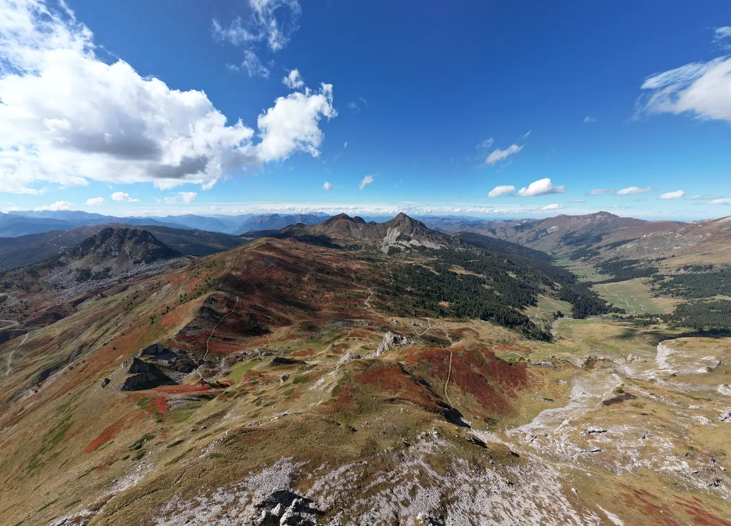
Multi-day, very demanding marked hiking tour through Prokletije National Park.
Via Dinarica is a marked hiking trail in Prokletije National Park, 56.8 km long, with 3,721 m of ascent. It starts near Andrijevica, passes by Plav and Hridsko jezero, and is walked over several days.
Via Dinarica is a hiking tour in Prokletije National Park. The trail is 56.8 km long and goes in one direction, with the start near Andrijevica. Along the way it passes by Plav and Hridsko jezero, with the highest point at 2,345 m a.s.l. and the lowest at 756 m a.s.l.
The terrain consists of dirt and forest paths (60%), gravel roads (22%), and asphalt or concrete (18%). The total ascent is 3,721 m and the total descent is 2,194 m. The trail is marked with round red markers with a white dot. There are mountain huts and shelters along the route, with notable highlights including the Pločice viewpoint, the peaks Goveđak and Rogovi, and the passes Stubica and Drekina kosa.
The tour is very demanding and intended for experienced hikers; the estimated walking time without breaks is 23 h 55 min, so it should be planned as a multi-day tour. Due to the altitude, weather changes, and length, good mountain equipment and careful planning are required.
What this difficulty means
Very long or alpine terrain where hands may be needed, with few ways out. Only for experienced mountaineers in stable weather.
Mountain hiking grade SAC T2 (scale T1–T6).
Move along the profile to follow the route on the map; switch on 3D for the terrain.
↑ 3,721 m · ↓ 2,194 m · highest point 2,345 m
Along the way
The lake is located about 0.1 km from the trail.
A viewpoint at 1,911 m a.s.l., 10.3 km from the start of the trail.
A peak at 2,039 m a.s.l., 11.1 km from the start of the trail.
A peak at 2,012 m a.s.l., 12.5 km from the start of the trail.
A mountain hut at 1,749 m a.s.l., 25.3 km from the start of the trail.
Plan the tour as a multi-day trip: the length is 56.8 km and the walking time without breaks is 23 h 55 min.
Bring enough water and food; although a larger number of water taps and springs are recorded along the route, do not rely solely on them at high sections.
Use hiking footwear and layered clothing; it can be cold at high sections.
Set off early and monitor the weather forecast, especially due to fog and thunderstorms.
The trail is marked, but bring a GPS device or an offline map and a spare battery.
At high sections, fog and thunderstorms can appear quickly; monitor the weather forecast and do not climb in bad weather. Mobile network signal may be weak or intermittent. In case of an emergency, call 112.
Emergency number in Montenegro: 112.
Good to know
Best season
Due to elevations of up to 2,345 m, the most favourable period is usually from June to September; higher sections can be cold and windy even in summer.
Getting there
The trailhead is about 0.2 km from Andrijevica, and there is a parking area at the start.
The trail is 56.8 km long, with a total ascent of 3,721 m and a total descent of 2,194 m.
The estimated walking time without breaks is 23 h 55 min; the tour is multi-day.
It is very demanding and intended for experienced hikers; according to the SAC scale it is T2.
Yes, it is marked with red circular signs with a white dot. The starting point is about 0.2 km from Andrijevica, where there is a parking area.
44.2 km↑ 1,188 m3½–5 h
Loop16.9 km↑ 353 m1–1½ h
Loop
41.0 km↑ 1,242 m4½–6½ h
Loop
14.6 km↑ 1,061 m4½–6½ h
28.2 km↑ 879 m3–4½ h
26.9 km↑ 450 m2–2½ h
6.9 km↑ 164 m30–40 min
Loop
24.6 km↑ 2,054 m2–3 days
Times and grades are estimates. Conditions change: check the weather and local information before you set out.

Ask about Montenegro
Ask me about destinations, restaurants or activities.
