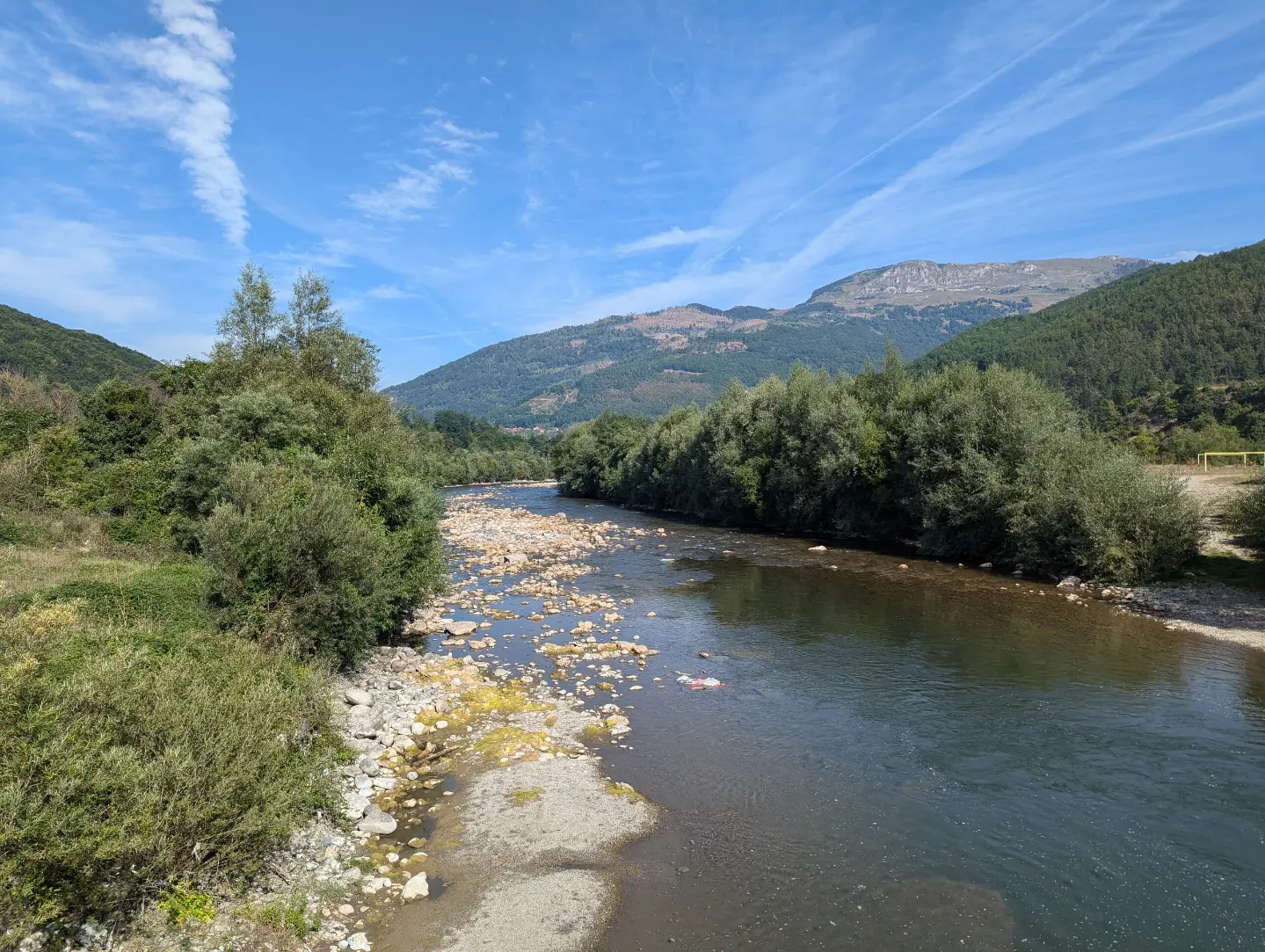
Asphalt cycling tour from Andrijevica to Plav, 26,9 km long, with moderate climbs and proximity to Lake Plav.
The Plav cycling route leads from Andrijevica to Plav. The length is 26,9 km, total ascent 450 m, and the surface is 100 % asphalt/concrete; estimated riding time without breaks is 2 h 5 min.
The Plav cycling route begins near Andrijevica, at about 750 m above sea level, and leads to Plav. The route is one-way, 26,9 km long, with 450 m of total ascent and 279 m of descent. The surface is entirely asphalt/concrete, so the ride is predictable, but with noticeable climbing.
Along the route there are several drinking water fountains: at 1,5 km, 2,2 km, 3,2 km, 7,1 km, and 10,5 km from the start. The highest point is at 962 m above sea level, and the lowest at 750 m above sea level. At 25,2 km there is the camp „Camping Lakeview“ at 910 m above sea level. The route passes by Plav, and Lake Plav is about 0,9 km from the route. In the wider surroundings are also Hridsko Lake (about 8 km) and Gusinje (about 9,1 km).
The route is of moderate difficulty and suitable for cyclists with basic fitness. Estimated riding time without breaks is 2 h 5 min. Parking is available at the beginning and at the end of the route.
What this difficulty means
Some longer climbs or rougher surfaces. You need regular riding fitness.
Places on this route
Move along the profile to follow the route on the map; switch on 3D for the terrain.
↑ 450 m · ↓ 279 m · highest point 962 m
Along the way
The route begins near Andrijevica, at about 750 m above sea level. There is parking at the beginning.
At 1,5 km, 2,2 km, 3,2 km, 7,1 km, and 10,5 km from the start there are fountains for refilling water.
At 25,2 km from the beginning, at 910 m above sea level, the route passes by the camp.
The route ends in Plav; Lake Plav is about 0,9 km from the route.
Bring enough water; along the route there are several fountains, so you can refill your bottle.
Check brakes and tires before riding because the route has ascent and descent.
Start earlier, especially in summer, and bring a light layer for changeable weather.
The estimated duration of 2 h 5 min does not include breaks; plan extra time for rest.
Parking is available both at the beginning and at the end of the route.
Ride carefully, especially on descents and in curves. On wet roads or in fog, reduce speed. In emergencies call 112.
Emergency number in Montenegro: 112.
Good to know
Best season
The best period for riding is from late spring to early autumn, when temperatures are more pleasant and the road is mostly dry. On higher sections and in the morning it can be cool, so bring an extra layer.
Getting there
The start of the route is near Andrijevica, about 0,2 km from the center; there is parking at the start. The end of the route is in Plav, where there is also parking.
The route length is 26,9 km, and the total ascent is 450 m.
The estimated duration without breaks is 2 h 5 min.
The surface is 100 % asphalt/concrete, and the route is of moderate difficulty.
It starts near Andrijevica and ends in Plav.
44.2 km↑ 1,188 m3½–5 h
Loop16.9 km↑ 353 m1–1½ h
Loop
41.0 km↑ 1,242 m4½–6½ h
Loop
14.6 km↑ 1,061 m4½–6½ h
28.2 km↑ 879 m3–4½ h
56.8 km↑ 3,721 m3–4 days
6.9 km↑ 164 m30–40 min
Loop
24.6 km↑ 2,054 m2–3 days
Times and grades are estimates. Conditions change: check the weather and local information before you set out.

Ask about Montenegro
Ask me about destinations, restaurants or activities.
