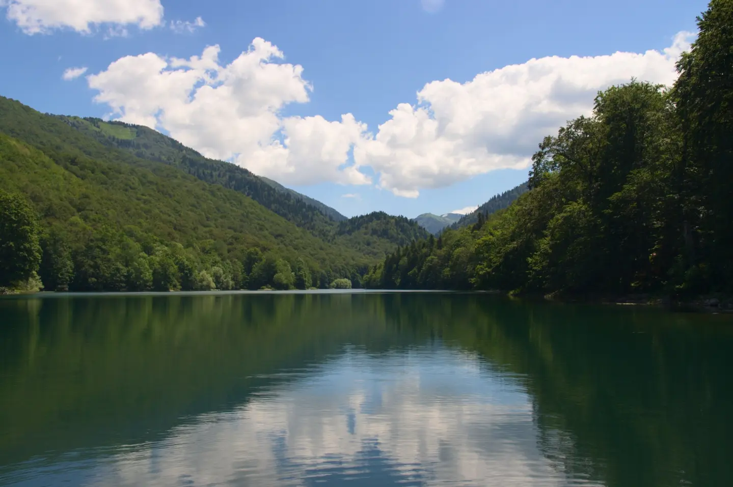
Multi-day cycling tour through eastern Montenegro, with a mix of asphalt and gravel and significant climbs.
A cycling route 262.2 km long with a total ascent of 6918 m. It leads through Biogradska Gora National Park and past Mojkovac, Plav and Gusinje, along mountain huts and viewpoints.
Top Biking Trail 3 – Eastern Enchantment is a multi-day cycling route in eastern Montenegro. It begins near Šiško Lake and leads one way through diverse landscapes. It is 262.2 km long, with a total ascent of 6918 m and a total descent of 6679 m. The lowest point is at 658 m a.s.l., and the highest at 1931 m a.s.l.
Terrain is a combination of asphalt and concrete (72%) and gravel (26%). Although technically less demanding (MTB scale 0), the route is physically very demanding due to its length and elevation differences. It passes through Biogradska Gora National Park and past Mojkovac, Plav and Gusinje. Near the trail are Lake Plav and Pešića Lake.
Along the route there are mountain huts and seasonal mountain hamlets, including Katun Reljina Mountain Retreat, Suvodo Mountain Hut and Vranjak Mountain Hut. There are also several drinking fountains and springs. The trail is intended for experienced cyclists looking for a multi-day challenge and ready for long climbs and changing weather.
What this difficulty means
Very long, very steep or technical riding. For strong riders with good bike handling and self-sufficiency.
Move along the profile to follow the route on the map; switch on 3D for the terrain.
↑ 6,918 m · ↓ 6,679 m · highest point 1,931 m
Along the way
The trail passes through this protected mountain area.
Near the trail, about 0.9 km away.
Mountain hut at 1691 m a.s.l., 42.9 km from the start.
It is located at 1763 m a.s.l., 254.4 km from the start, in the final part of the route.
A peak at 1923 m a.s.l., 257.1 km from the start, close to the highest point of the route.
Plan each stage in advance and allow for a multi-day tour: estimated riding time without breaks is 31 h 20 min.
Bring enough water and food; along the route there are drinking fountains and springs, but water availability may depend on the season.
Due to the elevation up to 1931 m and changeable mountain weather, bring layered clothing, a rain jacket and sun protection.
Check the condition of your bike, bring tools, a spare inner tube and a pump, as some sections are on gravel and far from bike services.
Respect the rules of Biogradska Gora National Park and do not leave litter.
Start early, especially on longer climbs, and book accommodation in mountain huts or seasonal mountain hamlets in advance.
The trail leads through mountain areas with elevations up to 1931 m. Sudden weather changes, fog and thunderstorms are possible. In emergencies, call 112.
Emergency number in Montenegro: 112.
Good to know
Best season
It is best to ride from late spring to early autumn, when mountain roads are passable. At elevations above 1700 m, snow and cold can persist even in late spring.
Getting there
The nearest place to the trail start is Šiško Lake, about 1.4 km away. To access it, use local roads and navigation.
The route is 262.2 km long and is not circular – the start and finish are not in the same place.
Estimated duration without breaks is 31 h 20 min. It is a multi-day tour, so it should be divided into stages.
It is very demanding and intended for experienced cyclists. It has a total ascent of 6918 m. Technically it is MTB scale 0, and the surface is 72 % asphalt/concrete and 26 % gravel.
The start is about 1.4 km from Šiško Lake.
43.0 km↑ 1,950 m5½–8 h
50.2 km↑ 1,943 m6–8½ h
95.7 km↑ 3,723 m2–3 days

399 km↑ 9,352 m5–8 days

143 km↑ 5,436 m6–9 days
41.4 km↑ 1,496 m2–3 days
22.8 km↑ 1,540 m7½–10½ h
22.7 km↑ 1,426 m7–10 h
Times and grades are estimates. Conditions change: check the weather and local information before you set out.

Ask about Montenegro
Ask me about destinations, restaurants or activities.
