Cycling tour through Bjelasica: 28.6 km from Jovanov grob to Zekova česma.
The Bjelasica cycling trail runs from Jovanov grob to Zekova česma, covering 28.6 km. It is moderate, with a total ascent of 619 m and descent of 1032 m, and the surface is predominantly asphalt with sections of gravel road and forest track.
The Bjelasica trail begins at Jovanov grob and leads to Zekova česma. The route is 28.6 km long and is ridden in one direction. The lowest point of the trail is at 1305 m a.s.l., and the highest at 1826 m a.s.l. The total ascent is 619 m and the total descent is 1032 m. The estimated riding time without breaks is 3 h 10 min, and the difficulty is moderate.
The surface is varied: asphalt and concrete make up 65% of the route, gravel road 21%, and dirt and forest tracks around 15%. The trail is marked. Near the trail are Andrijevica, at approximately 5.4 km, and Pešića jezero, at approximately 6.1 km from the trail.
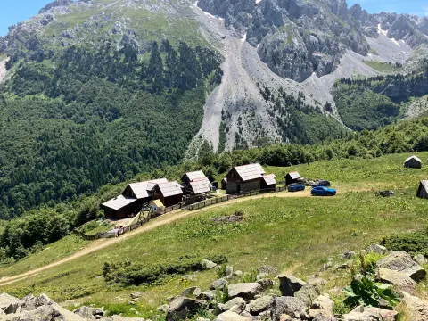
At 8.9 km from the start is the mountain lodge Mountain Center "Krivi Do" at 1688 m a.s.l. Further along, the route passes by the peaks Kršnjata glava (1688 m a.s.l.) and Pobodenjak (1839 m a.s.l.). There are several water fountains along the trail, including Krcelova voda at 7.5 km and fountains at 4.7 km, 7.3 km, 15.5 km, 27.7 km and 28.7 km from the start.
Due to the mixed surface and elevation changes, the trail is suitable for moderately fit cyclists.
What this difficulty means
Some longer climbs or rougher surfaces. You need regular riding fitness.
Places on this route
Move along the profile to follow the route on the map; switch on 3D for the terrain.
↑ 619 m · ↓ 1,032 m · highest point 1,826 m
Along the way
A mountain lodge at 1688 m a.s.l., located 8.9 km from the start of the trail.
A drinking water fountain at 1772 m a.s.l., located 7.5 km from the start.
A peak at 1688 m a.s.l., located 17.7 km from the start of the trail.
A peak at 1839 m a.s.l., located 20.8 km from the start of the trail.
A lake near the trail, approximately 6.1 km from the route.
Check the weather forecast before setting off, as mountain weather can change rapidly.
Bring enough water; fountains exist along the trail, but the gaps between them can be long.
Wear a helmet and bring a spare inner tube and basic tools.
For gravel and forest sections, use a bike with slightly wider tyres.
Plan for longer than 3 h 10 min if you want breaks for rest and photography.
Set off early and bring a mobile phone; in case of need, call 112.
The trail reaches an altitude of up to 1826 m a.s.l., where sudden weather changes, fog and thunderstorms are possible. Ride more carefully on gravel and forest sections. In case of an accident, call 112.
Emergency number in Montenegro: 112.
Good to know
Best season
The best time to ride is from late spring to early autumn, when mountain roads are usually dry and passable. At altitudes above 1300 m a.s.l., snow and ice are possible during colder months.
Getting there
The starting point of the trail is Jovanov grob. The nearest settlement to the trail is Andrijevica, at approximately 5.4 km.
The trail is 28.6 km long.
It starts at Jovan's grave and ends at Zeko's fountain. The route is one-way.
The estimated riding time without breaks is 3 h 10 min.
The difficulty is moderate, with a total ascent of 619 m and a descent of 1032 m. The surface is mixed: asphalt/concrete, gravel and dirt roads.
44.2 km↑ 1,188 m3½–5 h
Loop
143 km↑ 5,436 m6–9 days

262 km↑ 6,918 m4–5 days
41.4 km↑ 1,496 m2–3 days
22.0 km↑ 1,238 m6½–9½ h
5.5 km↑ 42 m1½–2½ h
15.2 km↑ 364 m4½–6 h
6.1 km↑ 830 m3–4½ h
Times and grades are estimates. Conditions change: check the weather and local information before you set out.

Ask about Montenegro
Ask me about destinations, restaurants or activities.
