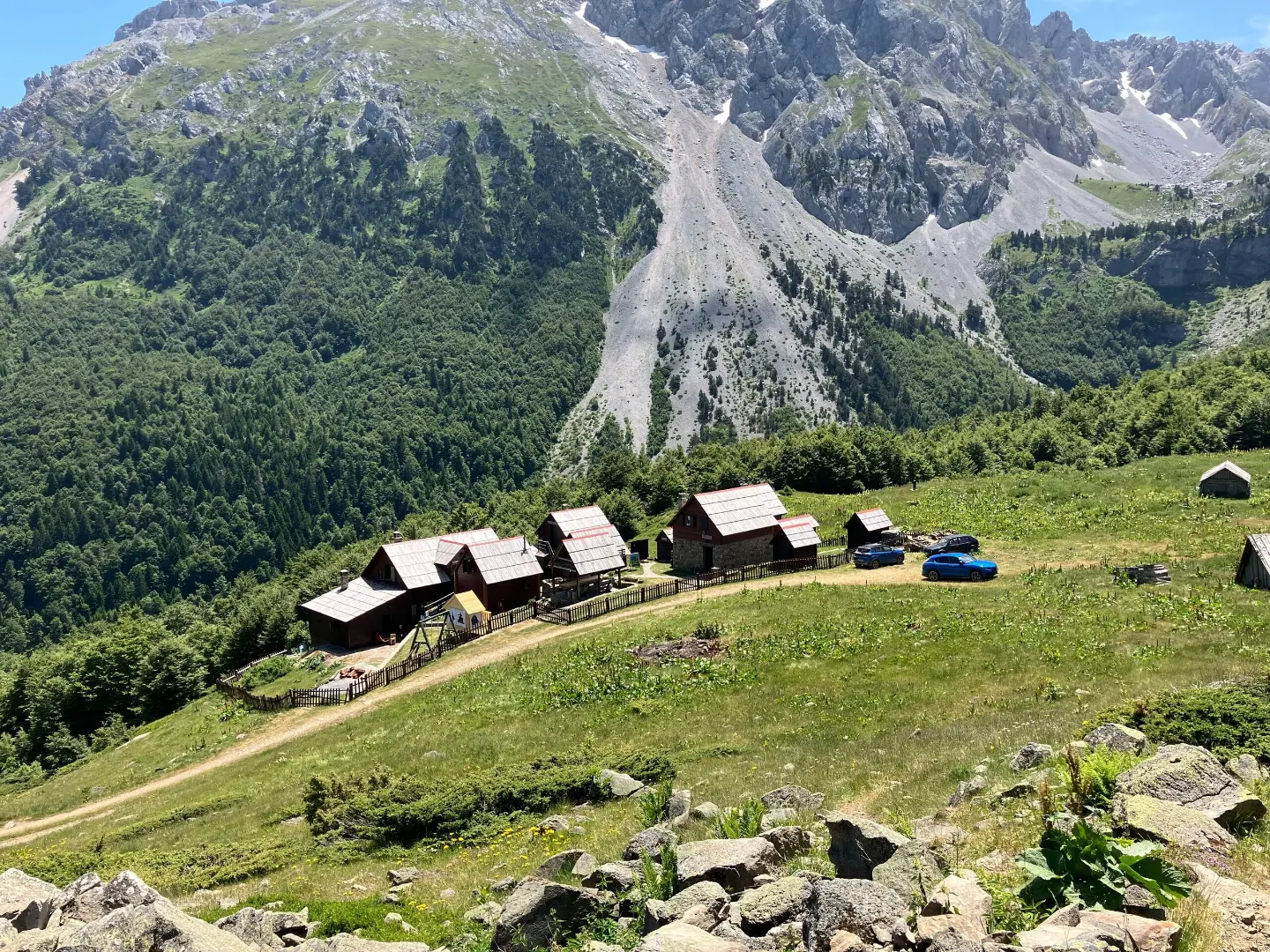
An easy hiking trail of 5.5 km with a gentle ascent and a long descent through forest and gravel road sections.
A one-way hiking trail from Han Drndarski to Ljuban, 5.5 km long, with a total descent of 531 m and an ascent of 42 m. An easy trail on gravel roads and forest paths, taking about 2 hours without breaks.
The Han Drndarski – Ljuban trail is an easy one-way hiking route, 5.5 km long. The highest point is at 1,702 m a.s.l., and the lowest at 1,170 m a.s.l. The total ascent is 42 m and the total descent is 531 m. The estimated walking time without breaks is about 2 hours.
The terrain is predominantly gravel road (68%), while the remaining 32% consists of dirt and forest paths. Near the start, just 0.1 km away, is Kamp Martinovića at 1,700 m a.s.l. At 2.1 km from the start, the trail passes a drinking water spring at 1,365 m a.s.l., and at 4.3 km another spring at 1,220 m a.s.l.
Due to the gentle gradient and short length, the trail suits most hikers and recreational walkers. Keep in mind, however, that the trail does not return to the starting point, so you will need to arrange transport or a return journey.
What this difficulty means
Well-made paths with gentle gradients. Fine for families and anyone used to walking a few hours.
Move along the profile to follow the route on the map; switch on 3D for the terrain.
↑ 42 m · ↓ 531 m · highest point 1,702 m
Along the way
The camp is located just 0.1 km from the start of the trail, at 1,700 m a.s.l.
Drinking water at 2.1 km from the start, useful for refreshment.
A second drinking water spring, at 4.3 km from the start.
The trail is one-way – arrange transport or a return journey in advance.
Although there are two springs, bring water with you, especially in summer.
Wear comfortable shoes with good soles; the forest section may be slippery.
Check the weather forecast before setting out and bring layered clothing.
Set off earlier during the summer months due to high temperatures at lower elevations.
The trail runs between 1,170 m and 1,702 m a.s.l., where weather can change quickly. Monitor the forecast and avoid the trail during thunderstorms or fog. In case of an emergency, call 112.
Emergency number in Montenegro: 112.
Good to know
Best season
The most pleasant time is from late spring to early autumn, when the trails are dry and visibility is good. In winter and early spring, there may be snow at higher elevations.
Getting there
The trail starts at Han Drndarski, near Kamp Martinovića (0.1 km from the start). It ends in Ljuban.
The trail is 5.5 km long and runs in one direction.
Without breaks, it takes about 2 hours of walking.
It is easy. The total ascent is 42 m and the descent is 531 m; the highest point is 1,702 m a.s.l. and the lowest is 1,170 m a.s.l.
Yes, at 2.1 km and 4.3 km from the start there are fountains with drinking water.
Hiking
Hiking
Hiking
Hiking
Hiking

Hiking · Crno Jezero · Durmitor National Park

Hiking

Hiking
Times and grades are estimates. Conditions change: check the weather and local information before you set out. Map and data sources →

