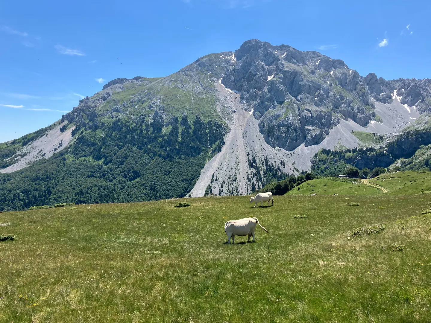
A short hiking trail to the summit of Kom Ljevorečki (Kraljski Kom).
The hiking trail from Ljuban to the summit of Kom Ljevorečki (Kraljski Kom) is 2,4 km long, with an ascent of 606 m. The estimated walking time without breaks is about 2 hours and 20 minutes, and the difficulty is moderate.
The hiking trail starts at Ljuban and leads in one direction to the summit of Kom Ljevorečki (Kraljski Kom). The trail is 2,4 km long, with a total ascent of 606 m and only 6 m of descent. The lowest point is at 1813 m above sea level, and the highest at 2423 m above sea level. The estimated walking time without breaks is about 2 hours and 20 minutes. The trail is marked.
The surface is dirt/forest along its entire length (100 %). The terrain climbs through a forest area, and over a short stretch there is a pronounced ascent. The difficulty is rated as moderate, so the trail is suitable for hikers with basic fitness and experience.
At the end of the trail, 2,4 km from the start, is the summit of Kom Ljevorečki (Kraljski Kom) at 2470 m above sea level. As the trail is one-way, plan your return in advance. Due to the mountain altitude, be prepared for colder conditions and rapid weather changes.
What this difficulty means
Longer or steeper sections and uneven ground. You need basic fitness, sturdy shoes and a little mountain experience.
Move along the profile to follow the route on the map; switch on 3D for the terrain.
↑ 606 m · ↓ 6 m · highest point 2,423 m
Along the way
The trail’s destination at 2470 m above sea level, 2,4 km from the start.
Over a short 2,4 km section, there is 606 m of ascent and only 6 m of descent.
The surface is dirt/forest along the entire length, and the trail is marked.
The lowest point is at 1813 m above sea level, and the highest at 2423 m above sea level.
Bring enough water.
Wear hiking footwear and layered clothing.
Check the weather forecast before you set off.
Start earlier in the morning to avoid the heat and possible afternoon showers.
The trail is marked; follow the markers.
The trail runs through mountain terrain at an altitude of 1813 m to 2423 m, so expect rapid weather changes. In case of fog or thunderstorm, turn back or find shelter. For emergencies, call 112.
Emergency number in Montenegro: 112.
Good to know
Best season
The best period for hiking is from late spring to early autumn, when the trails are mostly passable and free of snow. In winter and early spring, snow and ice are possible on the higher sections.
Getting there
The trailhead is at Ljuban.
The trail is 2,4 km long and leads in one direction from Ljuban to the summit of Kom Ljevorečki (Kraljski Kom).
The estimated duration without breaks is 2 hours and 20 minutes.
The difficulty is moderate, with a total ascent of 606 m and a descent of 6 m.
The lowest point is at 1813 m above sea level, and the highest at 2423 m above sea level.
Hiking
Hiking
Hiking
Hiking
Hiking

Hiking · Crno Jezero · Durmitor National Park

Hiking

Hiking
Times and grades are estimates. Conditions change: check the weather and local information before you set out. Map and data sources →

