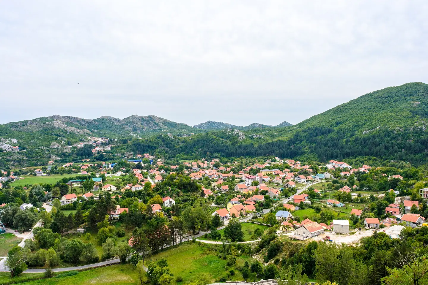
Easy one-way foot trail with several viewpoints and a drinking fountain at the end.
Easy one-way foot trail, 3.5 km long, with 6 m of ascent and 216 m of descent. It starts at Đinovo Brdo and leads past several viewpoints to a drinking fountain and parking.
The trail starts at Đinovo Brdo (863 m above sea level) and descends in one direction to a drinking fountain and parking at 3.5 km. In total it has 6 m of ascent and 216 m of descent, and the route without breaks is estimated at about 1 h 5 min. The trail is easy and marked.
For the most part it runs on earthen and forest ground (65%), and to a lesser extent on asphalt or concrete (32%). Along the way there are several viewpoints at 828 m, 740 m, 690 m, 687 m and 684 m above sea level. The highest point of the trail is 860 m above sea level, and the lowest is 639 m above sea level.
At the end of the trail there is a drinking water fountain (648 m above sea level) and parking. The trail passes near Cetinje (about 0.3 km), and Cetinje Monastery is about 1.4 km from the start. In the wider surroundings, about 8.3 km from the trail, is Kosmač Fortress. Because of its short length and little ascent, it is suitable for recreational walkers and easy family walks.
What this difficulty means
Well-made paths with gentle gradients. Fine for families and anyone used to walking a few hours.
Places on this route
Move along the profile to follow the route on the map; switch on 3D for the terrain.
↑ 6 m · ↓ 216 m · highest point 860 m
Along the way
The starting point of the trail at 863 m above sea level.
There are five viewpoints along the route at elevations from 684 m to 828 m above sea level.
At the end of the trail, 3.5 km from the start, there is a drinking fountain at 648 m above sea level.
Parking is available at 3.1 km and 3.5 km from the start.
The trail passes about 0.3 km from Cetinje, and Cetinje Monastery is about 1.4 km from the start.
Wear comfortable footwear with good soles — although the trail is easy, most of it descends.
Bring enough water; the drinking fountain is only at the end of the trail.
The trail is one-way, so plan your return or transport in advance.
Check the weather forecast; the forest section can be slippery after rain.
In summer, set off earlier or later in the afternoon because of the heat.
The trail is short and easy, but it descends for the most part, so be careful on wet or slippery ground. In summer, avoid the hottest part of the day. In case of emergency, call 112.
Emergency number in Montenegro: 112.
Good to know
Best season
It is most pleasant from spring to autumn. In summer, set off earlier because of the heat, and in winter count on possible snow and slippery sections.
Getting there
The nearest known point to the start of the trail is Cetinje Monastery, about 1.4 km away. The trail passes about 0.3 km from Cetinje. At the end of the trail, 3.1 km and 3.5 km from the start, there are parking spaces.
The trail is 3.5 km long and goes in one direction.
Without breaks, it is estimated at about 1 h 5 min.
It is easy: total ascent is 6 m and descent 216 m. The highest point is 860 m above sea level, and the lowest is 639 m above sea level.
Yes, at the end of the trail, 3.5 km from the start, there is a drinking water fountain.

195 km↑ 3,259 m2–3 days

406 km↑ 10,191 m6–8 days
34.3 km↑ 1,738 m2–3 days
19.7 km↑ 216 m5–7½ h
16.5 km↑ 692 m4½–6½ h
0.5 km10–10 min
1.8 km↑ 266 m55–80 min
14.1 km↑ 547 m4–5½ h
Times and grades are estimates. Conditions change: check the weather and local information before you set out.

Ask about Montenegro
Ask me about destinations, restaurants or activities.
