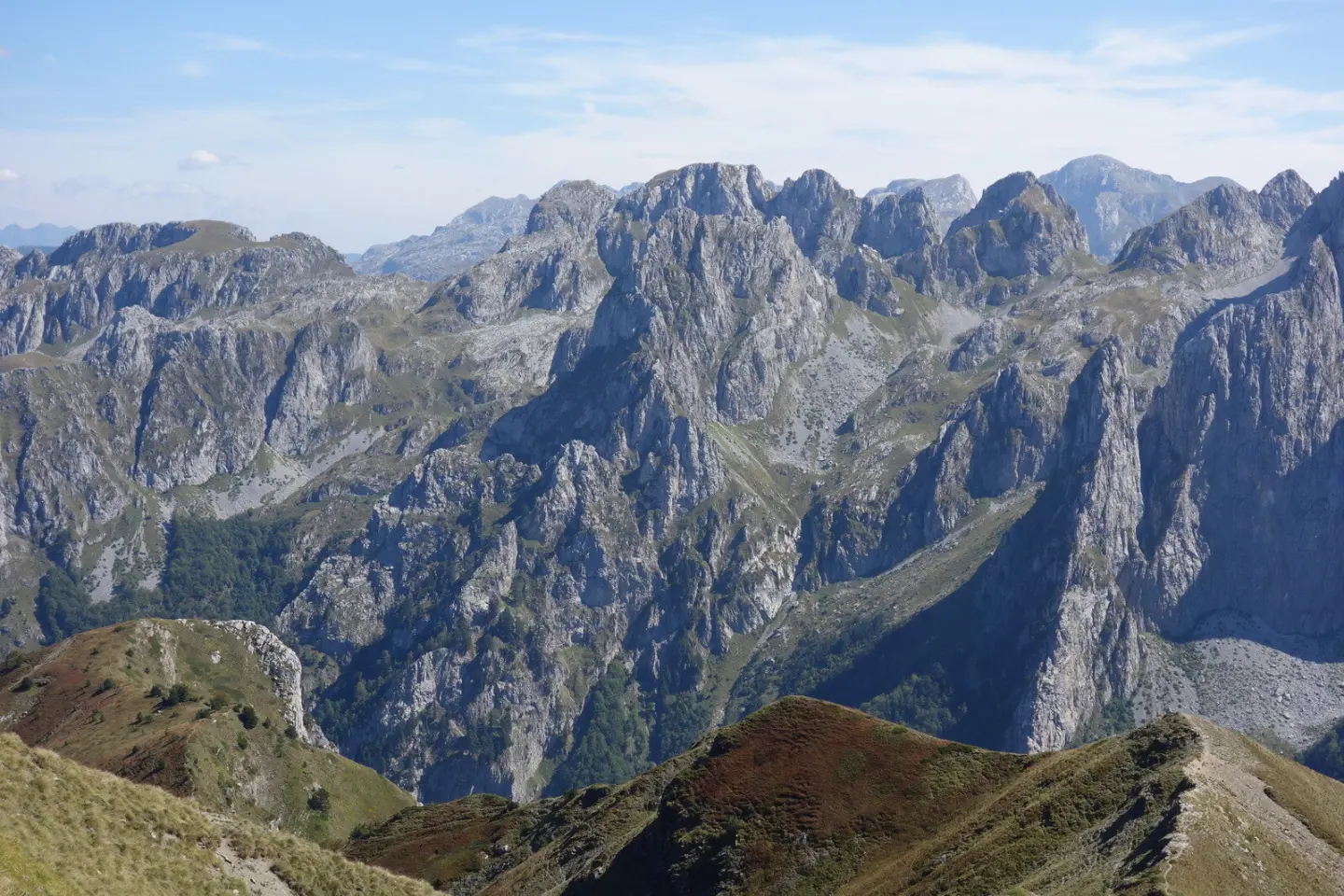
A challenging ridge at altitudes above 1960 m in Prokletije National Park.
A short but highly demanding ridge trail, 1.7 km long, leading through the rocky terrain of Prokletije. Suitable exclusively for experienced hikers with appropriate equipment.
The Karanfili ridge trail runs along the ridge at elevations between 1960 m and 2116 m, within Prokletije National Park. Despite its short length of only 1.7 km, a total ascent of 144 m and predominantly rocky terrain (58%) make it physically and technically challenging.
Immediately at the start of the trail there is a viewpoint at 1954 m a.s.l., and just 100 m further the trail passes by the summit of Podgojs (2021 m a.s.l.). At around the halfway point, at 0.5 km and 0.6 km from the start, you will encounter two caves called Jama. Closer to the end, at 1.3 km from the start, the summit of Mali Karanfili (2119 m a.s.l.) is reached.
The remaining 42% of the surface consists of an earth trail. The trail is marked and runs in one direction — the start and end points are not the same. The estimated walking time without breaks is approximately 50 minutes.
The trail is intended exclusively for experienced hikers (SAC scale T6). It is not recommended for those without experience moving along exposed rocky ridges.
What this difficulty means
Very long or alpine terrain where hands may be needed, with few ways out. Only for experienced mountaineers in stable weather.
Mountain hiking grade SAC T6 (scale T1–T6).
Places on this route
Move along the profile to follow the route on the map; switch on 3D for the terrain.
↑ 144 m · ↓ 89 m · highest point 2,116 m
Along the way
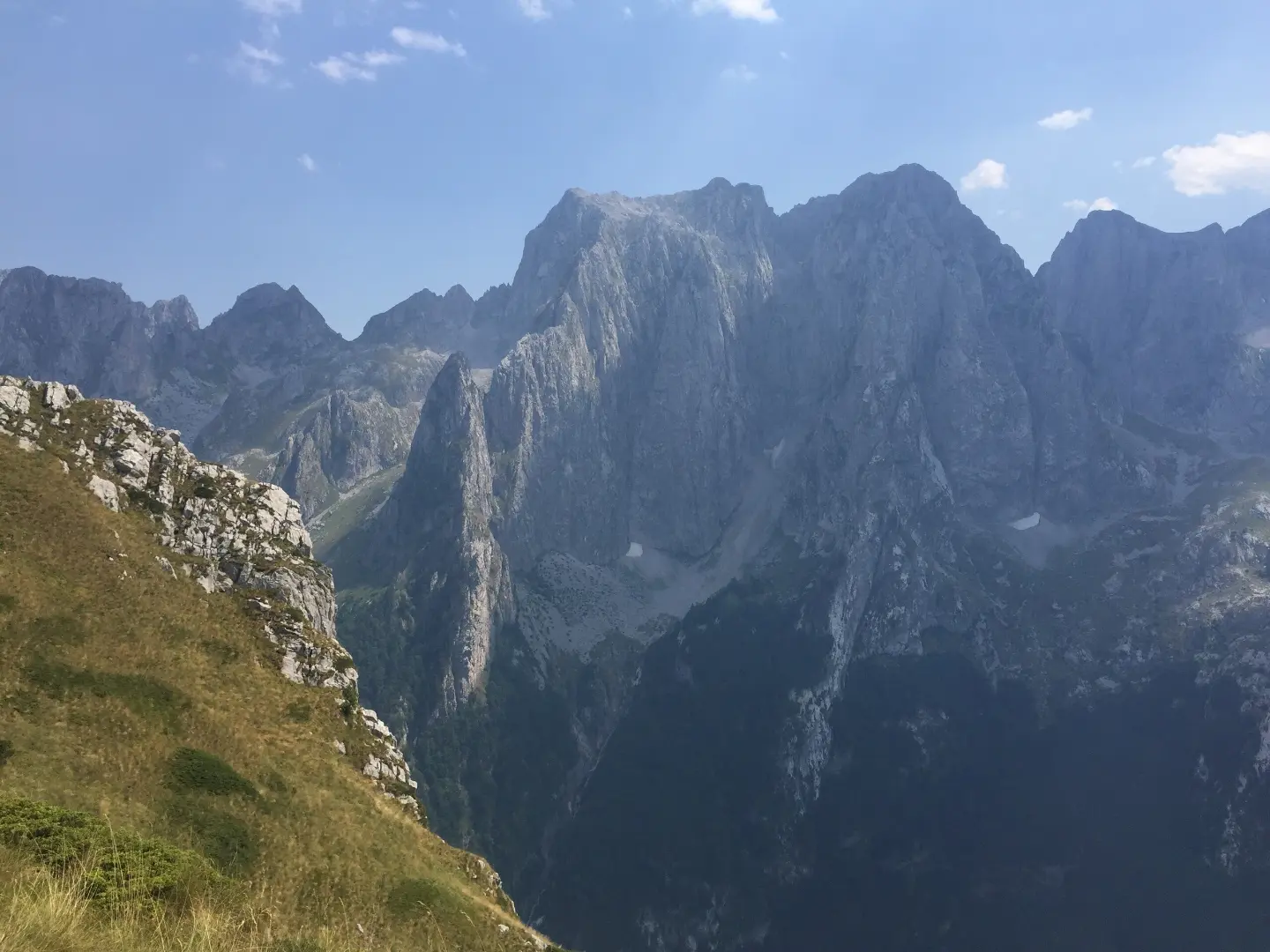
The main objective of the trail, at 1.3 km from the start, near the highest point of the entire route.
Located at the very start of the trail, it offers views of the surrounding mountain terrain of Prokletije.
The first prominent point on the ridge, reachable within the first 100 m from the start.
Two caves marked with the name Jama are located at 0.5 km and 0.6 km from the start of the trail, at elevations of around 1995–1996 m a.s.l.
Wear hiking boots with a stiff sole and good rubber grip — rocky terrain requires stable footwear.
Bring enough water and food; there are no known water sources along the trail.
Set off early in the morning to avoid afternoon thunderstorms, which are common at such altitudes during summer months.
Be sure to bring a windproof jacket and an extra layer of clothing — on the ridge above 2000 m, temperature and wind can change rapidly.
The trail runs in one direction — plan your return or transport to the endpoint in advance.
It is recommended to hike with a companion or to inform someone you trust of your hiking plan beforehand.
The ridge above 2000 m a.s.l. is exposed to sudden weather changes, strong winds, and thunderstorms, especially in the afternoon hours. Rocky terrain is slippery in wet conditions, and moving along it requires full attention and stable footwear. In case of emergency, call the European emergency number **112**.
Emergency number in Montenegro: 112.
Good to know
Best season
At elevations between 1960 m and 2116 m, the trail is safest in the period from July to September, when the terrain is generally free of snow. Outside this period, snow and ice are possible, which further increases the level of difficulty.
Getting there
The nearest place to the start of the trail is Gusinje, approximately 5.0 km away. You need to reach the trailhead by private transport or by organised arrangement.
The trail is 1.7 km long and is completed in one direction, from the start to the end point.
The estimated walking time without breaks is approximately 50 minutes. Allow more time when including breaks and sightseeing.
The trail is rated as very demanding and corresponds to the SAC hiking scale T6. It is intended exclusively for experienced hikers with appropriate equipment and experience moving on exposed terrain.
Yes, the trail is marked. Follow the markings throughout the entire route.
4.3 km↑ 107 m25–35 min
2.3 km1½–2 h
3.8 km↑ 1,099 m4½–6 h
0.9 km↑ 302 m55–80 min
25.3 km↑ 571 m2½–3½ h
Loop
181 km↑ 9,342 m9–12 days
Loop
8.8 km↑ 279 m60–85 min
5.6 km↑ 434 m2–2½ h
Times and grades are estimates. Conditions change: check the weather and local information before you set out.

Ask about Montenegro
Ask me about destinations, restaurants or activities.
