An easy cycling trail near Pljevlja, with 529 m of ascent and a predominantly asphalt surface.
Biking Trail PV05 is an easy one-way cycling trail, 14.5 km long. It has 529 m of ascent and a predominantly asphalt surface, and the nearest town is Pljevlja.
Biking Trail PV05 is an easy one-way cycling trail. It is 14.5 km long and mostly runs on asphalt or concrete (89%), while a smaller part is gravel (11%). The start and finish are not in the same place, so plan the return in advance.
The trail climbs from the lowest point at 810 m above sea level to the highest at 1310 m above sea level. The total ascent is 529 m, and the descent only 30 m. The estimated riding time without breaks is 1 h 35 min. Although the difficulty is rated as easy, expect a steady climb.
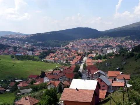
Near the start of the trail is Vidikovac Meandri Ćehotine, a viewpoint about 5.9 km from the starting point, so the ride can be combined with a short stop for the view. The nearest town is Pljevlja, about 9.1 km from the trail.
The trail is suitable for recreational cyclists and those who enjoy a longer climb. Thanks to the predominantly asphalt surface, the ride is predictable, and the short gravel section does not require any special technique.
What this difficulty means
Mostly flat or gentle riding on good surfaces. Fine for occasional riders and families.
Places on this route
Move along the profile to follow the route on the map; switch on 3D for the terrain.
↑ 529 m · ↓ 30 m · highest point 1,310 m
Viewpoint near the start of the trail, about 5.9 km from the starting point; the name refers to the view of the meanders of the Ćehotina River.
The nearest town is Pljevlja, about 9.1 km from the trail.
The trail climbs from 810 m above sea level to 1310 m above sea level with only 30 m of descent.
Check the weather forecast; at the highest point of 1310 m above sea level, it can be noticeably cooler.
Bring enough water and snacks, especially in the warmer months.
Wear a helmet and dress in layers.
Because of the 529 m ascent, pace yourself and plan breaks even though the trail is easy.
The trail is one-way, so arrange the return or transportation in advance.
The trail is easy, but it climbs to 1310 m above sea level, so bring water and sun protection. In mountainous areas, the weather can change quickly. In case of an accident, call 112.
Emergency number in Montenegro: 112.
Good to know
Best season
The most favorable period is from late spring to early autumn, when the roads are mostly dry and free of snow at the highest points.
Getting there
The trail is located near Pljevlja, which is about 9.1 km away. The nearest known landmark to the trail start is Vidikovac Meandri Ćehotine, about 5.9 km from the starting point.
The trail is 14.5 km long.
The estimated riding time without breaks is 1 h 35 min.
The difficulty is easy, but the trail has a total ascent of 529 m.
The surface is 89 % asphalt/concrete and 11 % macadam.
50.9 km↑ 1,081 m3½–5 h
13.9 km↑ 160 m65–90 min
13.4 km↑ 279 m1–1½ h
37.0 km↑ 1,617 m5–7 h
36.9 km↑ 757 m2½–3½ h
36.3 km↑ 953 m3½–5 h
30.0 km↑ 747 m3–4 h
19.2 km↑ 770 m2–2½ h
Times and grades are estimates. Conditions change: check the weather and local information before you set out.

Ask about Montenegro
Ask me about destinations, restaurants or activities.
