An asphalt bike trail of moderate difficulty with the Javor Spring and a 757 m climb.
Biking Trail PV10 is a 36.9 km long, predominantly asphalt, one-way bike trail. It starts about 3 km from Pljevlja, has a 757 m climb, a 305 m descent and the Javor Spring at 28.5 km.
Biking Trail PV10 is a one-way bike trail. The start of the trail is about 3.0 km from Pljevlja. The route is 36.9 km long, and the surface is 98% asphalt or concrete, so the ride mostly follows the road.
The trail has a total climb of 757 m and a total descent of 305 m. The lowest point is at 663 m above sea level, and the highest at 1208 m above sea level. The estimated riding time without breaks is 3 hours and 5 minutes. The trail difficulty is moderate.
At 28.5 km from the start, the Javor Spring is located at 865 m above sea level. Bring enough water and plan your breaks. The route is suitable for cyclists who enjoy longer moderate-intensity asphalt sections.
What this difficulty means
Some longer climbs or rougher surfaces. You need regular riding fitness.
Places on this route
Move along the profile to follow the route on the map; switch on 3D for the terrain.
↑ 757 m · ↓ 305 m · highest point 1,208 m
Along the way
The Javor Spring is located at 28.5 km from the start of the trail, at 865 m above sea level.
The trail has a total climb of 757 m and a total descent of 305 m.
The highest point of the route is at 1208 m above sea level.
The lowest point of the route is at 663 m above sea level.
The start of the trail is about 3.0 km from Pljevlja.
Bring enough water, especially in the warmer months.
Before you set off, check the weather forecast and adjust your equipment.
Use a bicycle suited to an asphalt surface.
Plan for about 3 hours and 5 minutes of riding without breaks, and allow more time with rest stops.
The start of the trail is about 3 km from Pljevlja, so set off in good time.
Check the weather conditions before riding; fog or thunderstorms can occur on higher sections. In emergencies, call 112.
Emergency number in Montenegro: 112.
Good to know
Best season
The best period for riding is from late spring to early autumn, when conditions at the highest points of the route are more favorable. In winter it can be colder and changeable.
Getting there
The start of the trail is located about 3.0 km from Pljevlja, which is the nearest town to the beginning of the route.
The trail is 36.9 km long.
The estimated duration without breaks is 3 hours and 5 minutes.
The trail is of moderate difficulty, with a total ascent of 757 m and descent of 305 m.
The surface is 98% asphalt or concrete.
37.0 km↑ 1,617 m5–7 h
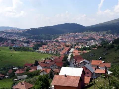
50.9 km↑ 1,081 m3½–5 h
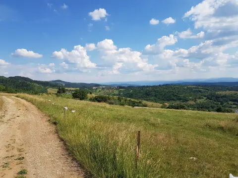
19.2 km↑ 770 m2–2½ h
13.9 km↑ 160 m65–90 min
8.0 km↑ 119 m40–55 min
14.5 km↑ 529 m1½–2 h
13.4 km↑ 279 m1–1½ h
30.0 km↑ 747 m3–4 h
Times and grades are estimates. Conditions change: check the weather and local information before you set out.

Ask about Montenegro
Ask me about destinations, restaurants or activities.
