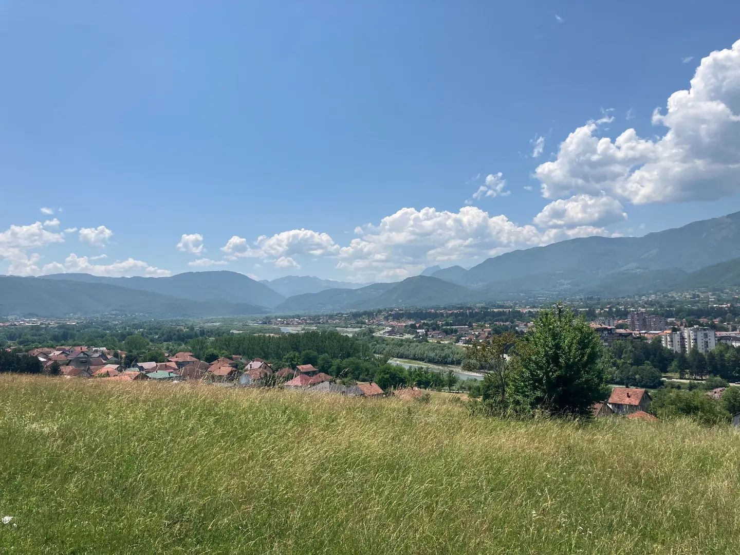
A long mountain tour from Berane to Bogaje through ridges with peaks above 1600 m.
A 27.2 km tour leads from Berane to Bogaje (Rožaje) with a total ascent of 1216 m. It passes a series of mountain peaks and is intended for experienced hikers.
The trail starts from the outskirts of Berane (684 m a.s.l.) and gradually climbs towards the mountain ridge, reaching its highest point of 1667 m a.s.l. The terrain is varied: just over half of the route is asphalt and concrete, a fifth is gravel road, and the remaining 19% is dirt and forest trail.
In the first half of the route, smaller and higher peaks alternate – Maraševo brdo (1155 m), Sijerak (1284 m), Debelo brdo (1478 m) and Ostrožer (1456 m) – which gradually introduce the higher mountain terrain. From the 15th kilometre onwards, the trail passes by the peaks Bijeljež (1676 m), Golješ (1666 m) and Mušino brdo (1664 m), which form the most attractive hiking segment of the tour.
At 19.5 km from the start, at an altitude of 1628 m, there is a spring with drinking water – a welcome refreshment in the second half of the route. The tour ends with a descent towards Bogaje, with a total descent of 838 m.
The trail is intended for experienced hikers with good physical fitness. The length, elevation difference and duration of approximately 9 h 40 min (without breaks) require an early departure and careful planning.
What this difficulty means
Very long or alpine terrain where hands may be needed, with few ways out. Only for experienced mountaineers in stable weather.
Places on this route
Move along the profile to follow the route on the map; switch on 3D for the terrain.
↑ 1,216 m · ↓ 838 m · highest point 1,667 m
Along the way
Photos and short clips from points along the route – tap one to open it.
The highest peak along the trail, reached at 15.6 km from the starting point, offering a sense of the high-mountain character of this tour.
On the section between the 15th and 18th kilometre, the trail passes by three peaks above 1660 m, making it the most demanding and most spectacular part of the route.
At 19.5 km from the start there is a spring with drinking water – the only known refreshment point in the upper section of the trail.
Two prominent peaks (1478 m and 1456 m) in the middle of the tour mark the transition between the lower and the high mountain terrain.
The combination of asphalt, gravel road and forest trail gives the trail a changeable character and requires adaptable footwear and attention throughout the entire route.
Set out early in the morning – the estimated duration without breaks is 9 h 40 min, so a timely departure is essential.
Carry enough water, especially for the first half of the trail up to the spring at 19.5 km.
Wear hiking boots with good ankle support – the terrain includes gravel road and forest trail.
The trail is one-way; arrange transport or a person to pick you up in Bogaje in advance.
Monitor the weather forecast – at altitudes above 1600 m, thunderstorms and fog can develop quickly.
Bring warm and waterproof clothing regardless of morning conditions; the temperature on the ridge can be significantly lower than in Berane.
The trail passes through high mountain terrain above 1600 m where conditions can change rapidly – fog, thunderstorms and sudden drops in temperature are real risks. Always inform someone of your planned outing and expected return. In case of emergency, call the emergency services on 112.
Emergency number in Montenegro: 112.
Good to know
Best season
The optimal period for this tour is from May to October, when the mountain ridges are passable and free of snow. In summer, set out early to avoid afternoon thunderstorms on the ridge.
Getting there
The trail begins near Berane, approximately 0.8 km from the town centre. Berane is reached by road from various directions; park in town and head towards the marked starting point.
The trail is 27.2 km long. The estimated walking time without breaks is 9 h 40 min.
The tour is rated as very demanding and is recommended for experienced hikers. The total ascent is 1216 m.
No. The trail is one-way – it starts in the area of Berane and ends in Bogaji (Rožaje), so you need to arrange your return or transportation in advance.
Late spring, summer, and early autumn are recommended, when the mountain passes are accessible and the days are long enough to safely complete this lengthy route.
Cycling · Šiško Lake · Biogradska Gora National Park
Hiking · Berane · Biogradska Gora National Park
Cycling · Berane
Cycling · Berane
Hiking · Berane
Hiking · Berane
Cycling · Berane
Climbing · Berane
Times and grades are estimates. Conditions change: check the weather and local information before you set out. Map and data sources →