A short mountain hike along a dirt trail with a water source at the very end.
The 3,3 km trail leads uphill through forest terrain, with a total ascent of 427 m. It is suitable for hikers of all levels looking for a short but rewarding outing.
The trail starts at an elevation of 1395 m and climbs to 1772 m a.s.l., recording a total ascent of 427 m and only 62 m of descent. It is a one-way route — the start and finish are not in the same place, so it is best to arrange transport or a pick-up in advance.
Already at 0,5 km from the start you come across a drinking water fountain, a welcome chance to top up supplies at the beginning of the ascent. The trail is entirely a dirt forest trail, so it offers pleasant walking without more demanding rocky terrain.
At the very end of the trail, at 3,3 km, there is a drinking fountain known as Mala voda (1772 m a.s.l.) — a natural rest and refreshment point. Estimated walking time without breaks is about 1 hour and 55 minutes.
The trail is rated easy and is recommended for families with children, recreational hikers and anyone who wants to enjoy mountain nature without technical challenges.
What this difficulty means
Well-made paths with gentle gradients. Fine for families and anyone used to walking a few hours.
Places on this route
Move along the profile to follow the route on the map; switch on 3D for the terrain.
↑ 427 m · ↓ 62 m · highest point 1,772 m
Along the way
Right at the very beginning of the trail, half a kilometre from the start at an elevation of 1519 m a.s.l., there is a drinking water fountain — ideal for topping up supplies.
At the end of the trail, at an elevation of 1772 m a.s.l., the Mala voda drinking fountain awaits you — an excellent place to rest and refresh after the ascent.
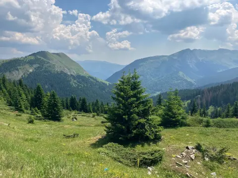
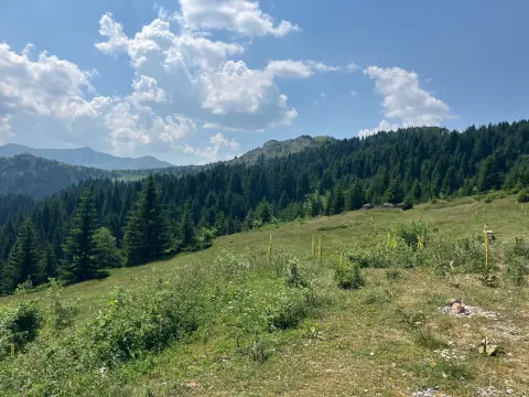
The entire trail passes through forest terrain with a dirt surface, making for pleasant walking suitable for hikers of all ages.
Bring enough water, even though the trail has two drinking fountains — you never know if the source is active.
Set off in the morning to avoid afternoon thunderstorms, which are common in the mountains in summer.
Wear lightweight hiking boots with good ankle support — the terrain is dirt and can be slippery after rain.
The trail is one-way, so arrange return or alternative transport to the starting point in advance.
Bring a light jacket or windbreaker because the temperature difference between 1395 m and 1772 m a.s.l. is noticeable.
Follow the weather forecast — fog and thunderstorms can appear suddenly at these elevations.
At elevations between 1400 m and 1800 m a.s.l., sudden weather changes are possible, especially afternoon thunderstorms and fog — follow the forecast and set off earlier. In an emergency, call 112.
Emergency number in Montenegro: 112.
Good to know
Best season
The trail is most suitable from June to October. Outside that period there may be snow and more difficult terrain at these elevations.
Getting there
The nearest town is Andrijevica, about 9,8 km from the trail. The trailhead is reached by private transport.
The trail is 3,3 km long and goes only in one direction, so the start and finish are not in the same place.
Estimated walking time without breaks is about 1 hour and 55 minutes. With breaks, allow a bit more time.
The trail is rated easy. The total ascent is 427 m, and the surface is entirely dirt and forest.
The recommended period is from June to October, when weather conditions are most favorable for hiking at these altitudes.
61.3 km↑ 1,755 m6½–9 h
10.4 km↑ 538 m3½–5 h

262 km↑ 6,918 m4–5 days
93.5 km↑ 3,250 m4–5 days
52.1 km↑ 3,118 m3–4 days
13.5 km↑ 689 m4½–6 h
15.5 km↑ 836 m5½–7½ h
Loop
26.9 km↑ 450 m2–2½ h
Times and grades are estimates. Conditions change: check the weather and local information before you set out.

Ask about Montenegro
Ask me about destinations, restaurants or activities.
