A circular hiking tour in the surroundings of Berane with an ascent to an altitude of 1,616 m.
Trail CS12 is a loop route of 15.5 km that starts and finishes at the same point. It passes through forested and rural landscapes, with a total ascent of 836 m and an estimated hiking duration of approximately 6 h 25 min.
Trail CS12 is a demanding loop tour of 15.5 km in the hinterland of Berane. It begins at an altitude of 879 m and gradually climbs to its highest point of 1,616 m. The total ascent is 836 m and the descent 834 m — the terrain is pronounced and requires good physical fitness.
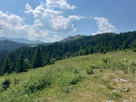
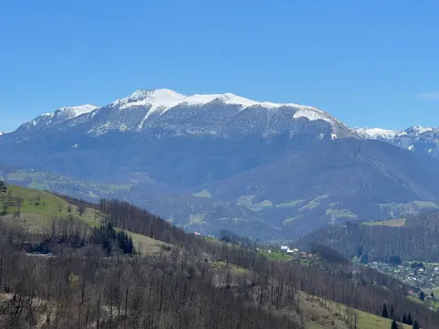
The surface is mixed: approximately 61% asphalt or concrete, with the remaining 39% consisting of dirt and forest paths. The forested sections offer pleasant shade and natural scenery. At 8.7 km from the starting point, the route passes near the peak of Mečit (1,649 m a.s.l.), which dominates this part of the terrain.
Along the trail there are three drinking fountains: the first at 1.4 km, then Vrelo Male rijeke at 2.3 km (998 m a.s.l.), and Velika česma at 6.5 km (1,541 m a.s.l.). These are useful stops for rest and refreshment.
The trail is intended for experienced hikers who are familiar with mountain movement and navigation in variable weather conditions.
What this difficulty means
Steep, rocky or exposed passages and a long day out. For fit, sure-footed hikers with mountain experience.
Places on this route
Move along the profile to follow the route on the map; switch on 3D for the terrain.
↑ 836 m · ↓ 834 m · highest point 1,616 m
Along the way
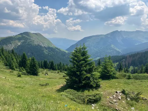
At 8.7 km from the starting point, the trail passes near the peak of Mečit — one of the highest points in this area, with open views over the surrounding mountain landscape.
At 6.5 km from the start, at a high altitude, Velika česma is a welcome stop with drinking water in the middle of one of the most demanding sections of the route.
Just 2.3 km from the starting point, Vrelo Male rijeke offers fresh drinking water and a pleasant spot for a short rest at the beginning of the ascent.
Already at 1.4 km from the starting point there is a drinking fountain — useful for topping up supplies right at the beginning of the tour.
The trail combines paved roads and dirt forest paths, offering a varied experience of moving through rural and mountain landscapes.
Set off early in the morning to avoid the midday heat and to have enough daylight for the entire tour.
Bring enough water, even though the trail has several drinking fountains — it is always good to have a reserve in your bottle.
Wear hiking boots with good soles, as the trail includes steep dirt sections that can be slippery in wet weather.
Allow at least 6 h 25 min of walking time without breaks — with rest stops, plan for a full day.
Monitor the weather forecast: at altitudes above 1,500 m conditions can change quickly, and thunderstorms are common on summer afternoons.
Bring a windproof and rain layer, especially for the higher section of the trail around Mečit.
At altitudes above 1,500 m weather conditions can change rapidly — fog, strong winds and sudden thunderstorms are possible. Do not set out in fog or a storm, and do not delay your return if the sky clouds over. In case of emergency, call **112**.
Emergency number in Montenegro: 112.
Good to know
Best season
The trail is most accessible from late spring to early autumn, approximately from May to October. Outside this period, snow and ice may appear on the higher sections, significantly increasing the risk.
Getting there
The trailhead is located approximately 7.9 km from Berane. The easiest way to reach the starting point is by private vehicle from the direction of Berane.
The trail is 15.5 km long and is a loop — it starts and finishes at the same point.
The estimated walking duration without breaks is 6 h 25 min. With rests and breaks, you should plan for a full day.
The trail is rated as demanding. The total ascent is 836 m, and the highest point reaches 1,616 m above sea level. It is recommended for experienced hikers.
Yes, the trail is marked. We advise you to follow the trail markers and use the GPS route recording as additional navigation.
93.5 km↑ 3,250 m4–5 days
27.2 km↑ 1,216 m8–11½ h

262 km↑ 6,918 m4–5 days
22.2 km↑ 359 m1½–2 h
61.3 km↑ 1,755 m6½–9 h
13.5 km↑ 689 m4½–6 h
52.1 km↑ 3,118 m3–4 days
3.3 km↑ 427 m1½–2½ h
Times and grades are estimates. Conditions change: check the weather and local information before you set out.

Ask about Montenegro
Ask me about destinations, restaurants or activities.
