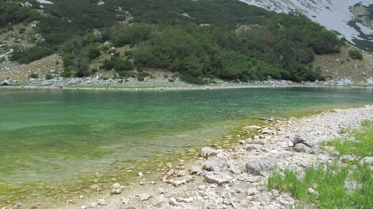
A mountain tour through the heart of Durmitor, from forest trails to high-altitude lakes.
A trail of 11.6 km leads from the Škrka Mountain Lodge to the Škrčka Lakes through Durmitor National Park. The trail is demanding, with a total ascent of 542 m and descent of 821 m, passing several mountain springs and offering a beautiful viewpoint.
The trail begins at the Škrka Mountain Lodge (1720 m a.s.l.), and right next to it there is a spring and shelter that can serve as a starting point for preparation. Already at 1.1 km, you reach the Marica spring (1815 m a.s.l.), and the trail then continues uphill towards its highest point of 2102 m a.s.l.
At 4.8 km from the start, there is the Vodice spring (1970 m a.s.l.), which is a good opportunity for a short break in the upper part of the trail. The terrain is mostly earthen and forested (79%), with sections of asphalt (17%) and gravel road (5%), which requires sturdy mountain footwear.
In the lower part of the trail, at 9.3 km, a viewpoint (1546 m a.s.l.) opens up, offering views of the surrounding landscape. Just before the end, at 10.5 km, there is the Zaboj spring (1494 m a.s.l.). The trail ends at its lowest point of 1436 m a.s.l.
The tour is one-way and is recommended for hikers in good physical condition. The estimated walking time without breaks is 4 h 55 min.
What this difficulty means
Steep, rocky or exposed passages and a long day out. For fit, sure-footed hikers with mountain experience.
Mountain hiking grade SAC T1 (scale T1–T6).
Move along the profile to follow the route on the map; switch on 3D for the terrain.
↑ 542 m · ↓ 821 m · highest point 2,102 m
Along the way
A shelter at 1720 m a.s.l. at the very beginning of the trail — an ideal starting point and place to prepare before setting off.
A mountain spring at 1815 m a.s.l., just 1.1 km from the start, marking the beginning of the ascent section of the route.
A spring at 1970 m a.s.l. in the upper parts of the trail, 4.8 km from the beginning — a natural oasis in a mountain setting.
At 9.3 km from the start, a viewpoint opens up offering views of the surrounding landscape of Durmitor.
A spring at 1494 m a.s.l., just before the end of the trail at 10.5 km — an excellent place for a rest in the final section of the tour.
Bring enough water, even though the trail passes several springs — do not rely on them exclusively.
Set off early in the morning to avoid afternoon thunderstorms, which are common on Durmitor during summer.
Wear sturdy hiking boots with good grip — the trail combines earthen, gravel, and asphalt sections.
The trail is one-way, so arrange transport or a pick-up at the end point in advance.
Bring warm clothing and a windbreaker — at altitudes above 2000 m, the temperature can drop suddenly.
The trail is located in Durmitor National Park — respect the park rules and do not leave waste in nature.
The trail passes through the high terrain of Durmitor, where weather conditions can change rapidly — fog, strong winds, and thunderstorms are possible, especially in the afternoon. Carry appropriate gear and check the weather forecast before setting out. In case of emergency, call the emergency services at **112**.
Emergency number in Montenegro: 112.
Good to know
Best season
The trail is most suitable from June to October, when the high-mountain areas are free of snow. Outside this period, snow and ice are possible, requiring specialized equipment.
Getting there
The starting point is located at the Škrka Mountain Lodge. The nearest larger town is Žabljak, about 9.1 km from the trail, from where transport to the start can be arranged.
The trail is 11.6 km long. The estimated walking time without breaks is 4 h 55 min.
The trail is rated as demanding on our scale. The total ascent is 542 m, and the descent is 821 m, with an elevation range between 1436 m and 2102 m above sea level.
The trail is one-way — the start and end are not at the same location, so it is necessary to arrange transport to or from the endpoint.
Given the elevation reaching 2102 m, the trail is most accessible during the summer and early autumn months, when the snow cover has melted.
42.4 km↑ 1,630 m2–3 days
23.5 km↑ 1,394 m8½–12 h
1.7 km↑ 551 m3–4 h
3.9 km↑ 16 m1½–2½ h
8.9 km↑ 1,244 m5½–7½ h

413 km↑ 8,566 m5–8 days
81.6 km↑ 2,135 m8–11½ h
11.7 km↑ 1,090 m5½–8 h
Times and grades are estimates. Conditions change: check the weather and local information before you set out.

Ask about Montenegro
Ask me about destinations, restaurants or activities.
