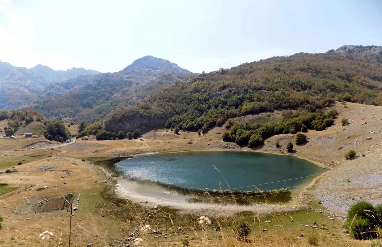
A demanding one-way hiking trail with an ascent to the peak of Maglić (2142 m a.s.l.) and springs along the route.
A one-way hiking trail 14.4 km long with 735 m of ascent and 965 m of descent. It passes near the peak of Maglić (2142 m a.s.l.) and offers several springs and viewpoints; estimated duration is 6 h 10 min.
The trail is a one-way hiking route 14.4 km in length. The starting point is approximately 6.4 km from Bukumirsko jezero. The lowest point is at 1443 m a.s.l. and the highest at 2137 m a.s.l. Total ascent is 735 m and total descent is 965 m; estimated duration without breaks is 6 h 10 min. For these reasons it is rated as demanding.
The first section of the trail leads to the peak of Stražarica (1885 m a.s.l.) at 3.0 km, and then to the peak of Maglić (2142 m a.s.l.) at 5.1 km. In this section the trail reaches its highest point of 2137 m a.s.l. At 6.7 km it crosses the pass Ćaf kiša (1958 m a.s.l.), after which a descent follows.
Further along, forested and alpine terrain alternate. The trail passes several springs and water taps, including Biočki izvor (12.4 km) and Mali izvor (13.2 km). Near the end there are viewpoints at 12.8 km and 13.7 km, and the last water tap is at 14.4 km.
The surface is mostly dirt/forest track (87%), with a smaller portion of gravel road (13%). Due to its length, ascent and altitude, the trail is intended for physically fit hikers.
What this difficulty means
Steep, rocky or exposed passages and a long day out. For fit, sure-footed hikers with mountain experience.
Places on this route
Move along the profile to follow the route on the map; switch on 3D for the terrain.
↑ 735 m · ↓ 965 m · highest point 2,137 m
Along the way
The nearest place to the start of the trail, approximately 6.4 km away.
At 5.1 km from the start; in this area the trail reaches its highest point of 2137 m a.s.l.
At 3.0 km from the start; a prominent peak in the first section of the trail.
Located at 6.7 km from the start, after the ascent to Maglić.
A water tap with drinking water at 12.4 km from the start of the trail.
The trail is one-way – plan your transport or return journey in advance.
Bring enough water; there are several springs and water taps along the trail, but it is good to carry a reserve.
Start early: the estimated duration without breaks is 6 h 10 min, and the trail is demanding.
Wear layered clothing and sturdy hiking boots; the surface is dirt/forest track and gravel road.
Check the weather forecast before setting off; elevations exceed 2000 m.
In the alpine section above 2000 m, weather can change rapidly; fog and thunderstorms can be dangerous. Follow the trail markers, do not stray from the path, and in case of emergency call 112.
Emergency number in Montenegro: 112.
Good to know
Best season
The most favorable period is from late spring to early autumn. At altitudes above 2000 m, snow and poor conditions can persist into late spring, and the trail is not recommended in winter.
Getting there
The nearest place to the start of the trail is Bukumirsko jezero, approximately 6.4 km away. The trailhead is reached via local roads; check road conditions before setting off.
The trail length is 14.4 km. The trail is one-way.
The estimated duration without breaks is 6 h 10 min.
The trail is demanding. The total ascent is 735 m, and the descent is 965 m; the highest point is at 2137 m above sea level.
Along the trail there are several springs and water taps, including Biočki izvor and Mali izvor. Nevertheless, bring enough water.

Hiking · Crno Jezero · Durmitor National Park
Hiking · Rikavačko jezero
Hiking
Hiking
Hiking · Bukumirsko jezero
Hiking
Hiking
Cycling · Riblje jezero · Durmitor National Park
Times and grades are estimates. Conditions change: check the weather and local information before you set out. Map and data sources →

