Easy hiking trail on a dirt road, with a spring and water fountains along the way.
The trail to Zagon Katun is 3.3 km long and easy to walk. It runs in one direction on a dirt road surface, with several drinking water points along the way.
A short and easy hiking trail leads to Zagon Katun. The trail is marked and 3.3 km long, running in one direction on a dirt road surface (100%). The total ascent is 103 m and the descent is 122 m. The trail runs between 1,620 m and 1,750 m above sea level, and the estimated duration without breaks is 1 h 5 min.
The start of the trail is located near Bukumirsko jezero, which is about 3.8 km from the starting point. Rikavačko jezero is also near the trail, approximately 2.4 km away. Along the trail there are several water points: at the start there is a spring at 1,734 m above sea level, and water fountains are located at 0.2 km, 1.7 km, 2.1 km and 2.8 km from the start.
The trail is suitable for families, beginners and anyone who wants a leisurely walk in a mountain setting. Due to the altitude, expect variable weather conditions. The best period to visit is from June to October.
What this difficulty means
Well-made paths with gentle gradients. Fine for families and anyone used to walking a few hours.
Places on this route
Move along the profile to follow the route on the map; switch on 3D for the terrain.
↑ 103 m · ↓ 122 m · highest point 1,750 m
The closest landmark to the start of the trail; it is about 3.8 km from the starting point.
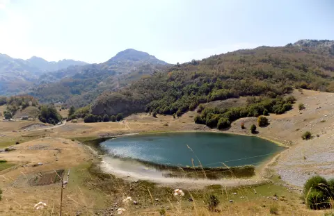
A lake near the trail, approximately 2.4 km from the trail.
A spring at 1,734 m above sea level, right at the beginning of the trail (0.0 km).
Water fountains / drinking water at 0.2 km (1,742 m a.s.l.), 1.7 km (1,623 m a.s.l.), 2.1 km (1,629 m a.s.l.) and 2.8 km (1,701 m a.s.l.) from the start.
The trail runs in one direction; plan your return in advance or arrange transport at the end point.
Wear layered clothing and footwear suitable for a dirt road surface; even in summer at altitudes above 1,600 m it can be cool.
There are several water fountains and a spring along the trail, but bring your own water as well.
Set off early and check the weather forecast; the walking duration without breaks is about 1 h 5 min.
The best months to visit are June, July, August, September and October.
The trail runs at an altitude of 1,620 to 1,750 m. Weather in mountain areas can change quickly, so keep an eye on the clouds and take shelter before a thunderstorm. In an emergency, call 112.
Emergency number in Montenegro: 112.
Good to know
Best season
The most suitable months are June, July, August, September and October. In other months, at this altitude it can be cold, snowy or slippery.
Getting there
The start of the trail is reached from the direction of Bukumirsko jezero, which is about 3.8 km from the starting point. Rikavačko jezero is also near the trail, approximately 2.4 km away.
The trail is 3.3 km long and runs in one direction.
The estimated duration without breaks is 1 h 5 min.
The trail is easy, with a total ascent of 103 m and a descent of 122 m.
The best months to visit are June, July, August, September and October.

143 km↑ 5,436 m6–9 days
14.4 km↑ 735 m5–7½ h
18.3 km↑ 931 m5½–8 h

413 km↑ 8,566 m5–8 days
2.5 km↑ 304 m1½–2 h
15.8 km↑ 740 m5–7 h
30.9 km↑ 2,722 m2–3 days
5.0 km↑ 56 m2–2½ h
Times and grades are estimates. Conditions change: check the weather and local information before you set out.

Ask about Montenegro
Ask me about destinations, restaurants or activities.
