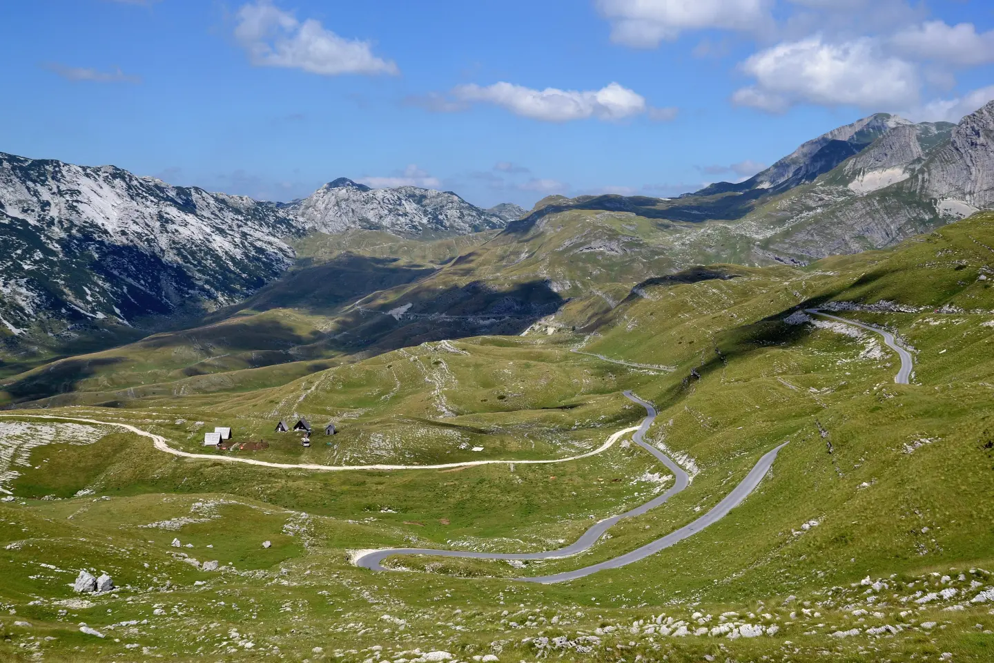
Panoramic Road No. 2 around Durmitor – via Štuoc, the Sušica Canyon and Sedlo
The Durmitor Ring is the official panoramic road marked as No. 2: a circular asphalt route around the Durmitor massif starting and ending in Žabljak, officially 76 km long. It runs along the edge of the Tara Canyon, through the Sušica Canyon and the villages of the Piva Mountain, over the passes below Štuoc (1,952 m) and Sedlo (1,907 m). It is suitable for driving and cycling.
The ring begins in the centre of Žabljak. It is recommended to drive anti-clockwise – the audio guide is also recorded in this direction – while campers are advised to go the opposite way. The route is marked in both directions with brown 'Panoramic Roads' signs bearing the number 2. From Žabljak the road leads towards Bosača, a village at about 1,600 m on the slopes of Štuoc, then uphill to the pass between Veliki Štuoc (2,104 m) and Mali Štuoc (1,953 m). At 1,952 m this is the highest point of the ring, also called the 'gate to Mala Crna Gora'.
Below Veliki Štuoc the road follows the very edge of the Tara Canyon, and then descends through the forest to the village of Mala Crna Gora. Just after the village the route drops into the Sušica Canyon, 15 km long and up to 700 m deep; at the bottom of the valley lies Sušičko Lake, which dries up completely in summer. Mala Crna Gora and Nedajno are only a few hundred metres apart as the crow flies, but the road over the canyon connects them over a distance of about 16 km. Beyond Nedajno the road passes through the dense forest of Milogora to Trsa, a village at the halfway point of the route.
From Trsa the route goes across the Piva Mountain to Pišče, a village with the Church of St. John dating from 1883, known for its sheep's cheese and skorup. It then climbs past Pirni Do to Todorov Do (about 1,800 m), above which rises Prutaš (2,393 m), and on to the Sedlo pass (1,907 m) – one of the most visited viewpoints, from where hiking trails set off towards Bobotov Kuk and Sedlena Greda.
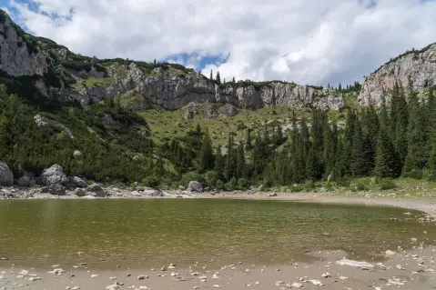
From Sedlo the road descends below Stožina through the Pošćen Valley, where the circular trail 'Jezero' begins (6.2 km, about 3 hours on foot). The last section of the ring follows the Šavnik – Žabljak main road, with a view of Savin Kuk (2,313 m). The road is asphalted throughout, but it is narrow and winding; the tour takes about 4 hours of driving and walking, or 4–5 hours with stops. For cyclists this is a demanding mountain tour due to its length and climbs.
Route: © OpenStreetMap contributors (ODbL).
What this difficulty means
Long distances, big climbs or technical sections. For fit, experienced riders.
Move along the profile to follow the route on the map; switch on 3D for the terrain.
↑ 2,040 m · ↓ 2,041 m · highest point 1,949 m
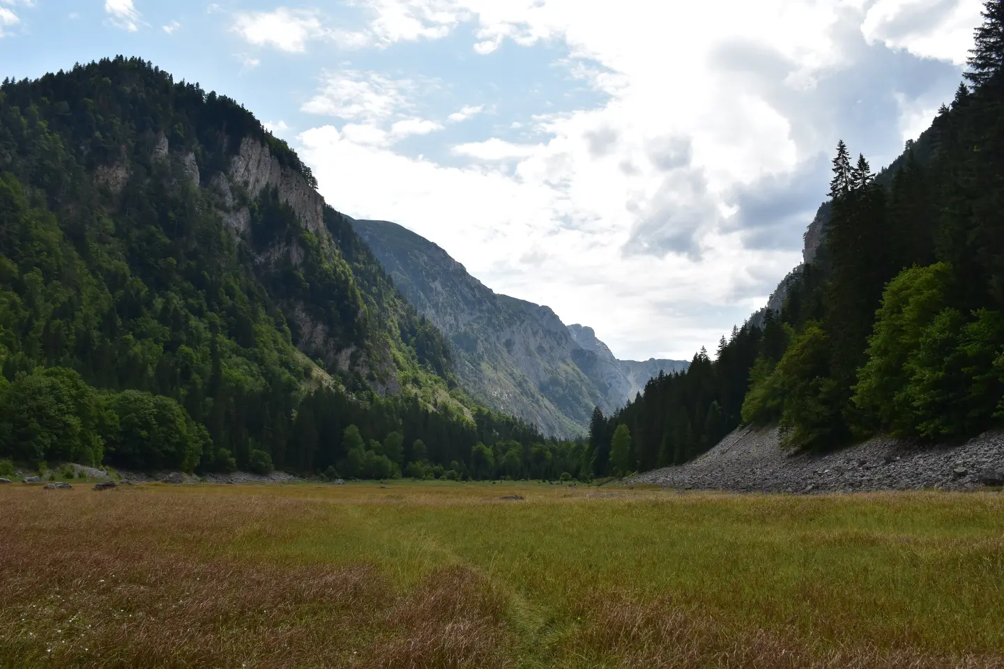
A canyon 15 km long and up to 700 m deep, into which the road descends just after Mala Crna Gora. At the bottom lies Sušičko Lake, which dries up in summer.
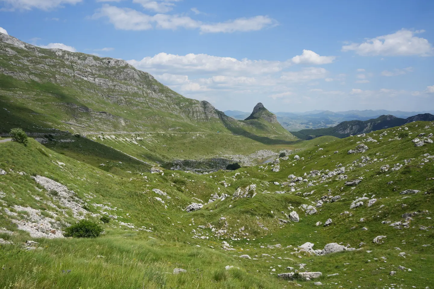
A viewpoint at 1,907 m with views of the surrounding lakes, Stožina and Šljeme; from here trails set off towards Bobotov Kuk and Sedlena Greda.
The highest point of the ring, at 1,952 m, between Veliki and Mali Štuoc. From here the road continues along the very edge of the Tara Canyon.
Villages of the Piva Mountain at the halfway point of the route. In Pišče there is the Church of St. John from 1883, and the area is known for sheep's cheese and skorup.
A valley at about 1,800 m above which rises Prutaš (2,393 m), with clearly visible rock strata.
A short excursion at the beginning of the route: 3 km on asphalt towards Tepca to the car park, then about 1.1 km of easy trail to the viewpoint (1,625 m) above the Tara Canyon.
Fill up with fuel before setting off – there are no petrol stations on the ring; the nearest are in Žabljak, Šavnik and Plužine.
Drive anti-clockwise; campers are recommended to go clockwise.
Tickets for Durmitor National Park are purchased from the wardens at car parks along the ring, e.g. at Sedlo, Ćurevac and Prutaš.
The weather in the mountains is different from the rest of the country – bring appropriate clothing and sun protection.
The road is narrow and winding. After winter and rain, rockfalls and road surface damage are possible, especially in the Sušica Canyon.
Emergency number in Montenegro: 112.
Good to know
Best season
Mainly from late May/June to October; check accessibility; in winter the road is mostly closed due to snow.
Getting there
The start is in the centre of Žabljak. You can also join the ring via regional road R-16 from Plužine or main road M-6 from Šavnik.
Officially 76 km, starting and ending in the centre of Žabljak. The tour takes about 4 hours of driving and walking, or 4–5 hours with stops.
In winter it is mostly closed due to snow. It is usually passable from late May or June to October, but before setting off check whether the entire route is passable.
Only with a smaller one: the route is not for campers longer than 7 m, wider than 2.30 m or higher than 2.90 m, and drivers of smaller campers should have experience on narrow mountain roads. For campers, driving clockwise is recommended.
The pass between Veliki Štuoc and Mali Štuoc, at 1,952 m. The Sedlo Pass is at 1,907 m.
Hiking · Žabljak · Durmitor National Park
Cycling · Španjola Fortress · Durmitor National Park
Cycling · Bijelo Polje · Biogradska Gora National Park
Cycling · Riblje jezero · Durmitor National Park
Hiking · Crno Jezero · Durmitor National Park

Hiking · Crno Jezero · Biogradska Gora National Park
Hiking · Žabljak
Hiking · Žabljak
Times and grades are estimates. Conditions change: check the weather and local information before you set out. Map and data sources →

