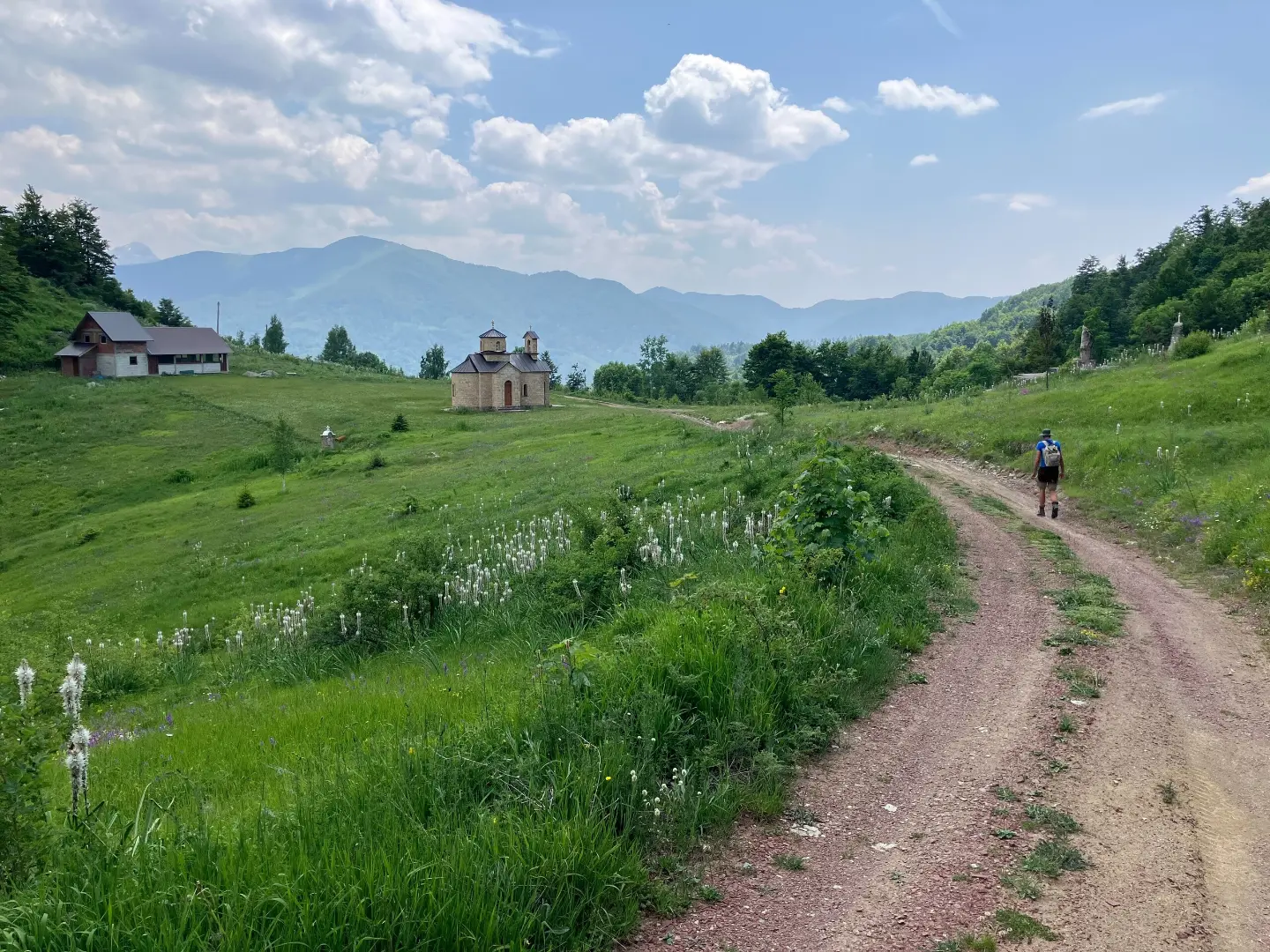
A demanding one-way hiking route with several drinking fountains and a spring.
The hiking trail from Mateševo via Ključ to Krivi Do is 15.3 km long. It has 949 m of total ascent, the highest point at 1791 m above sea level, and takes about 5 h 40 min without breaks.
The trail starts at a camp near Mateševo, at 989 m above sea level. It leads over Ključ to Krivi Do in one direction. It is 15.3 km long, with a total ascent of 949 m and a descent of 237 m. The lowest point is at 991 m above sea level, and the highest at 1791 m above sea level. The estimated walking time without breaks is 5 h 40 min.
The terrain is a combination of macadam (74 %) and dirt/forest trail (26 %). The trail is marked. In the first part, the trail passes several drinking fountains: at 0.3 km, 2.8 km, 7.2 km, 8.2 km and 13.4 km. At 13.1 km there is a spring. Nearby, about 6.1 km from the trail, is Pešića Lake.
The trail is demanding and intended for physically fit hikers. Plan a full-day outing with breaks. Don't forget hiking footwear and check weather conditions before setting off.
What this difficulty means
Steep, rocky or exposed passages and a long day out. For fit, sure-footed hikers with mountain experience.
Places on this route
Move along the profile to follow the route on the map; switch on 3D for the terrain.
↑ 949 m · ↓ 237 m · highest point 1,791 m
Along the way
At 0.0 km from the start, at 989 m above sea level, there is a camp – the starting point of the trail.
Drinking water is available at several points: 0.3 km, 2.8 km, 7.2 km, 8.2 km and 13.4 km.
The spring is located at 13.1 km (1692 m above sea level), and the drinking fountain “Dobra voda” at 13.4 km (1709 m above sea level).
The lake is about 6.1 km from the trail, near the route.
Bring enough water; the drinking fountains may dry up in the summer months.
Wear layered clothing and a waterproof jacket, even when it is sunny in the valley.
Start early in the morning – walking without breaks takes about 5 h 40 min, and with breaks plan for a full day.
Wear hiking footwear as sections are on macadam and forest trails.
Check the weather forecast and avoid thunderstorm days in higher sections.
Bring a basic first aid kit and a charged phone battery.
The trail is a demanding hiking trail. In higher sections, watch out for fog and thunderstorms. In case of an accident, call 112.
Emergency number in Montenegro: 112.
Good to know
Best season
The most favorable period for hiking is from late spring to early autumn. Higher sections at 1791 m above sea level may be under snow until late spring.
Getting there
The trailhead is at a camp near Mateševo, about 6.9 km from Kolašin.
The trail is 15.3 km long and runs in one direction.
The trail is demanding, with a total ascent of 949 m. Estimated walking time without breaks is 5 h 40 min.
Yes, there are several fountains along the trail: at 0.3 km, 2.8 km, 7.2 km, 8.2 km and 13.4 km (the “Dobra voda” fountain), as well as a spring at 13.1 km.
The start is at a camp near Mateševo, about 6.9 km from Kolašin.
Cycling · Riblje jezero · Durmitor National Park
Hiking · Kolašin
Cycling · Bijelo Polje · Durmitor National Park
Cycling · Španjola Fortress · Durmitor National Park
Hiking · Kolašin · Biogradska Gora National Park
Hiking · Kolašin
Cycling · Šiško Lake
Hiking · Kolašin · Biogradska Gora National Park
Times and grades are estimates. Conditions change: check the weather and local information before you set out. Map and data sources →

