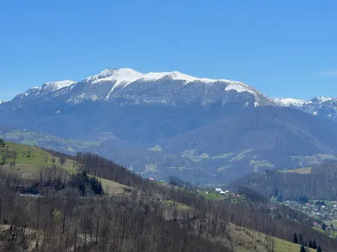
A one-way hiking trail through mountain terrain, with the summits of Kočine and Cmiljevica and two water springs.
The demanding hiking trail KRPLJE, 15.8 km long, runs one way with an ascent of 1182 m. It passes by the summit of Kočine, the summit of Cmiljevica and the pass Qafa e Dasmorëve, with two water springs along the way. Estimated duration: 7 hours.
The KRPLJE trail runs one way, from the starting point near Rožaje to the pass Qafa e Dasmorëve. The total length is 15.8 km, with an ascent of 1182 m and a descent of 546 m. The lowest point is at 1127 m a.s.l., and the highest at 1959 m a.s.l. The estimated walking time without breaks is about 7 hours, so the tour is intended for fit hikers.
In the first section, up to 6.0 km, the trail passes by the summit of Kočine (1446 m a.s.l.). At 8.7 km there is a drinking water spring at 1628 m a.s.l., after which the trail passes by the summit of Cmiljevica (1963 m a.s.l.) at 11.9 km. After that, at 13.6 km, there is another spring at 1767 m a.s.l., and the trail descends to the pass Qafa e Dasmorëve (1769 m a.s.l.) at 15.8 km.
The surface is varied: dirt and forest trail makes up 63%, asphalt/concrete 27%, and gravel road 10%. The walking is demanding due to the length, ascent and elevation difference. The trail offers views of the mountain area and connects several high-altitude points.
What this difficulty means
Steep, rocky or exposed passages and a long day out. For fit, sure-footed hikers with mountain experience.
Places on this route
Move along the profile to follow the route on the map; switch on 3D for the terrain.
↑ 1,182 m · ↓ 546 m · highest point 1,959 m
Along the way
At 6.0 km from the start, the trail passes by the summit of Kočine, at 1446 m a.s.l.
A drinking water spring is located at 8.7 km from the start.
At 11.9 km from the start, the trail passes by the summit of Cmiljevica, at 1963 m a.s.l.
A second drinking water spring is located at 13.6 km from the start.
At the end of the trail, at 15.8 km, lies the pass Qafa e Dasmorëve at 1769 m a.s.l.
Start early in the morning: the estimated walking time without breaks is 7 hours.
Bring enough water; there are two springs along the way (at 8.7 km and 13.6 km).
Wear hiking boots and layered clothing.
Check the weather forecast before setting out, as conditions at altitude can change rapidly.
Bring food and energy bars for a full-day effort.
In the mountains, sudden weather changes, fog and thunderstorms are possible. Check the forecast and do not set out if bad weather is threatening. In case of an accident, call 112.
Emergency number in Montenegro: 112.
Good to know
Best season
It is best to hike from late spring to early autumn, when the trails are generally dry and passable. Higher sections may be covered in snow from autumn to spring.
Getting there
The closest place to the start of the trail is Rožaje, approximately 7.7 km from the starting point.
The trail is 15.8 km long and runs one way.
The estimated duration without breaks is 7 hours.
The trail is demanding, with a total ascent of 1182 m and a descent of 546 m.
The closest place to the start of the trail is Rožaje, approximately 7.7 km away.

262 km↑ 6,918 m4–5 days
27.2 km↑ 1,216 m8–11½ h
93.5 km↑ 3,250 m4–5 days
24.9 km↑ 1,752 m2–3 days
37.4 km↑ 1,341 m4½–6 h
111 km↑ 2,882 m2–3 days
52.1 km↑ 3,118 m3–4 days
15.5 km↑ 836 m5½–7½ h
LoopTimes and grades are estimates. Conditions change: check the weather and local information before you set out.

Ask about Montenegro
Ask me about destinations, restaurants or activities.
