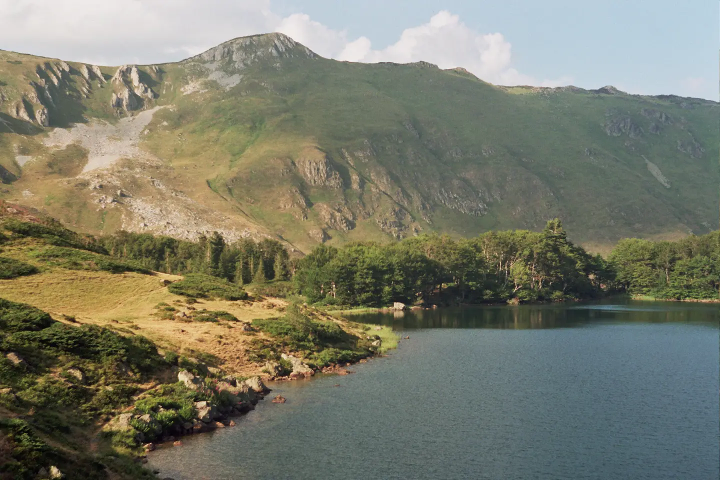
Bicycle trail through Biogradska Gora National Park with an ascent to the Olomerska Viewpoint.
An easy one-way cycling tour 7,3 km long, with a total ascent of 722 m. It leads through Biogradska Gora National Park and ends at the Olomerska Viewpoint (1.969 m above sea level).
Biking Trail BA05 is a one-way cycling tour 7,3 km long. The lowest point is at 1.268 m above sea level, and the highest at 1.968 m above sea level; total ascent is 722 m, and descent 30 m. The ride without breaks takes about 1 h 35 min. Most of the surface is asphalt/concrete (81 %), and a smaller part is dirt/forest trail (19 %).
The route passes through Biogradska Gora National Park. At 3,8 km, 4,1 km and 5,3 km from the start there are drinking water fountains, and at 5,3 km also a shelter. The trail ends at the Olomerska Viewpoint at 1.969 m above sea level, 7,3 km from the start.
The nearest place to the start is Pešića Lake, about 2,9 km away, and Šiško Lake is about 4,2 km from the trail. Due to easy difficulty and relatively short length, the trail is suitable for recreational cyclists; however, a constant ascent should be expected.
What this difficulty means
Mostly flat or gentle riding on good surfaces. Fine for occasional riders and families.
Places on this route
Move along the profile to follow the route on the map; switch on 3D for the terrain.
↑ 722 m · ↓ 30 m · highest point 1,968 m
Along the way
The end point of the trail at 1.969 m above sea level, 7,3 km from the start.
It is located at 1.753 m above sea level, 5,3 km from the start.
At 3,8 km (1.588 m above sea level), 4,1 km (1.631 m above sea level) and 5,3 km (1.755 m above sea level) from the start.
The trail passes through the national park area.
Near the trail, about 4,2 km.
Bring enough water even though there are fountains along the trail; at altitude the body is under greater strain.
Check the weather forecast before departure because conditions in the mountains change quickly.
Prepare your bike for a long ascent and partially dirt road; a spare inner tube and tools are essential.
Start earlier to avoid the heat and afternoon showers.
Respect the rules of Biogradska Gora National Park and do not leave the trail route.
In mountain conditions, fog, rapid weather changes and thunderstorms are possible. Bring a charged phone and monitor weather conditions. In emergencies call 112.
Emergency number in Montenegro: 112.
Good to know
Best season
The best period for riding is from late spring to early autumn, when the roads are usually passable and free of snow on higher sections.
Getting there
The nearest place to the start of the trail is Pešića Lake, about 2,9 km away. The trail is located in Biogradska Gora National Park.
The trail length is 7,3 km, one way.
Estimated riding time without breaks is 1 h 35 min.
On our scale it is easy, but it has a total ascent of 722 m; the lowest point is at 1.268 m above sea level, and the highest at 1.968 m above sea level.
Asphalt/concrete makes up 81% of the trail, and dirt/forest trail 19%.
22.8 km↑ 1,330 m7½–10½ h
44.4 km↑ 1,523 m4–5½ h
32.9 km↑ 1,691 m2–3 days
29.5 km↑ 1,189 m8½–12 h
15.1 km↑ 297 m1½–2 h
8.3 km↑ 1,148 m4–6 h
14.2 km↑ 269 m1½–2 h
43.0 km↑ 1,950 m5½–8 h
Times and grades are estimates. Conditions change: check the weather and local information before you set out.

Ask about Montenegro
Ask me about destinations, restaurants or activities.
