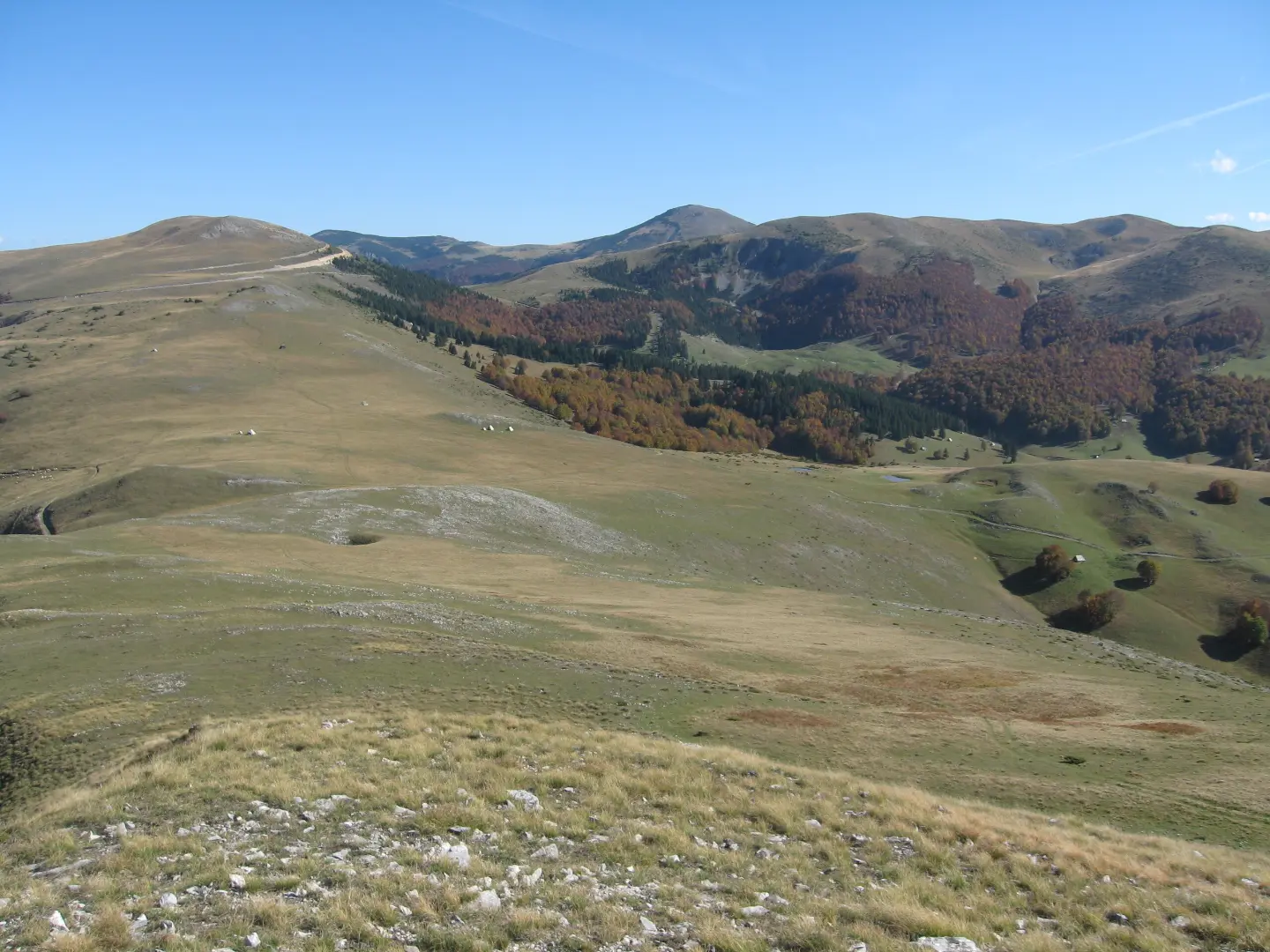
Demanding cycling trail, 39 km long with 1580 m of elevation gain, on asphalt and gravel roads.
A demanding one-way cycling trail, 39.0 km long. It passes through mountainous terrain with a total elevation gain of 1580 m and a mixed surface (61% asphalt/concrete, 39% gravel).
Biking Trail BP03 is a demanding one-way cycling trail, 39.0 km long. It starts near Šiško Lake and passes through the mountainous area between Bijelo Polje and Mojkovac. The total elevation gain is 1580 m, and the total descent is 1498 m.
The surface is mixed: 61% asphalt or concrete and 39% gravel. The lowest point of the trail is at 596 m a.s.l., and the highest is at 1814 m a.s.l. Along the way, forest areas, mountain ridges and open viewpoints alternate.
Notable points on the trail include the peak of Govedarice (1792 m a.s.l.) near the start, the Mountain Hut Cmiljača (1758 m a.s.l.) at 8.6 km from the start, and the peak of Mučnica (1809 m a.s.l.) just before the end. At several points there are drinking water fountains, including Bijela voda and Ugljar voda.
The trail is intended for physically fit cyclists. Due to the length, elevation gain and altitude difference, good fitness and technical preparation are required.
What this difficulty means
Long distances, big climbs or technical sections. For fit, experienced riders.
Places on this route
Move along the profile to follow the route on the map; switch on 3D for the terrain.
↑ 1,580 m · ↓ 1,498 m · highest point 1,814 m
Along the way
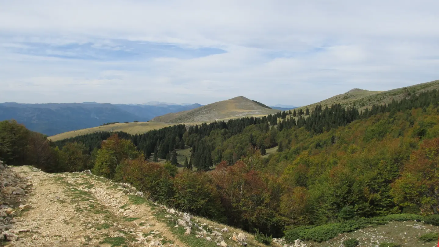
At 38.9 km from the start, just before the end of the trail; near the highest point of the route.
Located 1.0 km from the start of the trail.
Located 8.6 km from the start of the trail.
Drinking water at 14.6 km from the start of the trail.
Drinking water at 32.8 km from the start of the trail.
Check the weather forecast before setting off, as the trail reaches 1814 m a.s.l.
Bring enough water and refill it at the marked drinking fountains along the trail.
Start early and plan for 5 h 45 min of riding without breaks.
Use a bicycle suited for mixed surfaces (39% gravel).
Bring layered clothing and protection from sun and wind.
Be sure to bring tools for basic repairs and a spare inner tube.
The trail passes through mountainous terrain at altitudes of up to 1814 m a.s.l. Weather conditions can change quickly; fog and thunderstorms are possible during warmer months. In case of emergency, call 112.
Emergency number in Montenegro: 112.
Good to know
Best season
Due to the altitude of up to 1814 m a.s.l., the most favourable time to ride is from late spring to early autumn, when the roads are dry and weather conditions are more stable.
Getting there
The start of the trail is approximately 5.2 km from Šiško Lake. Bijelo Polje (about 5.7 km from the trail) and Mojkovac (about 6.0 km from the trail) are nearby.
The trail is 39.0 km long.
The estimated duration is 5 h 45 min without breaks.
The trail is rated as demanding, with a total ascent of 1580 m and descent of 1498 m.
Asphalt or concrete make up 61 % of the trail, and gravel road 39 %.
18.7 km↑ 149 m5–7½ h
41.4 km↑ 1,496 m2–3 days
78.8 km↑ 2,501 m3–5 days

143 km↑ 5,436 m6–9 days
11.3 km↑ 616 m3½–5 h
22.8 km↑ 1,540 m7½–10½ h

262 km↑ 6,918 m4–5 days

399 km↑ 9,352 m5–8 days
Times and grades are estimates. Conditions change: check the weather and local information before you set out.

Ask about Montenegro
Ask me about destinations, restaurants or activities.
