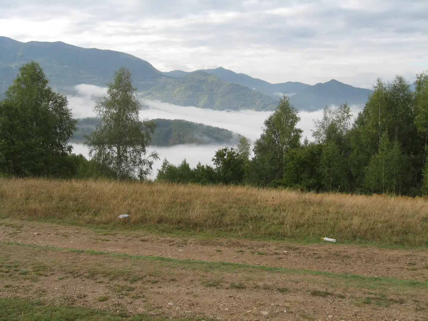
A hiking journey from Krstac to Vrioca through the mountainous terrain above Mojkovac.
The trail of 11.3 km leads from Krstac to Vrioca with a total ascent of 616 m. It is demanding and intended for experienced hikers who want a long, varied walk through the mountain terrain above Mojkovac.
The trail begins at Krstac, where within the first 100 m there is a viewpoint at 1007 m a.s.l. – a good opportunity to immediately survey the direction of travel and the surrounding terrain. The first few kilometres pass mostly along asphalt and gravel roads, and at around 4.0 km from the start you pass by the peak of Suvovrh (1162 m a.s.l.).
Afterwards the terrain gradually gains altitude. At 5.0 km there is a spring, and at 8.0 km another one – useful rest stops along the way. Around 9.2 km from the start the trail passes by the peak of Dekovac (1312 m a.s.l.), from where it continues towards higher elevations.
In the final section, between 10.2 km and 11.3 km, there are as many as four springs, and at 10.4 km the Mountain Hut Džambas (1420 m a.s.l.) is situated – a natural destination for a short rest before the end of the tour. The trail ends at Vrioca, where there is a spring at 1494 m a.s.l.
Since the trail is not circular, it is necessary to arrange transport to the end point or a return journey in advance. It is recommended for experienced hikers in good physical condition.
What this difficulty means
Steep, rocky or exposed passages and a long day out. For fit, sure-footed hikers with mountain experience.
Places on this route
Move along the profile to follow the route on the map; switch on 3D for the terrain.
↑ 616 m · ↓ 149 m · highest point 1,481 m
Along the way
Just 100 m from the start there is a viewpoint at 1007 m a.s.l. offering views of the surrounding mountain terrain.
At 4.0 km from the start the trail passes by the peak of Suvovrh, the first prominent landmark in the relief.
At 9.2 km from the start you pass by the peak of Dekovac, which marks the entry into the final, higher section of the trail.
At 10.4 km and 1420 m a.s.l. the Mountain Hut Džambas is situated – an ideal place to rest just before the end of the tour.
The trail features several springs, particularly densely spaced in the final section between 10.2 km and 11.4 km.
The trail is not circular – arrange transport in advance or have someone meet you at Vrioca.
Start early in the morning to avoid the midday heat and to have enough time without rushing.
Wear solid hiking footwear – the trail combines asphalt, gravel roads and dirt paths.
Carry enough water for the first half of the trail; springs are more frequent in the final section.
Bring spare warm clothing – the elevated terrain above 1400 m can be cold and windy.
If you encounter a thunderstorm, leave exposed peaks and take shelter in a safe place.
The trail passes through high mountain terrain up to 1481 m a.s.l., where weather conditions can change rapidly – pay attention to signs of approaching thunderstorms and fog. Carry appropriate equipment and do not set out in bad weather. In case of an accident, call the emergency services on 112.
Emergency number in Montenegro: 112.
Good to know
Best season
The trail is most suitable from late spring to early autumn (approximately May–October), while the mountain passes are passable. In winter there may be snow and ice on the higher sections of the trail.
Getting there
The starting point of the trail at Krstac is about 2.9 km from Mojkovac. Mojkovac can be reached by car, and from there you can continue to the starting point.
The trail is 11.3 km long and runs in one direction from Krstac to Vrioca.
The estimated walking duration without breaks is about 4 hours. Allow more time if you plan to take breaks.
The trail is rated as demanding, with a total ascent of 616 m and the highest point at 1481 m above sea level. It is recommended for experienced hikers.
The trail reaches 1481 m above sea level, so it is most suitable from late spring to early autumn, when the mountain passes are accessible and walking is safe.
Cycling · Mojkovac
Hiking · Crno Jezero · Durmitor National Park

Hiking · Crno Jezero · Biogradska Gora National Park
Cycling · Šiško Lake · Biogradska Gora National Park
Hiking · Mojkovac · Biogradska Gora National Park
Hiking · Šiško Lake · Biogradska Gora National Park
Hiking · Kolašin · Biogradska Gora National Park
Cycling
Times and grades are estimates. Conditions change: check the weather and local information before you set out. Map and data sources →

