A walk from the lake to the katun of the Bogavac family on the Bjelasica pass.
The trail from Biogradsko Lake to the Laništa katun and the Bogavac huts is about 3.7 km long (the sign in the park says 3.8 km). Forest roads and paths lead to the katun on the Bjelasica pass, on the border of Biogradska Gora National Park.
The trail starts at Biogradsko Lake, next to the Visitor Centre and parking lot, where a signboard “Summer in the Katun” points the direction to Laništa katun and Bogavac huts – 3,800 m. Shortly after the start, there is a water spring along the way.
Continue along forest paths and roads heading north to Laništa katun on the Bjelasica pass, on the border of Biogradska Gora National Park. The Bogavac family's katun got its name from the fawns that roe deer and does bring out to graze in spring below the upper forest limit. The mountain trail Biogradsko Lake – Laništa – Bjelojevići – Mojkovac also passes through the katun.
At the katun, the household offers accommodation in huts and homemade food, upon request. The signboard “Summer in the Katun” reminds how the local people lived “off livestock” and measured wealth by the size of the herd.
The route on the map is compiled from OpenStreetMap roads and paths (© OpenStreetMap contributors, ODbL) and corresponds to the length indicated on the signboard; on the ground follow the park's signposts.
What this difficulty means
Well-made paths with gentle gradients. Fine for families and anyone used to walking a few hours.
Move along the profile to follow the route on the map; switch on 3D for the terrain.
↑ 267 m · ↓ 37 m · highest point 1,355 m
Along the way
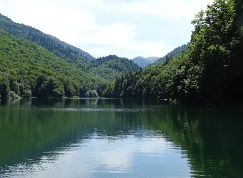
Starting point at the Visitor Centre, next to a glacial lake at 1,094 m surrounded by old-growth forest.
Along the way, shortly after the start.
Katun on the Bjelasica pass, on the park border, with huts for accommodation and homemade food upon request.
The trail is in Biogradska Gora National Park: the daily entrance fee is €4 per person (children under 15 are free), and parking for a car at the lake is €1 for the whole day (paid together with the entrance).
Announce accommodation or a meal at the katun in advance.
On the ground follow the park's signposts; the route on the map is compiled from OSM roads and paths.
Bring water and footwear with good soles – forest trails are slippery after rain.
Weather in the mountains changes quickly – bring a jacket, water, and footwear with good soles. In emergencies call 112.
Emergency number in Montenegro: 112.
Good to know
Best season
Best from May to October. The park closes to visitors in winter due to snow and ice (in 2026 from January 9 to March 16), and temporarily during severe storms – notifications are on nparkovi.me.
Getting there
An asphalt road about 3 km long leads to Biogradsko Lake from the park entrance at Kraljevo Kolo, next to the Kolašin – Mojkovac main road. The trail starts at the Visitor Centre and parking lot by the lake.
About 3.7 km one way; the sign in the park says 3.8 km.
At Biogradsko Lake, next to the Visitor Centre and parking lot.
Yes, the Bogavac family household at Laništa katun offers accommodation in huts and homemade food, upon request.
Cycling · Šiško Lake · Biogradska Gora National Park
Cycling · Šiško Lake · Biogradska Gora National Park
Hiking · Šiško Lake · Biogradska Gora National Park
Hiking · Kolašin · Biogradska Gora National Park
Cycling · Šiško Lake · Biogradska Gora National Park
Hiking · Mojkovac · Biogradska Gora National Park
Cycling · Šiško Lake
Hiking · Šiško Lake · Biogradska Gora National Park
Times and grades are estimates. Conditions change: check the weather and local information before you set out. Map and data sources →

