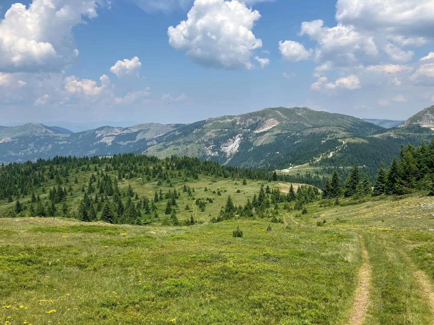
A demanding mountain tour along the peaks of Prokletije with numerous springs and panoramic views.
A 14.0 km tour leads through the heart of Prokletije National Park, crossing passes and peaks at elevations of up to 2,426 m above sea level. The trail is marked and suitable for experienced hikers.
The trail begins at an elevation of 1,581 m and heads northeast through Prokletije National Park. At around 1.4 km from the start there is a campsite near Babino polje, and as early as 3.8 km water can be refilled at a fountain at 2,184 m above sea level.
After the fountain the trail climbs towards the pass Ćafa Starac (2,307 m above sea level, km 6.2), then passes by the peak Bandera od Starca (Crni krš) (2,426 m above sea level, km 6.8) – the highest point of the route. A descent follows towards the peak Mali Starac (2,061 m above sea level, km 8.8), near which there are fountains at km 9.0 and 9.3, and a spring at km 9.4. At km 10.6 the trail passes Redžova česma (1,900 m above sea level).
In the final section the route crosses the pass Prevoj Dio (1,915 m above sea level) and the peaks Djevojački krš (2,037 m above sea level) and Ravno brdo (2,040 m above sea level), ending at the pass Čakor (1,859 m above sea level) where a shelter, viewpoint and bus stop are located.
The trail is entirely dirt and marked. Total ascent is 1,030 m, descent 809 m. It is intended for experienced hikers in good physical condition.
What this difficulty means
Steep, rocky or exposed passages and a long day out. For fit, sure-footed hikers with mountain experience.
Mountain hiking grade SAC T2 (scale T1–T6).
Move along the profile to follow the route on the map; switch on 3D for the terrain.
↑ 1,030 m · ↓ 809 m · highest point 2,411 m
Along the way
The highest point of the route at 6.8 km from the start. From here a wide view of the surrounding peaks of Prokletije opens up.
The key pass at 6.2 km, which marks the transition from the ascent to the ridge and offers open views in both directions.
A prominent peak at 8.8 km from the start, in the immediate vicinity of which there are as many as three water sources.
A fountain at 10.6 km, suitable for a short rest and water refill in the second half of the route.
At 14.0 km the trail ends at Čakor Pass (1,859 m above sea level), where a shelter, viewpoint and bus stop are located.
Set off early in the morning to finish the trail before the afternoon thunderstorms that are common in the summer months.
Wear hiking boots with good ankle support – the trail is entirely dirt, but the terrain is demanding and steep.
There are several fountains and springs along the route, but always carry water reserves as the reliability of the sources can vary.
The trail is one-way – arrange transport in advance or use the bus stop at Čakor.
In Prokletije National Park, observe the prescribed rules on movement and camping.
Bring warm clothing and a rain jacket even in fine weather – mountain climate can change suddenly.
The trail passes through mountain terrain at high elevations where weather conditions can change rapidly – fog, strong wind and thunderstorms are possible. Always inform someone of your planned itinerary and carry full equipment. In case of emergency call emergency services at 112.
Emergency number in Montenegro: 112.
Good to know
Best season
The trail is most suitable from June to September, when the terrain is passable and free of snow. Outside the summer season caution is advised due to possible snow and ice on the higher sections of the route.
Getting there
The closest lake to the start of the trail is Hridsko jezero, approximately 3.9 km away. The nearest town is Plav, about 8.5 km from the trail.
The trail is 14.0 km long. The estimated walking time without breaks is 6 h 50 min.
The trail is rated as demanding (SAC hiking scale T2) with a total ascent of 1030 m and descent of 809 m.
Yes, the trail is marked along its entire length.
The trail is located at elevations between 1581 m and 2426 m, so it is most suitable during the summer season (June–September), when passage through snow is minimal. Outside that period, it is recommended to check the conditions on the ground.
Hiking · Hridsko Lake · Prokletije National Park
Cycling · Plav · Prokletije National Park
Hiking · Hridsko Lake · Prokletije National Park
Hiking · Hridsko Lake · Prokletije National Park
Hiking · Andrijevica · Prokletije National Park
Hiking · Plav
Hiking · Plav
Hiking · Plav
Times and grades are estimates. Conditions change: check the weather and local information before you set out. Map and data sources →

