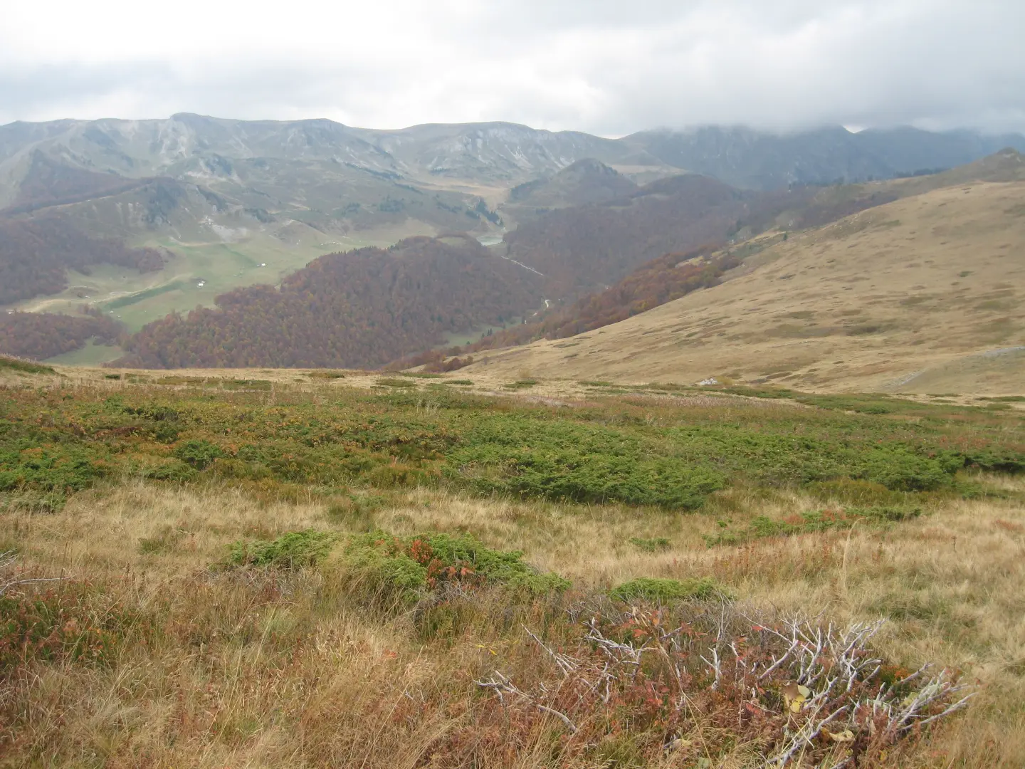
A very demanding hiking tour through Biogradska Gora National Park featuring Šiško Lake and peaks over 2000 m.
The Brzava – Šiško Lake hiking trail is 26.3 km long and leads through Biogradska Gora National Park. With 1589 m of ascent and the highest point at 2011 m above sea level, it is intended for experienced hikers.
The Brzava – Šiško Lake trail is 26.3 km long and runs one way through Biogradska Gora National Park. It starts in Brzava at 609 m above sea level and gradually climbs towards Ravni Klek Peak, where it reaches the highest point of 2011 m above sea level.
At 8.0 km the trail crosses Pravina Pass (1072 m above sea level). At 18.0 km there is the Bijela Voda Spring (1854 m above sea level), suitable for refilling water. At 19.5 km comes Ravni Klek Peak (2009 m above sea level), and at 24.1 km Čadorišta Peak (1902 m above sea level). The trail then descends and ends near Šiško Lake.
The surface is mixed: 38% asphalt/concrete, 33% earth/forest trail and 30% gravel road. Total ascent is 1589 m and descent 535 m. The trail is very demanding and intended for experienced hikers; the estimated walking time without breaks is 9 h 45 min.
What this difficulty means
Very long or alpine terrain where hands may be needed, with few ways out. Only for experienced mountaineers in stable weather.
Move along the profile to follow the route on the map; switch on 3D for the terrain.
↑ 1,589 m · ↓ 535 m · highest point 2,011 m
Along the way
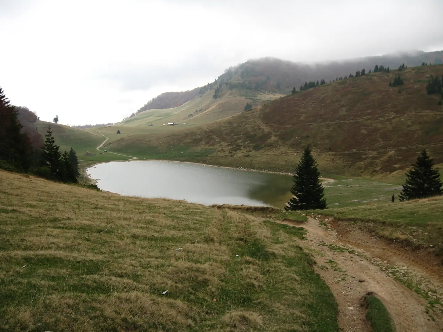
The trail passes by Šiško Lake, about 0.1 km from the shore itself.
The peak at 2009 m above sea level is located 19.5 km from the start. Near it the trail reaches the highest point of 2011 m above sea level.
The peak at 1902 m above sea level is located 24.1 km from the start, in the final part of the trail.
A drinking water spring at 1854 m above sea level, 18.0 km from the start.
The pass at 1072 m above sea level, 8.0 km from the start, is one of the natural landmarks on the ascent.
Bring enough water; the trail has marked springs, including Bijela Voda at 18.0 km.
Wear hiking footwear with good soles because the surface is mixed (asphalt, earth, gravel).
Start early in the morning because the estimated duration without breaks is 9 h 45 min.
Check the weather forecast before setting off; above 2000 m above sea level the weather changes quickly.
The trail is very demanding, so good physical condition and hiking experience are recommended.
The trail reaches altitudes over 2000 m; be prepared for fog, cold and rapid weather changes. In case of thunderstorms avoid exposed peaks. In emergencies call 112.
Emergency number in Montenegro: 112.
Good to know
Best season
Due to the altitude of up to 2011 m, the trail is most accessible from late spring to early autumn. In the winter months there can be snow and ice, so additional equipment is required.
Getting there
The trail starts in Brzava. The trail is located in Biogradska Gora National Park.
The trail is 26.3 km long, and the estimated duration without breaks is 9 h 45 min.
The trail is very demanding and is intended for experienced hikers.
The trail is marked.
No, the trail is one-way — the start and end are not in the same place.
44.2 km↑ 1,794 m5½–8 h
111 km↑ 2,882 m2–3 days
17.3 km↑ 1,380 m6–9 h
51.4 km↑ 1,468 m5½–7½ h

399 km↑ 9,352 m5–8 days
50.2 km↑ 1,943 m6–8½ h
95.7 km↑ 3,723 m2–3 days
39.0 km↑ 1,580 m5–7 h
Times and grades are estimates. Conditions change: check the weather and local information before you set out.

Ask about Montenegro
Ask me about destinations, restaurants or activities.
