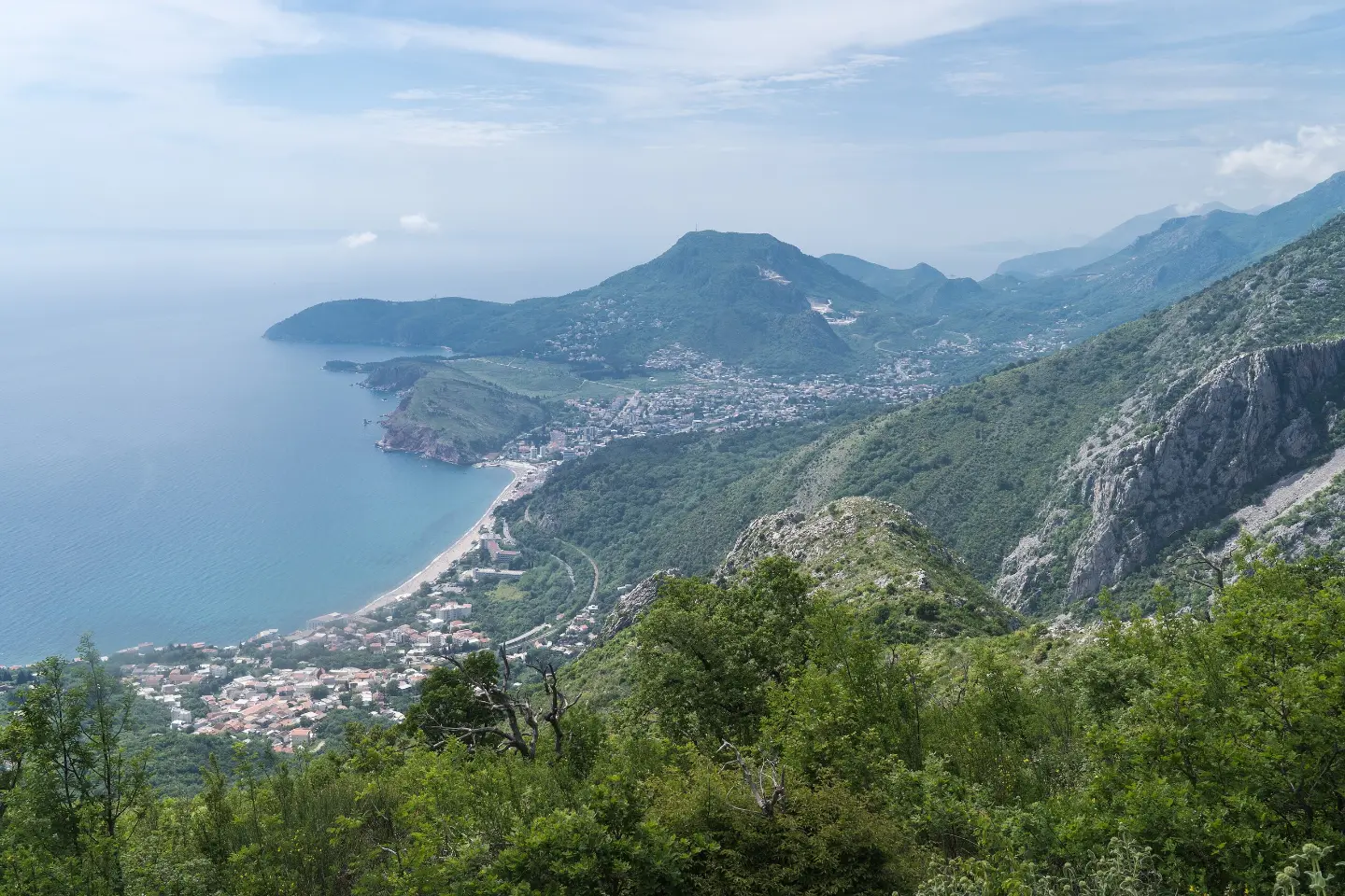
An easy marked hiking tour through wooded and rocky areas, with a spring and a viewpoint along the way.
The marked hiking trail in one direction from Sutorman to Mogila is 4.1 km long and takes about 1 h 55 min without breaks. The ascent is gentle (87 m), and the descent is 543 m; the trail is easy (T1).
The Sutorman – Mogila trail is a marked mountain and hiking tour in one direction. It is 4.1 km long, with a total ascent of 87 m and a descent of 543 m. The highest point on the route is 731 m above sea level, and the lowest is 264 m above sea level. Crossing without breaks takes about 1 h 55 min.
The terrain is mostly earthen and forested: 71% of the route consists of dirt and forest trails, and 25% rocky terrain. The trail is easy and corresponds to the T1 hiking scale. The marking is in the form of a red circle on a white background.
At 2.5 km from the start of the trail there is a spring at 611 m above sea level, and at 3.1 km the viewpoint Panoramic view point at 471 m above sea level. Near the trail are the beaches Red Beach, Žukotrlica Beach and Sutomore, and the nearest place to the start of the trail is Ratac Beach, about 3.6 km away.
Due to the gentle ascent and moderate descent, the tour is suitable for occasional hikers and those with basic fitness. Thanks to the marking and mostly earthen terrain, it is easy to follow, but the rocky section requires attention.
What this difficulty means
Well-made paths with gentle gradients. Fine for families and anyone used to walking a few hours.
Mountain hiking grade SAC T1 (scale T1–T6).
Places on this route
Move along the profile to follow the route on the map; switch on 3D for the terrain.
↑ 87 m · ↓ 543 m · highest point 731 m
Along the way
Natural spring next to the trail, 2.5 km from the start of the route and at 611 m above sea level.
View from the viewpoint at 3.1 km from the start of the trail, at an altitude of 471 m.
Within a radius of up to 10 km from the trail are Red Beach (about 1.0 km), Žukotrlica Beach (about 1.2 km) and Sutomore (about 1.8 km).
Wear light hiking footwear with a good sole; about 25% of the route is rocky.
Bring enough water, especially during the warm months.
Follow the marking in the form of a red circle on a white background.
Check the weather forecast and avoid the trail during thunderstorms.
Start early enough, as the trail is one-way and takes about 1 h 55 min without breaks.
On rocky and forest sections, slippery spots are possible after rain. Follow the markings and do not leave the route. In case of emergency, call 112.
Emergency number in Montenegro: 112.
Good to know
Best season
The trail can be used during most of the year. Due to the highest point of 731 m above sea level and the proximity of the sea, spring and autumn are a good choice; in summer avoid the hottest part of the day.
Getting there
The nearest place to the start of the trail is Ratac Beach, about 3.6 km away. Near the trail are the beaches Red Beach, Žukotrlica Beach and Sutomore.
The trail is 4.1 km long in one direction.
Walking without breaks takes about 1 hour and 55 minutes.
The trail is easy on our scale and corresponds to the T1 hiking scale.
Yes, the trail is marked with a red circle on a white background.

Cycling · Ada Bojana · Lake Skadar
Cycling · Topolica Beach · Lake Skadar
Hiking · Sutomore
Hiking · Sutomore
Hiking · Sutomore
Hiking · Utjeha

Hiking · Sutomore
Hiking · Haj-Nehaj Fortress
Times and grades are estimates. Conditions change: check the weather and local information before you set out. Map and data sources →

