A short and easy forest trail to the viewpoint and Treštenički vrh in Lovćen National Park.
An easy hiking tour in Lovćen National Park, 1.0 km long, with 83 m of ascent, lasting about 25 min. The trail leads to a viewpoint at 1480 m a.s.l. and Treštenički vrh at 1489 m a.s.l.
A short hiking trail in Lovćen National Park leads from the starting point at 1391 m a.s.l. to the final viewpoint at 1480 m a.s.l. The length is 1.0 km, and the total ascent is 83 m; there is no descent. The trail is one-way and runs entirely on a dirt/forest surface.
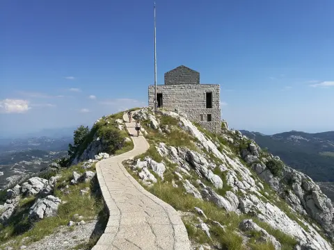
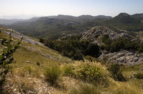
The walk is easy and takes about 25 min without breaks. At the end of the trail, 1.0 km from the start, is the viewpoint at 1480 m a.s.l., and next to it Treštenički vrh at 1489 m a.s.l. The trail offers views of the surroundings of Lovćen National Park.
The trail is suitable for recreational hikers and families with basic hiking experience. Due to its short length and gentle ascent, it is also good for a shorter outing. Nearby are Cetinje (about 7.0 km), Kotor (about 8.0 km), and Tvrđava Svetog Ivana (about 7.9 km).
What this difficulty means
Well-made paths with gentle gradients. Fine for families and anyone used to walking a few hours.
Move along the profile to follow the route on the map; switch on 3D for the terrain.
↑ 83 m · ↓ 0 m · highest point 1,480 m
Along the way
Summit at 1489 m a.s.l., 1.0 km from the trailhead.
A point at 1480 m a.s.l. with views, 1.0 km from the trailhead.
The trail runs entirely within Lovćen National Park.
Natural surface along all 1.0 km of the trail.
Bring enough water even though the trail is short.
Wear comfortable footwear suitable for a dirt/forest surface.
Check the weather forecast before setting off; in mountainous areas the weather can change quickly.
Bring layered clothing; at 1480 m a.s.l. it can be cooler than in the surrounding areas.
Set off earlier if you want a peaceful visit at the viewpoint.
The trail is short and easy, but it is located in a mountainous area. Check the weather conditions and avoid thunderstorms. In emergencies, call 112.
Emergency number in Montenegro: 112.
Good to know
Best season
The best period is from late spring to early autumn, when the trails are usually dry and clear. In winter and early spring, there may be snow or mud at this altitude.
Getting there
The trailhead is in Lovćen National Park. The closest landmark to the trailhead is Cetinjski manastir, about 7.0 km away; the nearest towns are Cetinje (about 7.0 km) and Kotor (about 8.0 km).
The trail is 1.0 km long and goes in one direction.
The walk without breaks takes about 25 minutes.
It is easy: it has 83 m of ascent and 0 m of descent, and runs entirely on a dirt/forest surface.
In Lovćen National Park. The closest place to the start of the trail is Cetinje Monastery, approximately 7.0 km away.
19.7 km↑ 216 m5–7½ h
16.5 km↑ 692 m4½–6½ h
7.7 km↑ 244 m2–3 h

406 km↑ 10,191 m6–8 days
34.3 km↑ 1,738 m2–3 days
6.1 km↑ 156 m1½–2½ h
2.8 km↑ 350 m1½–2 h
10.1 km↑ 265 m3–4½ h
Times and grades are estimates. Conditions change: check the weather and local information before you set out.

Ask about Montenegro
Ask me about destinations, restaurants or activities.
