Travel to Montenegro
Kotor to Cetinje over Lovćen: a drive up the serpentine to Njegoš's Mausoleum
Free audio guide

Kotor to Cetinje over LovćenA drive up the serpentine to Njegoš's Mausoleum

Free self-guided audio drive on the old road, no app needed

  • Free · no app needed
  • 1 languageME
  • Easy walk
by car
240 min
route
⁨58.7 km⁩
stops
12
Overview

An audio guide for the drive on the old road from Kotor to Cetinje: the twenty-five hairpins of the serpentine above the Bay of Kotor, the Krstac pass, Njeguši with its smoked ham and Njegoš's birthplace, the road through Lovćen National Park to Njegoš's Mausoleum on Jezerski vrh, and the descent via Ivanova Korita to Cetinje. Twelve stops, about sixty kilometres, half a day with stops.

Audio in this language is coming soon

Every stop's full text is on this page and in the player. You can also listen in:

How it works

  1. Download, then press start

    Save the tour over Wi-Fi before you set off – mountain roads lose signal. Choose “Driving” and connect the phone to the car or use headphones.

  2. Drive at your own pace

    Each stop starts by itself as you approach it. If one is still playing, the next waits until it ends – nothing is cut off.

  3. Hands on the wheel

    Big buttons, the screen stays on, and the steering-wheel or headphone buttons play, pause and skip.

Route

The drive on the map

The tour starts at Kotor, car park by the Old Town. Tap a number to play that stop.

Stop by stop

12 stops on the way

Listen, or read the full narration of every stop below.

Before you start

Welcome

Welcome. This is the Travel to Montenegro audio guide for the drive on the old road from Kotor to Cetinje. We will climb the serpentine above the bay to the Krstac pass, stop in Njeguši, go up to Njegoš's Mausoleum on Mount Lovćen and come down to Cetinje. It is about sixty kilometres with twelve stops, so allow half a day. You need a car for this tour. Without one, take a taxi or an organised trip. The stories start by themselves as you approach each stop. The driver watches the road, not the screen. The road is narrow, the bends are tight, and in summer buses use it too. Never stop on a bend; stop only at the lay-bys and car parks we mention. In the summer season the serpentine is closed to one direction at certain hours, so check the schedule before you set off. In winter Lovćen has fog, snow and ice. Tickets for the national park and the mausoleum are sold on site. Have a good trip.
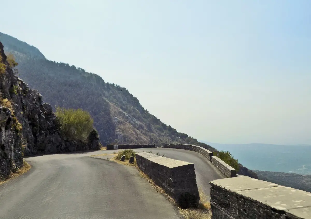
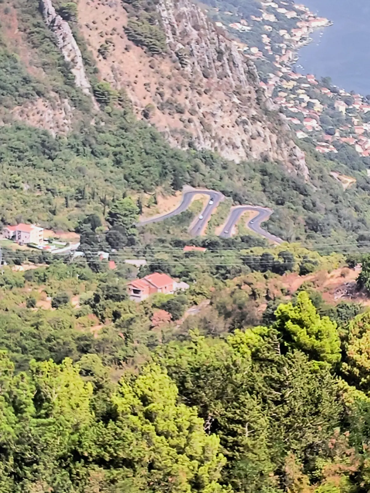
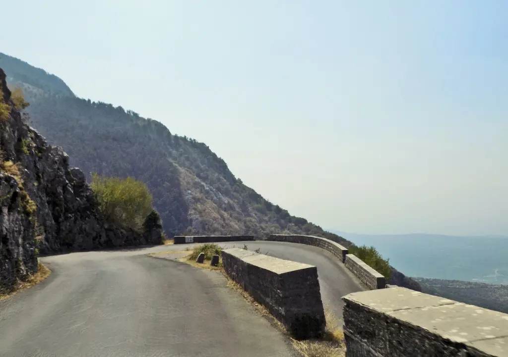
  1. A hairpin of the old road above the Bay of Kotor, with a stone parapet1
    Stop 1text only

    Trojica: where the serpentine begins

    Here, at Trojica, the old road to Lovćen and Cetinje begins. Ahead of you are twenty-five tight hairpin bends, called kanice here, and almost a thousand metres of climbing up to the Krstac pass. The road is more than a hundred and forty years old. When Montenegro was recognised as an independent state at the Congress of Berlin in eighteen seventy-eight, Prince Nikola invited the engineer Josip Slade from Trogir. Slade built the Montenegrin part of the road, from Cetinje through Njeguši to the border above Kotor, and finished it in eighteen eighty-one. Kotor and the whole bay then belonged to Austria-Hungary, which built its own part, from Kotor up to the border at Krstac. That part is these hairpins, finished in eighteen eighty-four. The road was made for horses and carriages, with a gentle, even gradient. That is why the bends are packed so tightly and why the road is in places barely wider than one car. Keep right and drive slowly, especially on the bends, and be ready to stop for oncoming traffic. Don't stop on a bend, not even for a photo. Higher up there is a lay-by with a view where we will stop. If you are the passenger, look for the driver. With every bend the bay drops further below you.

    On to the next stop (⁨1.1 km⁩): Follow the road uphill through the hairpins. The next story starts by itself in about six kilometres.

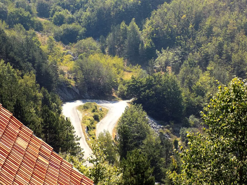
  2. The hairpins of the old road on the slope of Lovćen above Kotor2
    Stop 2text only

    Kanice: the hairpins above Kotor

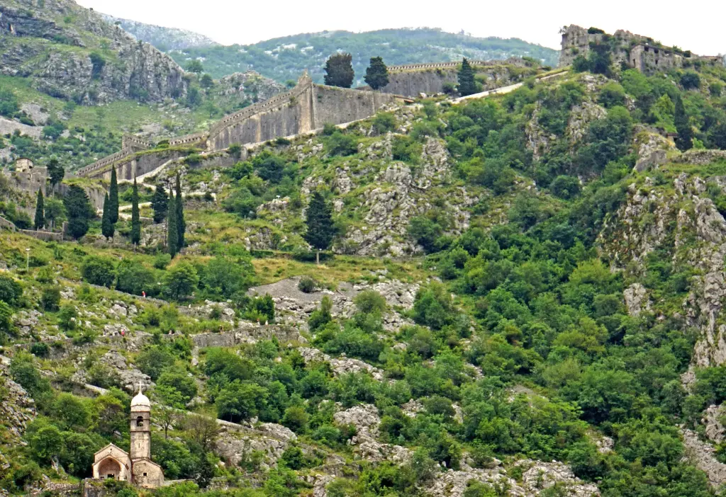
    You are now in the middle of the serpentine. People in Kotor say that, seen from above, the bends spell the letter M, and that the builder dedicated them to Princess Milena, the wife of Prince Nikola. That is a local story, not something written in the plans. Before this road, Kotor and the Montenegrin hills were linked only by a steep stone path. It still climbs the cliff above the Old Town, past St John's Fortress, all the way to Krstac. People from Njeguši and the nearby villages walked down it to the market in Kotor, with cheese, dried meat and firewood. Njeguši cheese was once sold in Kotor, and as far away as Trieste and Venice. The path is still waymarked. It is almost five kilometres long, with more than a thousand metres of ascent, and walkers allow several hours for it. You will find a description on our website. In nineteen sixteen, during the First World War, the Austro-Hungarian army began building a freight ropeway from Kotor over Krstac to Cetinje. It was driven by a steam engine and ran until the end of nineteen eighteen. Today a cable car crosses these slopes again, this time for passengers. We will talk about it on the way to Lovćen. Stay in your lane. There are a few more bends before the viewpoint.

    On to the next stop (⁨2.3 km⁩): Keep climbing for about six kilometres. The lay-by will be on your right, near the top of the hairpins.

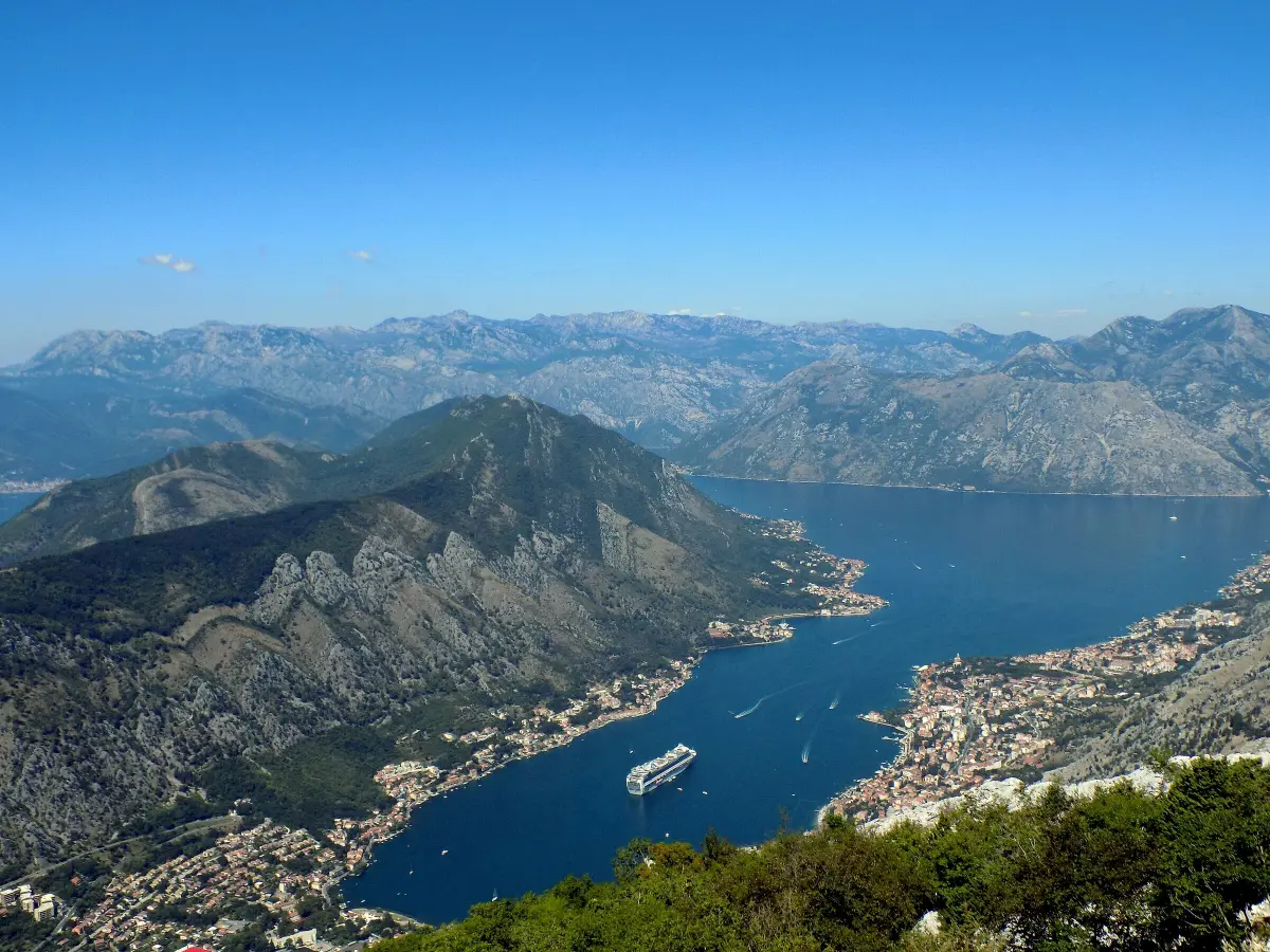
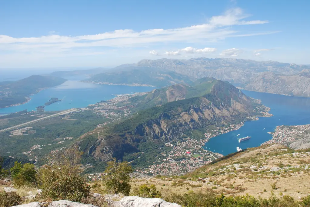
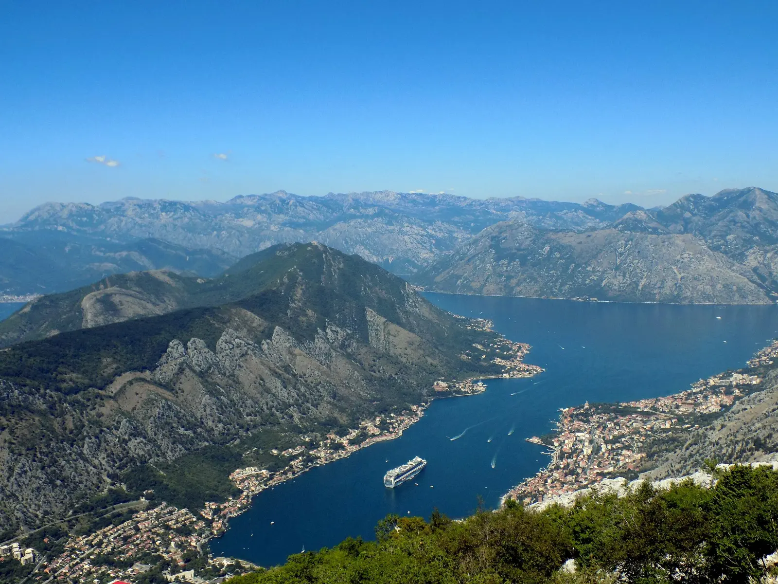
  3. Kotor and the Bay of Kotor seen from the serpentine, with a cruise ship in port3
    Stop 3text only

    Viewpoint above Kotor

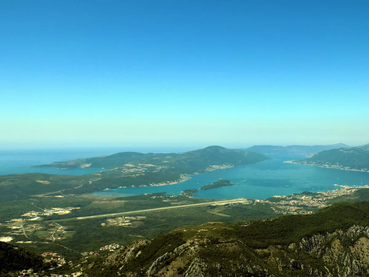
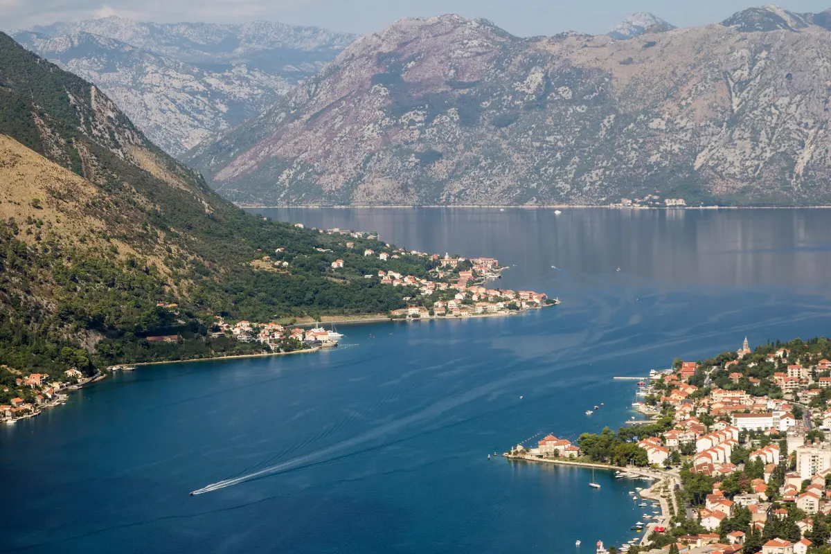
    If there is room, pull into the lay-by on the right and switch off the engine. Don't step out onto the road, and watch for cars coming round the bends. Look west, down below. At the very end of the bay is Kotor Old Town, a triangle of roofs by the water. Above it the walls zigzag up the hill to St John's Fortress. Along the shore to the north runs Dobrota, and across the water, on the far shore, is Prčanj. The hill behind Prčanj is Vrmac. It separates the Bay of Kotor from the Bay of Tivat, which you can see beyond it, wider and more open. From here you can see why Kotor was so well protected for centuries. The sea reaches deep in among the mountains, and the town is tucked away at the very end of the bay, under the cliff. The Natural and Culturo-Historical Region of Kotor was added to the UNESCO World Heritage List in nineteen seventy-nine. Cruise ships often lie in the port below you. From this height they look small, but they are several hundred metres long. When you pull out, indicate and let oncoming cars pass. The Krstac pass is about a kilometre further on.

    On to the next stop (⁨730 m⁩): Continue uphill for about a kilometre to the Krstac pass.

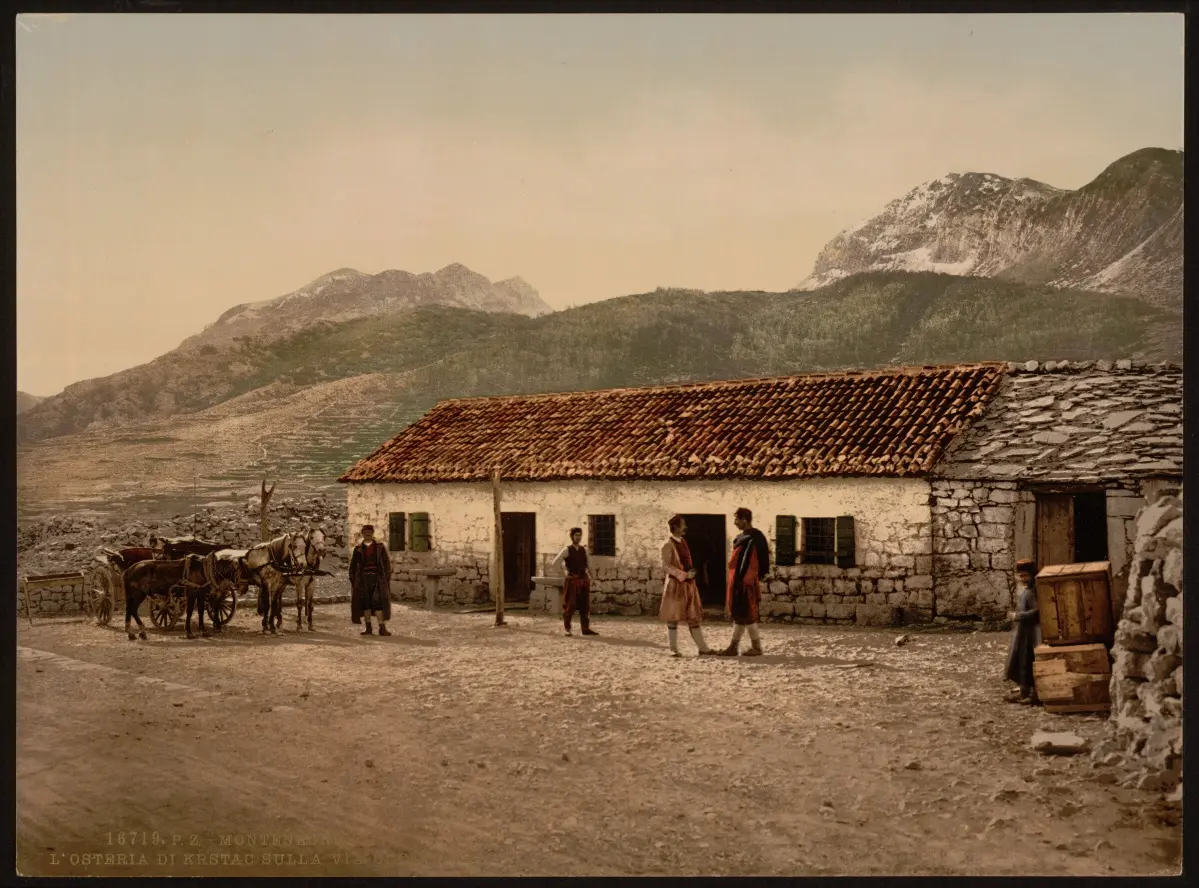
  4. The old inn at Krstac on the road to Cetinje, photographed in the late nineteenth century4
    Stop 4text only

    Krstac: the old border

    You have reached Krstac, a pass at nine hundred and thirty-seven metres above sea level. This is where the hairpins end, and where the old footpath from Kotor comes out. Until the end of the First World War a border ran through here. On one side was the Bay of Kotor, part of Austria-Hungary. On the other was the Principality, later the Kingdom, of Montenegro. The picture for this stop shows the old inn at Krstac in the late nineteenth century. Travellers rested their horses and themselves here before going down to Kotor or on to Cetinje. The border shaped life in these hills. Kotor was the nearest town and market for Njeguši, but it was in another country. That is why this road mattered so much. The section from Cetinje to Krstac is considered the oldest road for carriages in Montenegro, and it led straight towards the sea. At Krstac the road forks. We are going to Njeguši first. We will take the road to Lovćen and the mausoleum when we come back this same way, in about an hour.

    On to the next stop (⁨1.8 km⁩): Follow the sign for Njeguši. The first houses of the village are about two kilometres away.

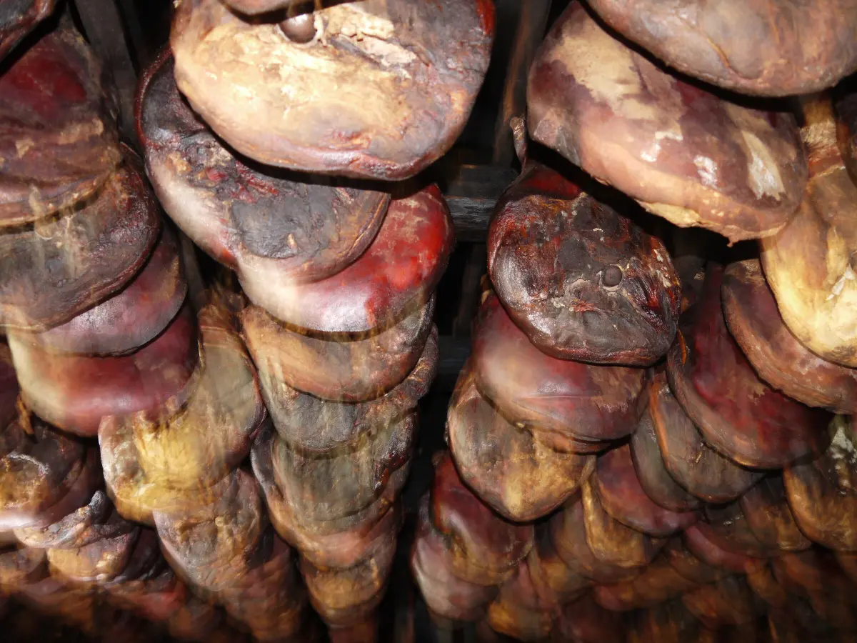
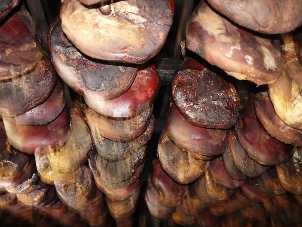
  5. Njeguši ham hanging under the roof of a smokehouse5
    Stop 5text only

    Njeguši: smoked ham and cheese

    You are entering Njeguši. The village lies around a stony karst field that locals simply call Polje, the field, and it is made up of about ten hamlets with houses of dressed stone. This is the cradle of the Petrović Njegoš dynasty, which ruled Montenegro until nineteen eighteen. Njeguši also has fifteen churches, a lot for one village. But most travellers stop here for the ham. Njeguški pršut is made only in these hamlets. Fresh legs are taken in only from mid-November to mid-February, the coldest months. They are rubbed with sea salt, then pressed, which gives them their flat shape. Then they are lightly smoked over beech wood and dried in the wind, which blows here cold from the mountain one day and warmer from the sea the next. The whole process takes at least nine months, usually about a year. Njeguši ham was the first Montenegrin product whose origin was protected by law, back in two thousand and three. The ham comes with Njeguši cheese, which is kept in oil. Drive slowly through the village and stop at one of the taverns by the road. At some of them you can also see the smokehouse. If you are driving on, order water with your ham and save the rakija for the end of the day.

    On to the next stop (⁨880 m⁩): Continue through the village for about a kilometre. Njegoš's birthplace is on the right, by a small car park.

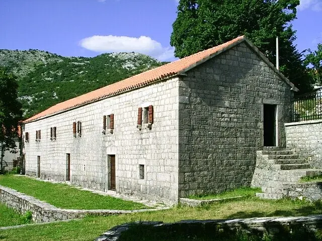
  6. The stone house in Njeguši where Petar II Petrović Njegoš was born6
    Stop 6text only

    Njegoš's birthplace

    On the right of the road is the stone house where Radivoje Petrović, known as Rade, was born in eighteen thirteen. The world knows him as Petar the Second Petrović Njegoš. The house is simple: rectangular, built of stone, with a vaulted cellar on the ground floor, like other old houses in this area. Across the road, in the same yard, is the house of Duke Mirko Petrović, the father of King Nikola. King Nikola himself was born here in Njeguši, in eighteen forty-one. Rade was seventeen when, in eighteen thirty, after the death of his uncle Petar the First, he came to power. He was both prince-bishop, the head of the Church, and ruler of the country. He brought a printing press to Cetinje and opened the first schools. But he is remembered above all as a poet. His Mountain Wreath, published in eighteen forty-seven, is one of the great works of South Slavic literature. He died of tuberculosis in Cetinje at the age of thirty-seven, and wished to rest on the summit of Lovćen. That is where we are going now. The house is part of the National Museum of Montenegro, and the ticket for Njegoš's Mausoleum includes it.

    On to the next stop (⁨4.4 km⁩): Turn around and drive back the same way to Krstac, about three and a half kilometres. There, follow the sign for Lovćen.

  7. The Bay of Tivat and Vrmac seen from the road to Lovćen7
    Stop 7text only

    Above the Bay of Tivat, and the cable car

    There is a lay-by with a view on the right. If it is free, stop there. Below you open the Bay of Tivat and the town of Tivat, and on a clear day the open sea. A little further on, at Kuk, is the top station of the Kotor–Lovćen cable car, at one thousand three hundred and forty-eight metres. The cable car opened in twenty twenty-three. From Dub station near Kotor it climbs almost four kilometres in about eleven minutes. If you come back another time without a car, it is the easiest way up Lovćen. These slopes were a front line. In January nineteen sixteen the Austro-Hungarian army attacked the Montenegrin positions on Lovćen. Guns in the forts around the bay and on warships in the bay pounded the mountain for days. Within a few days the positions fell, and soon afterwards Austro-Hungarian troops entered Cetinje. In the same year the chapel on Jezerski vrh, where Njegoš lay, was destroyed. For Montenegrins Lovćen was, and still is, a symbol. That is exactly why, of all the peaks, it was the target.

    On to the next stop (⁨2.8 km⁩): Continue on the same road for about four kilometres to the national park barrier at Međuvršje.

  8. Jezerski vrh with Njegoš's Mausoleum on top and the road leading up to it8
    Stop 8text only

    Međuvršje: entering Lovćen National Park

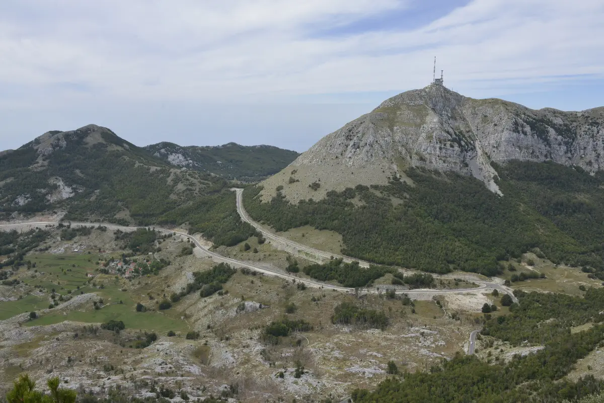
    You are approaching the Lovćen National Park barrier at Međuvršje. The park ticket is paid at the barrier: three euros per person for the day. Lovćen has been a national park since nineteen fifty-two. Its highest peak is Štirovnik, at one thousand seven hundred and forty-nine metres. Ahead of you is Jezerski vrh, one thousand six hundred and fifty-seven metres, with the mausoleum right on top. The slopes are covered with beech and Bosnian pine. It is often up to ten degrees colder here than on the coast, and fog can come down within minutes. If it does, turn on your lights, slow down and don't overtake. In winter there is snow and ice on Lovćen, and the mausoleum is closed from mid-November to mid-April. In the summer season the last stretch, from the car park to the mausoleum, has special traffic rules. Follow the signs and the instructions on site.

    On to the next stop (⁨1.3 km⁩): After the barrier keep right for the mausoleum. The car park below Jezerski vrh is about four kilometres away, with a few tight bends near the end.

  9. The steps leading to the tunnel entrance below Njegoš's Mausoleum9
    Stop 9text only

    The car park and the four hundred and sixty-one steps

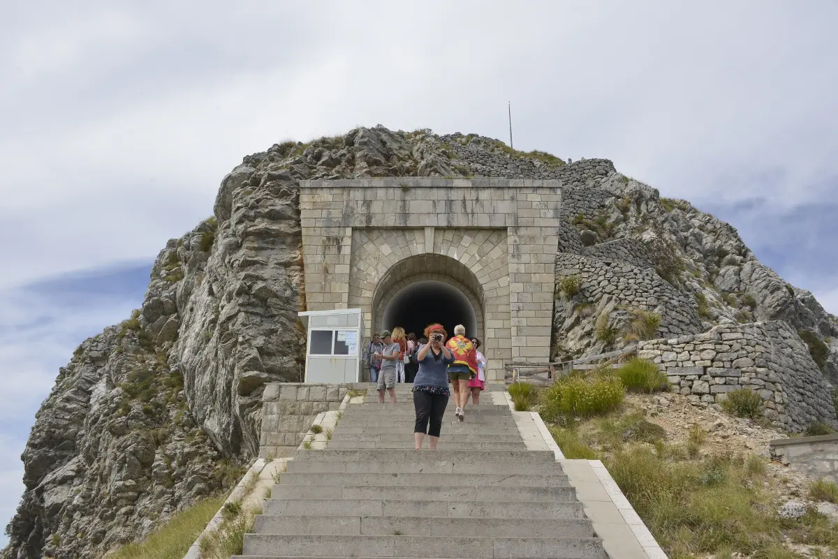
    You have reached the car park below Jezerski vrh. Park, lock the car, and take a jacket and some water. Four hundred and sixty-one steps lead up to the mausoleum. Most of the climb goes through a tunnel in the rock, so it is shady even in summer. Climb at your own pace and rest when you need to. Allow about an hour for the climb, the visit and the way back. The climb is steep and there are only steps, so it is not suitable for wheelchairs or pushchairs. The mausoleum ticket is eight euros for adults and four euros for pupils and students, and children under twelve go in free. The same ticket covers Njegoš's birthplace in Njeguši. The mausoleum is open from mid-April to mid-November, from nine in the morning to six in the evening. Off you go. The next story starts at the top, on the terrace in front of the mausoleum.

    On to the next stop (⁨580 m⁩): Climb the steps and go through the tunnel to the terrace in front of the mausoleum.

  10. Meštrović's granite figure of Njegoš with an eagle, under the gilded vault of the mausoleum10
    Stop 10text only

    Njegoš's Mausoleum

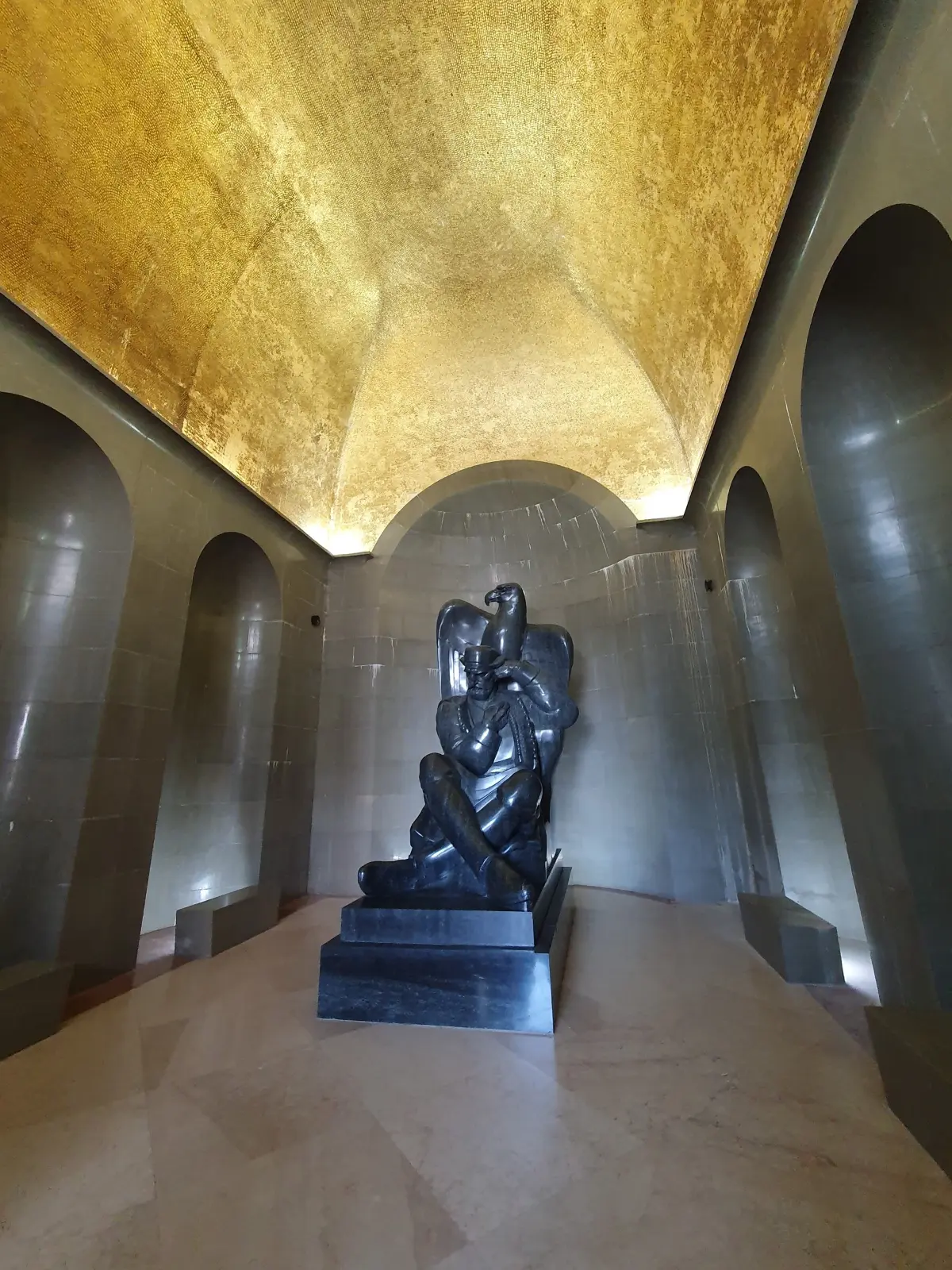
    On this summit Njegoš built a small chapel in his own lifetime, and asked to be buried in it. He died in eighteen fifty-one. He was first buried in Cetinje Monastery, and in eighteen fifty-five he was brought up here. The summit became a symbol, and suffered for it. In nineteen sixteen, during the Austro-Hungarian occupation, the chapel was destroyed and Njegoš's remains were taken to Cetinje. They were returned to a rebuilt chapel in nineteen twenty-five. In nineteen fifty-one, on the hundredth anniversary of Njegoš's death, the government of what was then the People's Republic of Montenegro decided to replace the chapel with a mausoleum designed by the sculptor Ivan Meštrović. The demolition of the chapel drew protests from the Orthodox Metropolitanate and part of the faithful. The mausoleum opened in nineteen seventy-four. At the entrance stand two Montenegrin women carved in black granite, like caryatids. Inside is a granite figure of Njegoš, also by Meštrović. The poet sits with an open book, with an eagle spreading its wings behind him. The vault is covered with a mosaic of about two hundred thousand gilded tiles. Below, in the crypt, is a plain marble sarcophagus carved with a cross and a coat of arms, signs of spiritual and worldly power. When you come out, follow the path behind the mausoleum to the round viewpoint. On a clear day the view takes in two thirds of Montenegro.

    On to the next stop (⁨2.3 km⁩): Go back down the same steps to the car park. Then drive down to the junction at Međuvršje and turn left there, towards Ivanova Korita and Cetinje.

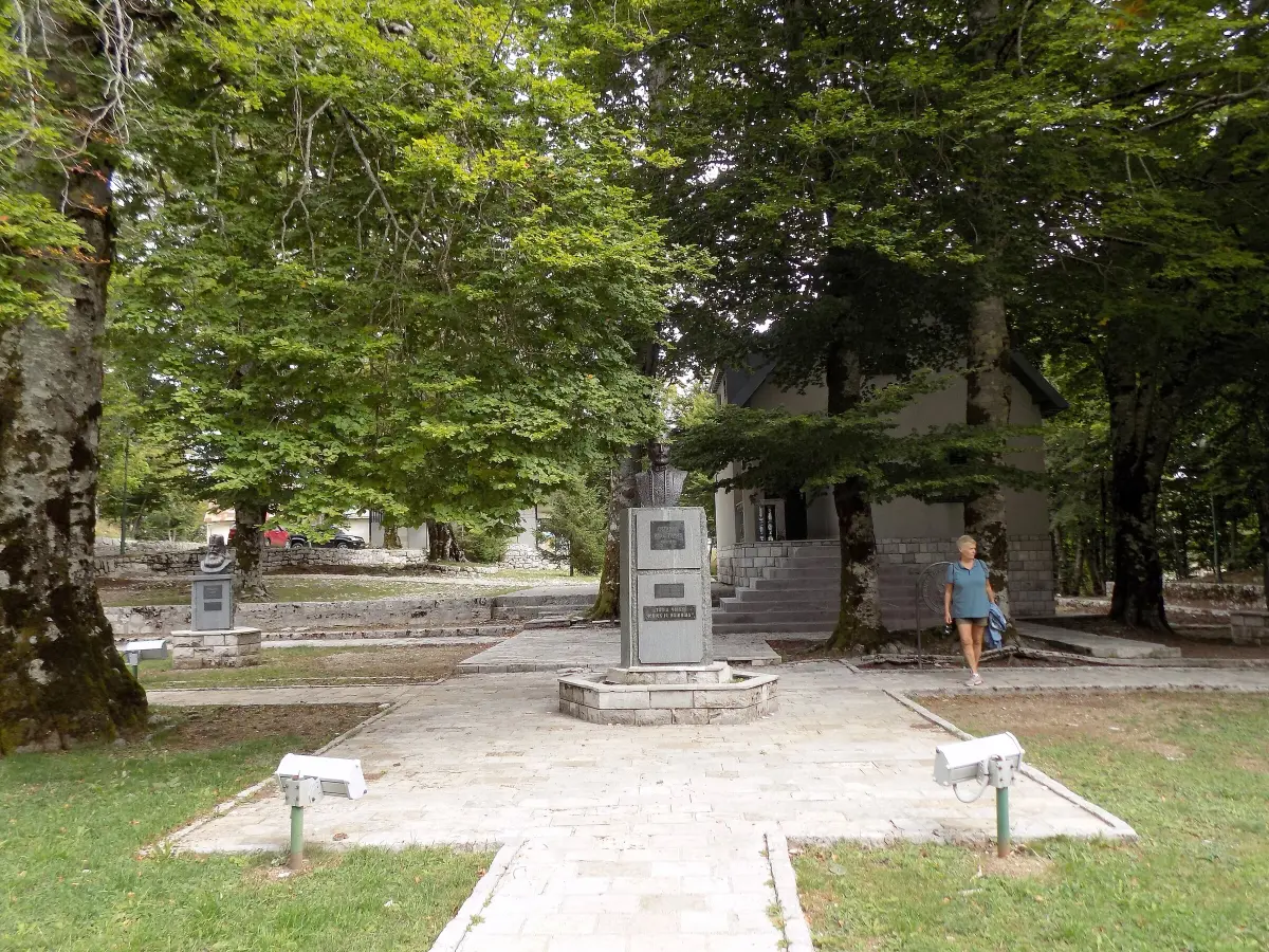
  11. Memorial park with busts of the rulers of the Petrović Njegoš dynasty at Ivanova Korita11
    Stop 11text only

    Ivanova Korita

    You are passing through Ivanova Korita, a wooded valley at about one thousand two hundred metres. Tradition links the name, which means Ivan's troughs, to Ivan Crnojević, the fifteenth-century ruler of Zeta and founder of Cetinje. The story goes that water from a nearby spring ran into troughs of beech logs made by Ivan-beg, as the people called him. Today this is the heart of the national park. On the left of the road is the visitor centre, where you can get information about the trails, and maps. There is also an adventure park, hotels and restaurants. In the park by the road stand busts of the rulers of the Petrović Njegoš dynasty, from Prince-Bishop Danilo to King Nikola. The most popular trails on Lovćen start here. In summer it is pleasantly cool, and in winter Ivanova Korita is often under snow. Winter equipment is compulsory in Montenegro from the fifteenth of November to the thirtieth of March. Cetinje is about fifteen kilometres away, mostly downhill. Use a lower gear and don't ride the brakes.

    On to the next stop (⁨7.4 km⁩): Continue downhill for about fifteen kilometres to Cetinje. As you enter the town, follow the signs for the centre.

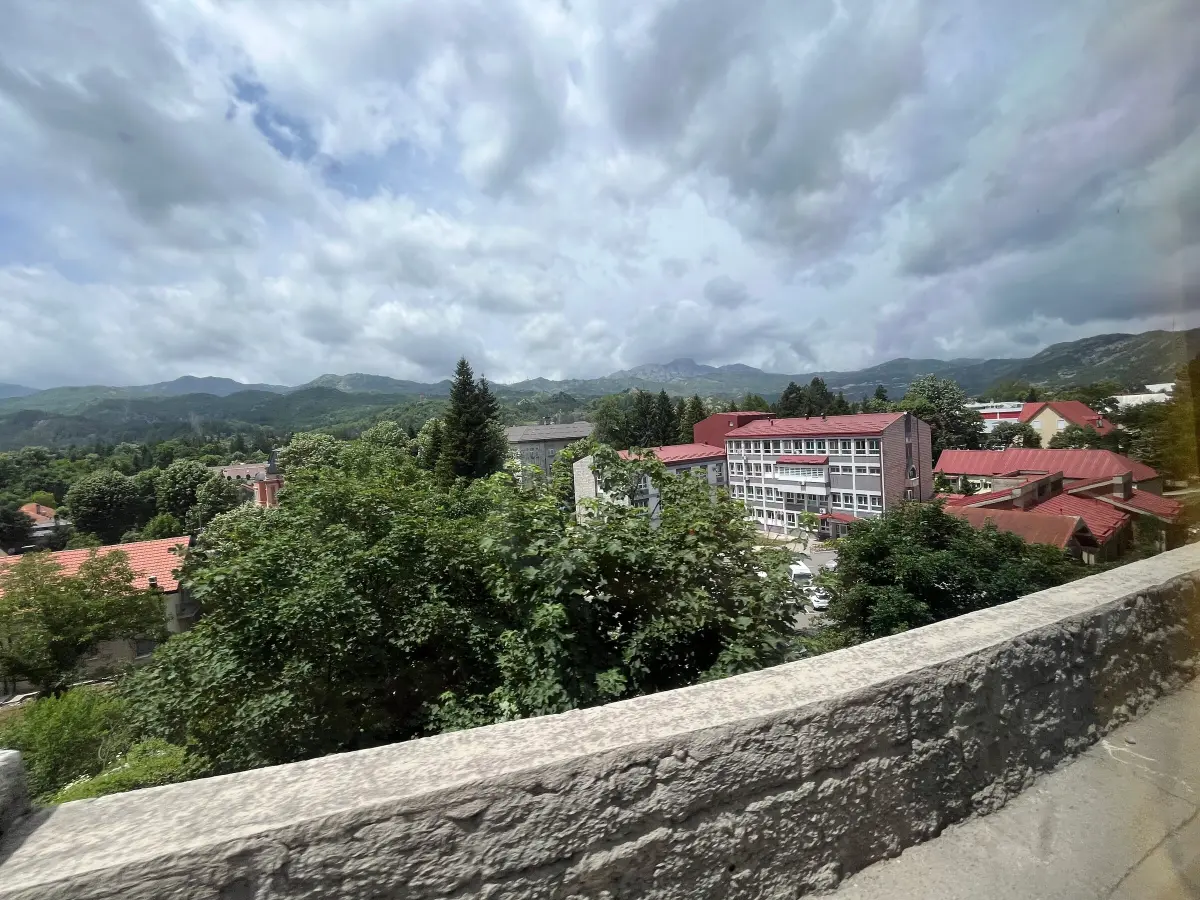
  12. View of Cetinje and the surrounding hills12
    Stop 12text only

    Cetinje: end of the drive

    Welcome to Cetinje, the old royal capital of Montenegro. This is where our drive ends. The town grew up around the monastery that Ivan Crnojević founded in fourteen eighty-four. Under Prince, later King, Nikola, Cetinje was a capital with legations of the European powers. Many former embassy buildings still stand in the centre. Park in the centre and carry on on foot. Cetinje Monastery, King Nikola's Palace and the Biljarda, Njegoš's residence, are a few minutes' walk from each other. For that we have a walking audio tour of Cetinje among our audio guides. To get back to the coast, you can return the same way through Njeguši, if the seasonal rules on the serpentine allow it, or go faster via Budva.

At the end

Farewell

This is the end of our audio guide from Kotor to Cetinje. You have driven the road that, more than a hundred and forty years ago, first linked Cetinje with the sea, climbed to Njegoš on Lovćen and come down into the old royal capital. If you still have time, explore Cetinje on foot with our walking audio tour. You will find more about Lovćen National Park, Njeguši ham, the Kotor–Lovćen cable car and driving in Montenegro on the Travel to Montenegro website. Drive carefully for the rest of the day. Thank you for travelling with us.

Good to know

Before you set off

Every word as text

The full narration of each stop is on this page and in the player, with the spoken sentence highlighted – for noisy streets and for deaf and hard-of-hearing visitors.

Works with the screen locked

Once you have pressed play, the narration keeps going with the screen off; use the lock-screen or headphone buttons for pause and next.

Your location stays on your phone

Location mode is optional and works only while this page is on screen. We never receive or store where you are.

Works offline

Download the tour before you go and it plays without mobile data.

Practical notes

Start: Kotor, car park by the Old Town. The old Lovćen road begins at the Trojica junction, about 5 km from town (follow the signs for Cetinje/Lovćen). End: Cetinje, town centre. Distance: about 59 km (Kotor – Trojica – Krstac – Njeguši and back to Krstac – Međuvršje – Njegoš's Mausoleum – Ivanova Korita – Cetinje). About 1.5 h of driving; 4–5 h with stops. Vehicle: you need a car; otherwise take a taxi or an organised trip. You can rent a car through our booking site: traveltomontenegro.com/booking/en/vehicles (guide to car rental and driving: /en/plan-your-trip/car-rental). Road: narrow, 25 hairpins, single lane in places with stone parapets. Drive slowly, never stop on a bend, stop only at lay-bys and car parks. Buses use the road in summer. Seasonal traffic rules (police order for 2026, 25 May – 15 October): Krstac → Trojica (downhill towards Kotor) is closed to all vehicles 08:00–15:00, and Trojica → Krstac (uphill from Kotor) 14:00–19:00; lorries over 7.5 t are banned 07:00–24:00; restrictions also apply on the Međuvršje – mausoleum section. Drive up from Kotor in the morning. Check the current year's order before you go. Tickets (2026): Lovćen National Park €3 per person per day, paid at the barrier at Međuvršje. Njegoš's Mausoleum €8 (pupils and students €4, children under 12 free), including Njegoš's birthplace in Njeguši. The mausoleum is open 15 April – 15 November, 9:00–18:00 (National Museum of Montenegro). Accessibility: 461 steps lead up to the mausoleum, mostly through a tunnel; not accessible for wheelchairs or pushchairs. The other stops are by the road or at car parks. Weather: Lovćen can be up to 10 °C colder than the coast, and fog is common. Snow and ice in winter; winter equipment is compulsory from 15 November to 30 March; the mausoleum is closed in winter. Check road conditions with AMSCG (the Montenegrin automobile club). Best time: May to October; set off in the morning (traffic rules, crowds and visibility). Back to the coast: the same way via Njeguši (if the traffic rules allow) or via Budva. Continue on foot: the Cetinje audio walk, starting at Court Square (Dvorski trg): traveltomontenegro.com/en/audio-tours/cetinje-old-royal-capital-audio-walk

Audio guides

More audio guides

Map © OpenStreetMap contributors, OpenFreeMap. Map data and sources →

Zora

Your Montenegro travel guide

Hi, I'm Zora

Ask me about places, beaches, food, events or a trip plan — in any language.