Travel to Montenegro
Kotor Old Town: a walk from the Sea Gate to the North Gate
Free audio guide

Kotor Old TownA walk from the Sea Gate to the North Gate

Free self-guided audio walk through the Old Town, no app needed

  • Free · no app needed
  • 1 languageME
  • Easy walk
  • Fits a cruise stop
walk
70 min
route
⁨2.6 km⁩
stops
14
of audio
1 min
Overview

A walking audio tour of Kotor's UNESCO-listed Old Town: three town gates, the Square of Arms and the clock tower, Saint Tryphon's Cathedral, the Maritime Museum, the Karampana fountain, churches from the 12th to the 20th century and the story of Blessed Osanna. Twelve stops, about an hour, with an optional climb up the walls to St John's Fortress.

Audio in this language is coming soon

Every stop's full text is on this page and in the player. You can also listen in:

How it works

  1. Press play at the first stop

    Nothing to install. Headphones are best; the lock screen and headphone buttons work too.

  2. Walk at your own pace

    Each stop ends with directions to the next one. Tap the next stop when you get there.

  3. Or let your location advance it

    Turn on location mode and the next stop starts when you arrive – while this page is open on screen.

Route

The walk on the map

The tour starts at Sea Gate. Tap a number to play that stop.

Stop by stop

14 stops on the way

Listen, or read the full narration of every stop below.

Before you start

Welcome

Welcome to Kotor. This is the Travel to Montenegro audio guide to the Old Town, a UNESCO World Heritage Site. The walk starts here, at the Sea Gate, and has twelve stops in town. It takes about an hour, and at the end you can climb the walls to St John's Fortress. When you reach a stop, the story starts by itself. If it doesn't, tap the stop on the map. Keep one ear free so you can hear what's going on around you. The stone paving is polished and slippery, especially when wet. On cruise-ship days the streets are busiest from morning to mid-afternoon, so start early or late in the day. Don't stop in narrow passages and gateways. Let's go.
  1. Sea Gate1
    Stop 1text only

    Sea Gate

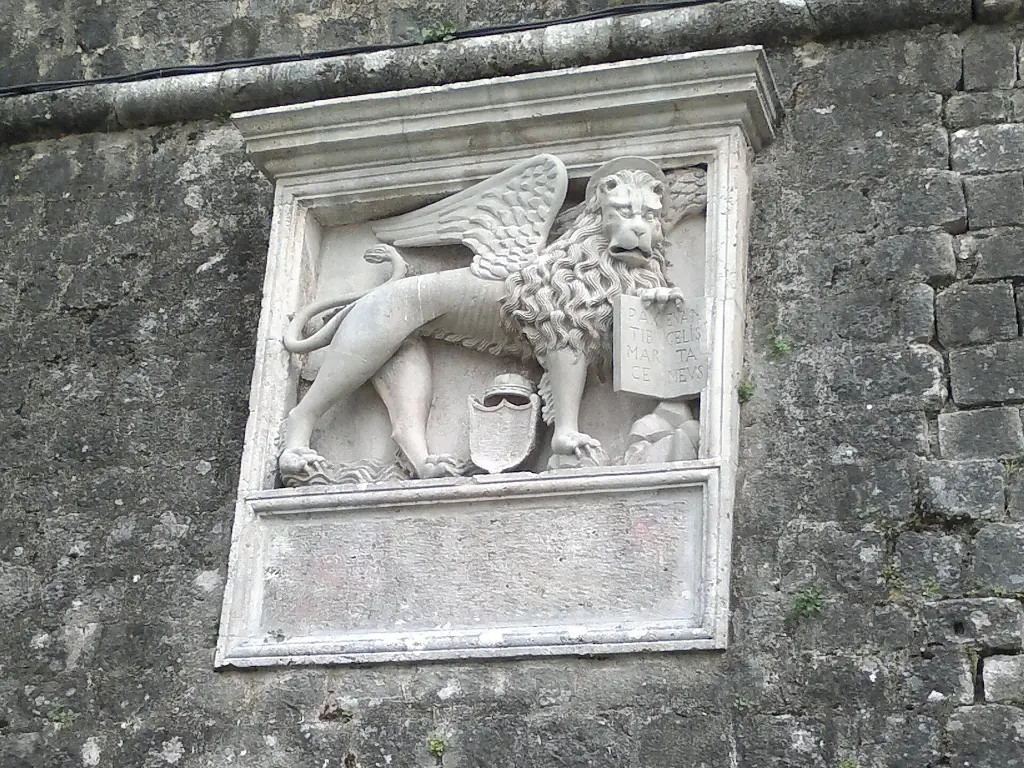
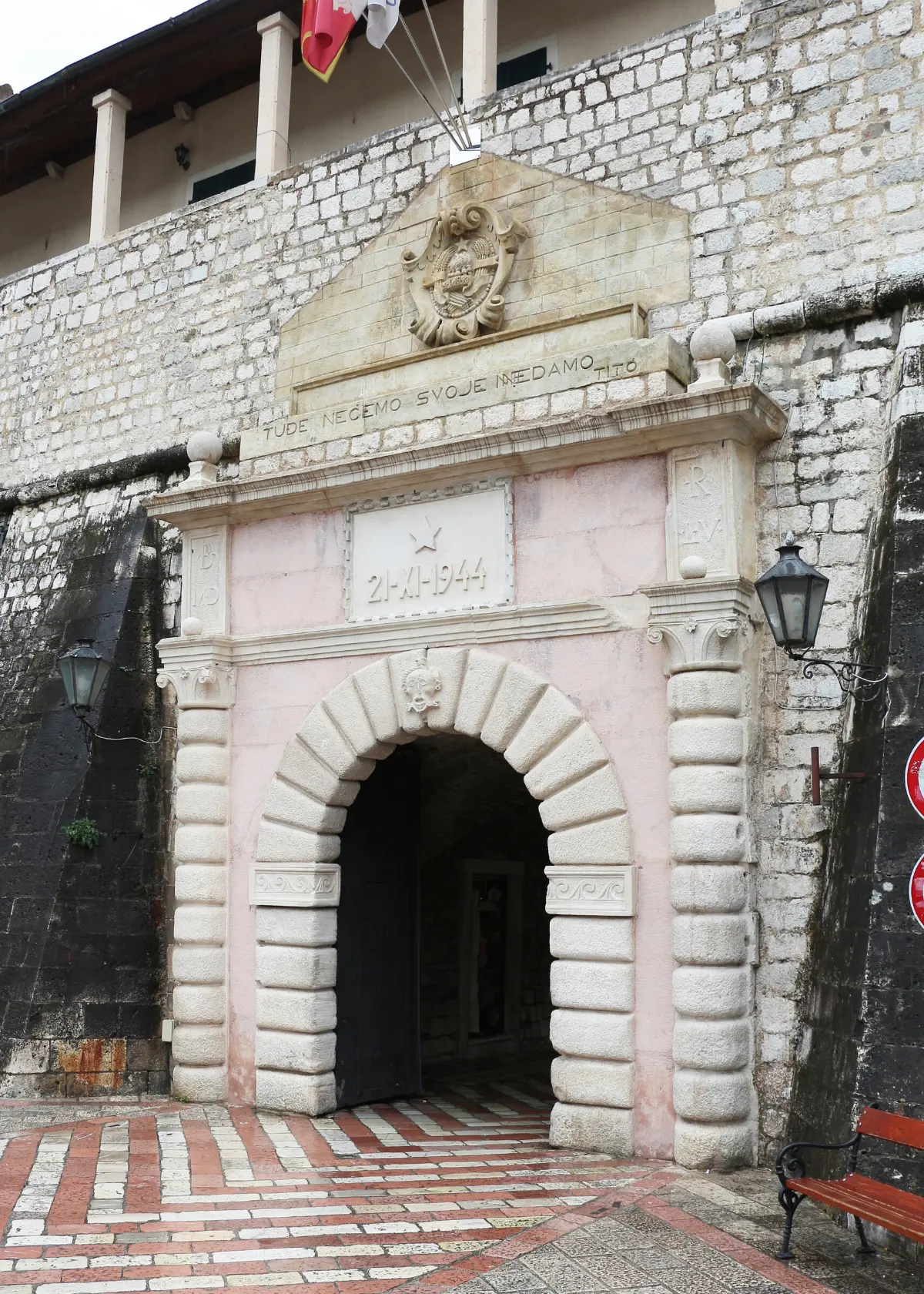
    Welcome to the Sea Gate, the main entrance to old Kotor. The name is literal. The sea once came almost up to the gate, and boats tied up right here, under the walls. The gate you see today was rebuilt by the Venetians in fifteen fifty-five. Kotor was then a frontier town of the Venetian Republic, living in constant fear of Ottoman attack. Look above the arch. A winged lion of Saint Mark, the emblem of Venice, once stood there. After the Second World War it was replaced with the coat of arms of Yugoslavia. Below it is a carved date, the twenty-first of November, nineteen forty-four. That was the day Kotor was liberated. Next to it is a line that translates as: We do not want what belongs to others, and we will not give up what is ours. As you step into the passage, look up. In a stone niche there is a fifteenth-century relief. It shows the Virgin with the Christ child, with Saint Tryphon, the town's patron, on one side and Saint Bernard on the other. The relief is older than the gate itself. Walk through slowly and don't stop in the middle of the passage, where it gets crowded. On the other side is the Square of Arms.

    On to the next stop (⁨60 m⁩): Walk through the gate onto the square and stop in its northern part, to your left, by the long building against the town wall and the Arsenal.

  2. Square of Arms, Prince's Palace and Napoleon Theatre2
    Stop 2text only

    Square of Arms, Prince's Palace and Napoleon Theatre

    This is the Square of Arms, the largest square inside the walls. It got its name under Venice, when weapons were repaired and stored here. The Arsenal building is on the north side of the square. The town's defenders gathered and armed in front of it. They did so in fifteen thirty-nine, when the fleet of Hayreddin Barbarossa sailed up to Kotor. After three days of fighting, the fleet withdrew. The Arsenal also fitted out Kotor's own galley, the Saint Tryphon. Under captain Jerolim Bizanti, men of Kotor sailed in her to the Battle of Lepanto in fifteen seventy-one. The long building against the town wall, with a balcony on stone brackets, is the Prince's Palace. It was the seat of the Venetian governors, called providurs. Beside it, right by the gate, stands the tower of the town guard. In the north-west corner is a building that is now a hotel. In eighteen ten the French authorities turned it into a theatre, one of the first in the region. That is why it is still called the Napoleon Theatre. In winter and in summer this square is the main stage of Kotor's carnivals. Now look east, straight across from the Sea Gate, to the clock tower.

    On to the next stop (⁨50 m⁩): Cross the square eastwards to the stone clock tower facing the Sea Gate, about fifty metres.

  3. Clock Tower and Pillar of Shame3
    Stop 31:16

    Clock Tower and Pillar of Shame

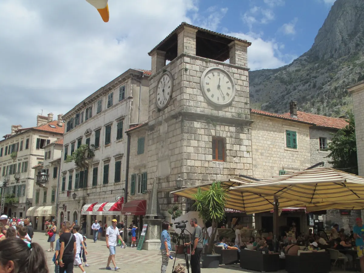
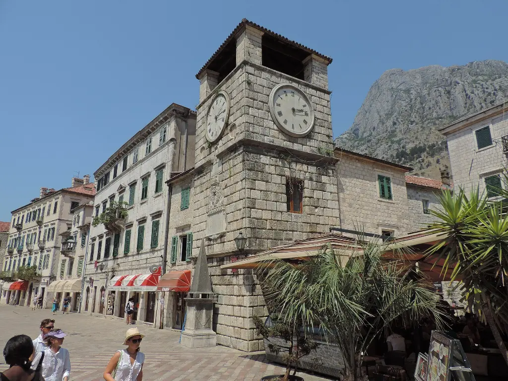
    In front of you is the town clock tower, one of the symbols of Kotor. It was built in sixteen-oh-two, under the Venetian governor Antonio Grimaldi. His initials and the year are carved on the coat of arms above the door. The walls are made of massive stone blocks with sunken edges. This style is called rustication, and it was popular in the Renaissance. Look at the tower for a moment from the edge of the square. You will notice it is not quite straight. Earthquakes, above all the one of the fifteenth of April, nineteen seventy-nine, tilted it towards the west, towards the sea, by about twenty centimetres. The foundations were later secured to stop it leaning further. In front of the tower is a stone pyramid, the pillar of shame. A pillar is believed to have stood here in the Middle Ages, where convicts were put on show for the whole town to see. The pyramid you see today has been restored. The side facing the gate once carried several inscriptions praising the governors. Some were removed by the Venetian authorities themselves, so that no one would build a personal cult. Now take the street to the right of the tower, past the Bizanti Palace, towards the Square of Flour.

    On to the next stop (⁨80 m⁩): Take the street to the right of the tower and follow it south for about a hundred metres, past the Bizanti Palace, to a small square with balconies.

  4. Square of Flour and the Pima Palace4
    Stop 4text only

    Square of Flour and the Pima Palace

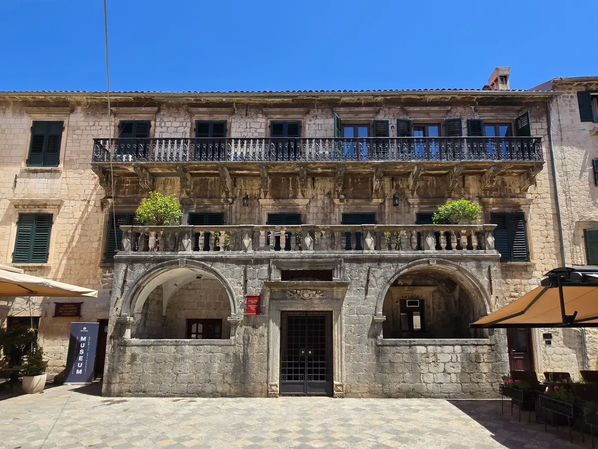
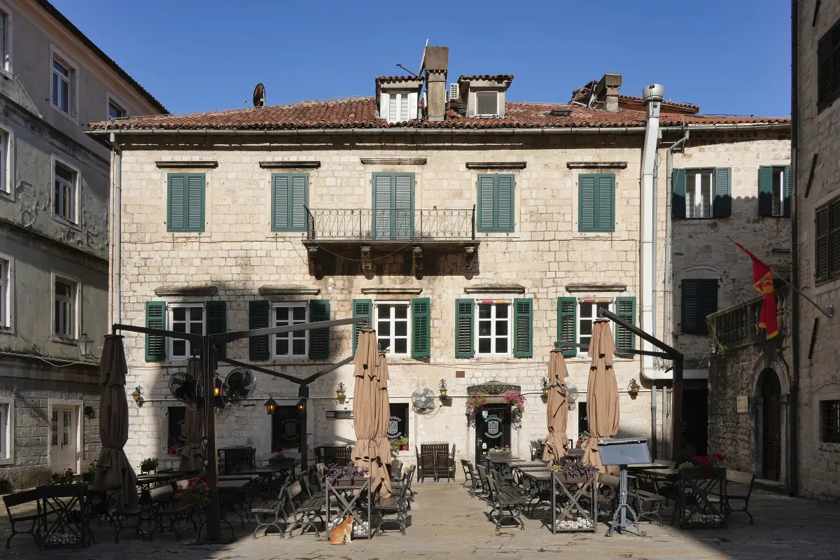
    This is the Square of Flour. It is named after the flour stores that once stood here. Kotor's squares are often named after what was sold or kept in them. There is also a Square of Milk, a Square of Firewood and a Square of Salad. The finest building here is the Pima Palace. It was built after the devastating earthquake of sixteen sixty-seven. The entrance portal with its terrace is Renaissance in style, while the windows and the upper balcony are Baroque. Count the stone brackets under the long balcony. There are twelve. The railing was forged by Kotor's blacksmiths. Above the main portal is the Pima family coat of arms, held up by two angels. The palace was badly damaged again in the earthquake of nineteen seventy-nine and has been restored. Opposite stands the Buća Palace, rebuilt many times. In the fourteenth and fifteenth centuries the Buća family produced merchants, diplomats and theologians. The best known is Nikola Buća, treasurer to the Serbian emperor Dušan. Look on the facade for traces of the family arms, a stylised lily. Walk a few dozen metres east. The square in front of Saint Tryphon's Cathedral will open up.

    On to the next stop (⁨60 m⁩): Head east for a few dozen metres to the square in front of the cathedral with two bell towers.

  5. Cathedral of Saint Tryphon5
    Stop 5text only

    Cathedral of Saint Tryphon

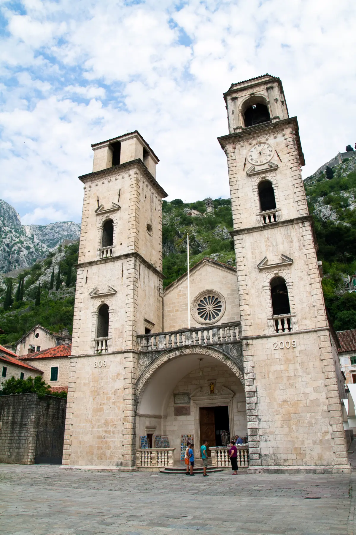
    In front of you is the Cathedral of Saint Tryphon, the most important monument of medieval Kotor. Saint Tryphon is the town's patron. As early as eight-oh-nine, a citizen of Kotor named Andrija Saracenis built a smaller church on this spot. It held the saint's relics, brought from Constantinople. The present cathedral took decades to build and was consecrated on the nineteenth of June, eleven sixty-six. Look at the facade. Between the two bell towers there is an arch, and above it a large rose window. The towers are not from the twelfth century. The earthquake of sixteen sixty-seven brought down part of the facade, and the towers were rebuilt in Baroque style at the end of the seventeenth century. The earthquake of nineteen seventy-nine also badly damaged the cathedral, and restoration took years. If you go inside, look for the stone canopy, the ciborium, over the main altar, from the fourteenth century, and the gilded silver altarpiece made by Kotor goldsmiths. Fragments of fourteenth-century frescoes also survive. There is an entrance fee; check opening hours on site. Every year on the third of February Kotor celebrates the feast of Saint Tryphon. On that day the Boka Navy dances its kolo in front of the cathedral. The next stop is the South Gate. Leave the square heading south.

    On to the next stop (⁨220 m⁩): From the square head south, along the street past the town hall, and follow it to the edge of town, about two hundred and fifty metres, to the gate above the water.

  6. South Gate (Gurdić Gate)6
    Stop 6text onlyOptional

    South Gate (Gurdić Gate)

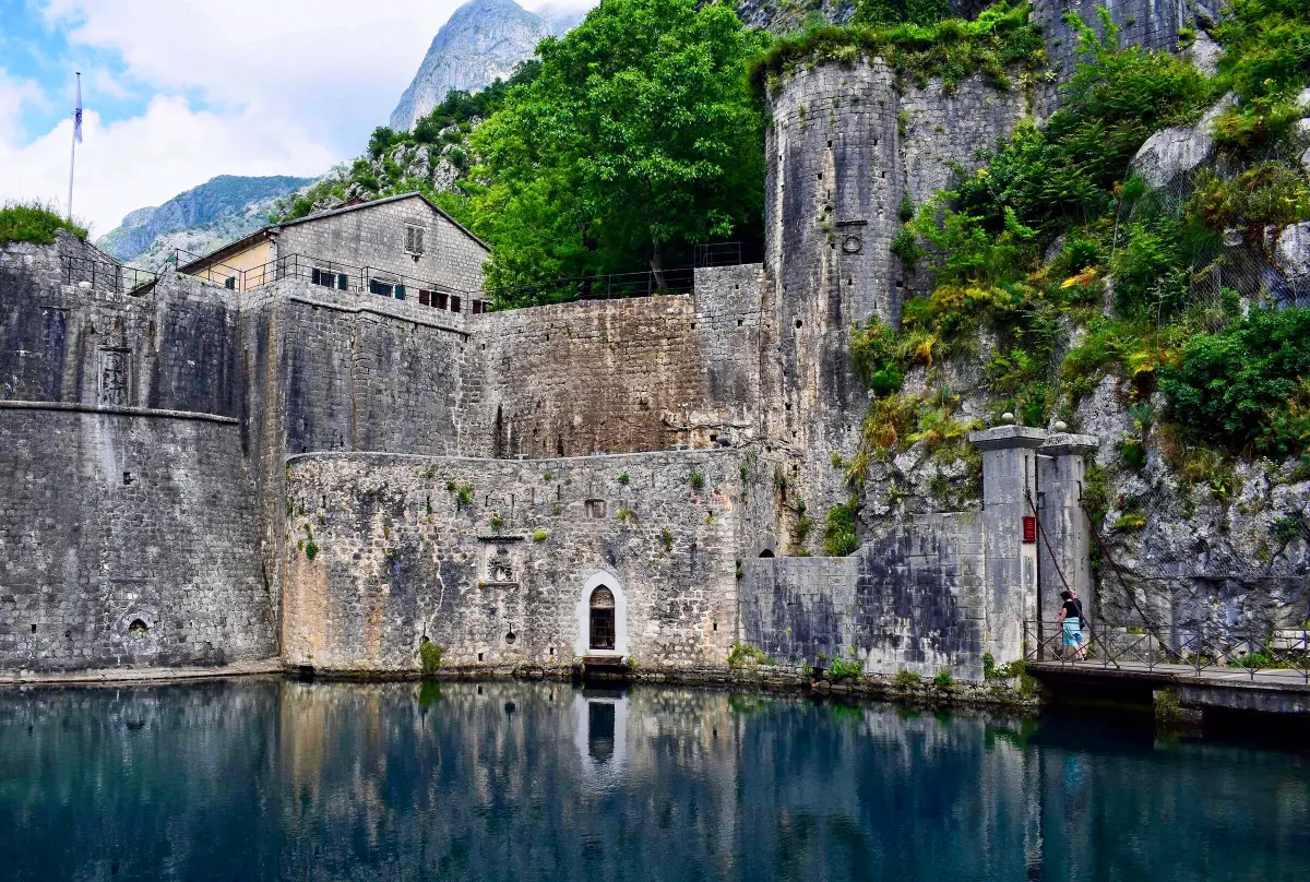
    You have reached the South Gate, also called the Gurdić Gate. It is named after the Gurdić spring, a source of water right under the walls. Look at the water in front of the ramparts, on the other side of the gate. Unlike the Sea Gate, this is not a single gate. It is a system of three gates, built at different times, one behind the other. Anyone who broke through the first would face a second, and then a third. The Gurdić bastion that guards them was built around fourteen seventy. The outer gate dates from the eighteenth century, and a drawbridge once crossed the water. From here you can see how Kotor was defended. The town sits on a triangle between the sea to the west, the river Škurda to the north and the steep hill of Saint John to the east. To the north and south, where the only approaches by land are, gates with bastions were built. From this gate the walls climb the cliff all the way to the fortress at the top. In the fifteenth and sixteenth centuries, when Kotor became a frontier facing the Ottoman Empire, this gate was strengthened several times. Now head back into town. The Maritime Museum is about three hundred metres to the north.

    On to the next stop (⁨300 m⁩): Walk back into town and head north along the street east of the cathedral, at the foot of the hill, about three hundred metres, to a square with a palace marked Museum Maritimum.

  7. Maritime Museum (Grgurina Palace)7
    Stop 7text only

    Maritime Museum (Grgurina Palace)

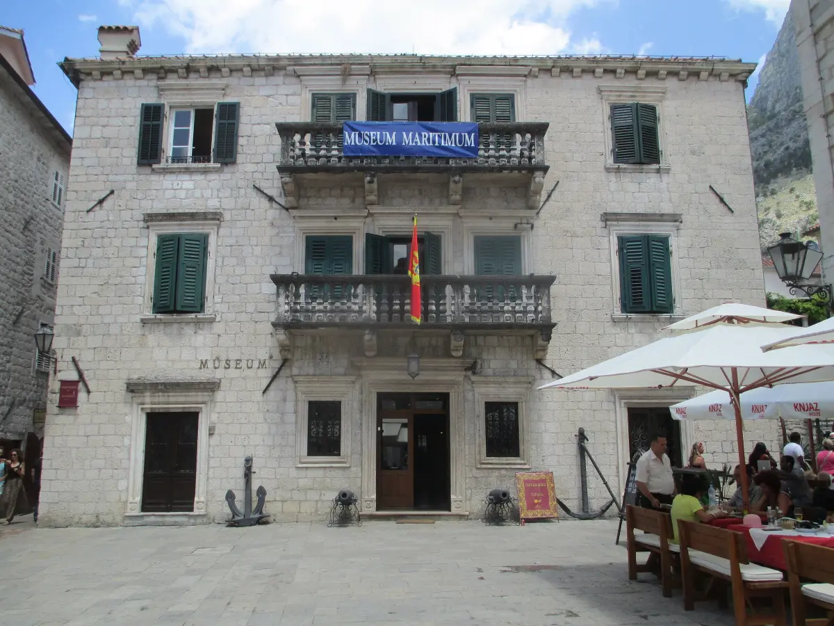
    This is the Maritime Museum of Montenegro, in the Grgurina Palace. The Grgurina family moved to Kotor from Koper in Istria in the second half of the seventeenth century. They worked in shipping and trade, grew rich and joined Kotor's nobility. Count Marko Grgurina built the palace at the start of the eighteenth century. It is a fine example of mature Baroque: a symmetrical facade, balconies with balustrades and a grand entrance. The dressed stone and carved details were shipped in from the island of Korčula. On the palace terrace is the family coat of arms with a goat. The goat is the symbol of Koper, a reminder of where the family came from. The museum grew out of the collection of the Boka Navy brotherhood, founded around eighteen eighty. It opened to the public in nineteen hundred and took over the whole palace after the Second World War. Today it tells the seafaring story of the Bay of Kotor through ship models, sea charts and instruments, weapons and furniture from noble houses. The earthquake of nineteen seventy-nine badly damaged the building. The museum reopened after five years of restoration. Look in front of the entrance: there are two small cannons and an anchor. The Karampana fountain is only a few steps away, around the corner of the palace.

    On to the next stop (⁨30 m⁩): Facing the museum, turn left and go round the corner of the palace. The fountain with an iron railing is about twenty metres away.

  8. Karampana Fountain8
    Stop 8text onlyOptional

    Karampana Fountain

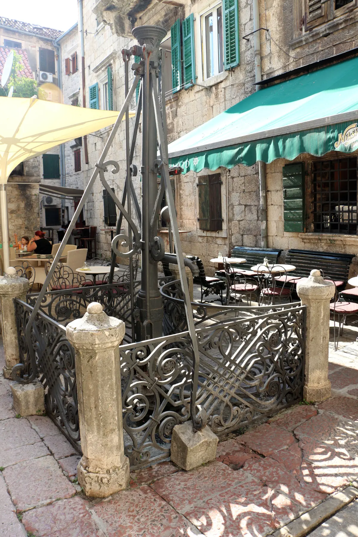
    This fountain is the Karampana. For a long time it was the only source of fresh water in town. So people came here every day with their jugs to fetch water. In its present form the fountain dates from the Baroque period, the late seventeenth or early eighteenth century. Look at the wrought-iron railing around it. It was made by one of Kotor's many blacksmiths, whose name has not survived. While people waited their turn, they talked. News was passed on here and stories spread through the town. That is why, for the people of Kotor, the Karampana became a symbol of the town's spirit, of everything that is known, told and retold. Stop for a moment and look around. There are no grand palaces here. This is everyday Kotor: narrow streets, many without names, small squares and houses leaning on one another. There is even a passage called Pušti me proć, which means let me pass, because it is so narrow. Over the centuries Kotor was hit by earthquakes many times, and much was rebuilt. Still, the street plan has stayed largely medieval. The next stop is the Square of Our Lady of the Angels, with the Cats Museum. Head west for about a hundred metres.

    On to the next stop (⁨70 m⁩): Head west along a narrow street for about a hundred metres to a small square with a cinema in a former church.

  9. Square of Our Lady of the Angels and Kotor's cats9
    Stop 9text only

    Square of Our Lady of the Angels and Kotor's cats

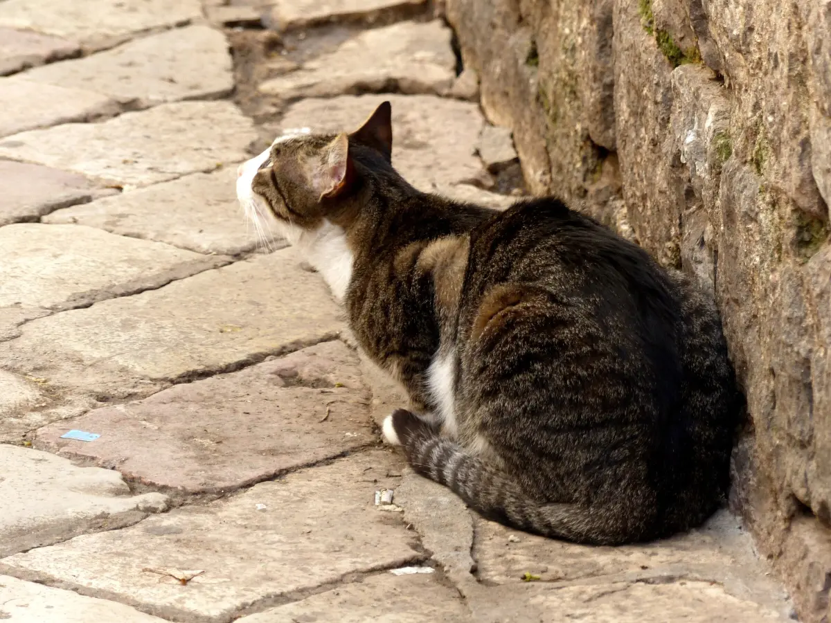
    You are standing in the Square of Our Lady of the Angels. It takes its name from the Baroque church of Our Lady of the Angels. Under French rule the church became a warehouse, and today it houses the town cinema. The Cats Museum is in the room that was once the refectory of a convent of Poor Clare nuns. You will meet cats everywhere in Kotor: on steps, in windows and on café chairs. They have become a symbol of the town and the main theme of its souvenirs. But be careful with the stories you hear. There is no evidence that cats saved Kotor from the plague or fed the townspeople during sieges. The Cats Museum, which opened in twenty thirteen, says itself that these are invented legends. When the museum opened, cats were not yet the town's emblem. That came later, with tourists and souvenirs. The museum holds a collection of old books, prints, postcards, newspapers and other objects featuring cats, from the sixteenth century to nineteen seventy. The street cats have no owners, but local people and charities look after them. They leave out water, food and cardboard boxes to sleep in. Volunteers have them neutered and treated. Now head north-east to the square of Saint Luke.

    On to the next stop (⁨80 m⁩): Head north-east for about a hundred metres to a square with a small stone church and a larger church with two bell towers behind it.

  10. Churches of Saint Luke and Saint Nicholas10
    Stop 10text only

    Churches of Saint Luke and Saint Nicholas

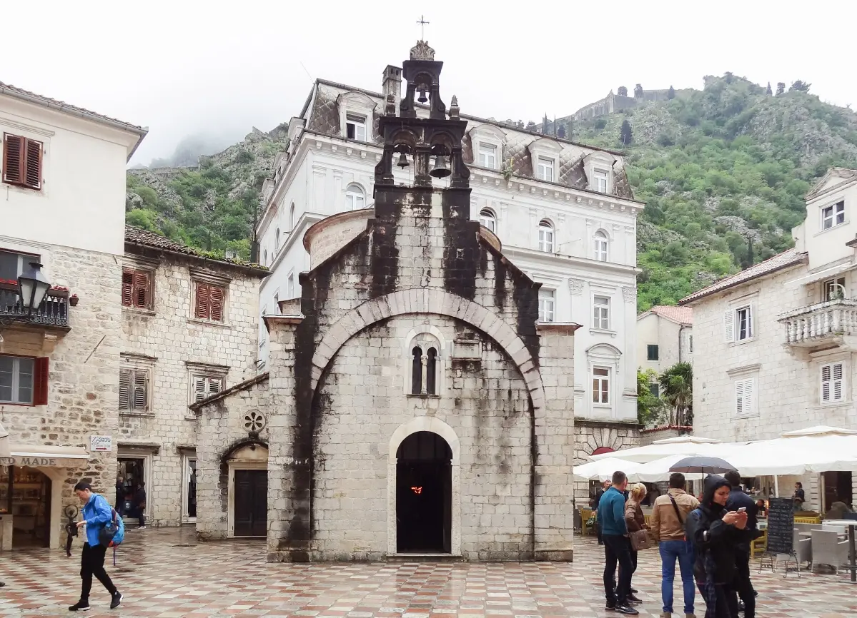
    On this square stand two Orthodox churches: the small church of Saint Luke and the large church of Saint Nicholas behind it. Saint Luke's is one of the oldest churches in Kotor. According to the inscription on its west front, it was built in eleven ninety-five by Mauro Kacafrangi and his wife Bona, in the time of the Serbian grand prince Stefan Nemanja and his son Vukan. It combines Romanesque and Byzantine styles. Under Venice it was a Catholic church, and after the earthquake of sixteen sixty-seven it was given to the Orthodox faithful. The Catholic altar stayed, so for a time the church had two altars. The floor is made of tombstones, because the people of Kotor were buried inside churches until the nineteen thirties. Saint Luke's came through Kotor's earthquakes without major damage. The church of Saint Nicholas was built between nineteen-oh-two and nineteen-oh-nine, on the site of an older church destroyed by fire. Its main front has two bell towers. Because space was so tight, its altar does not face east, as in most Orthodox churches. Continue north-east to the church of Saint Mary, beside the North Gate.

    On to the next stop (⁨70 m⁩): Head north-east for about a hundred metres to the Square of Firewood and the stone church with a dome, by the northern walls.

  11. Church of Saint Mary Collegiate and Blessed Osanna11
    Stop 11text only

    Church of Saint Mary Collegiate and Blessed Osanna

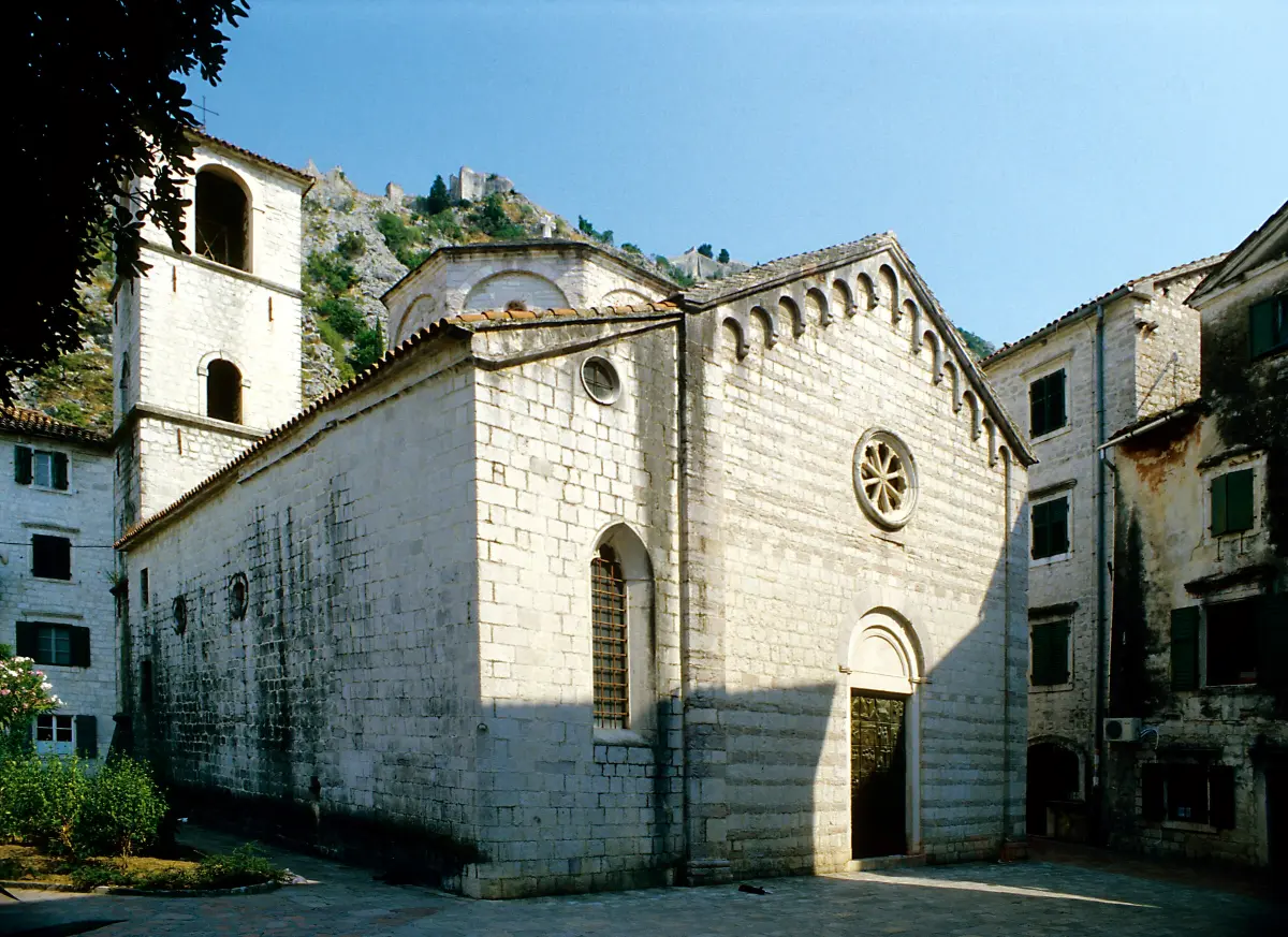
    This is the church of Saint Mary, known in Kotor as the Collegiate, Koleđata, and often as the church of Blessed Osanna. The present church was built in twelve twenty-one, on the site of an early Christian basilica from the sixth century. That basilica is the oldest building found in the town. Its remains can be seen in the sacristy, a metre and a half below today's floor. The bell tower was added in the eighteenth century. Look at the bronze doors. Their reliefs show scenes from the life of Blessed Osanna of Kotor. She was born in fourteen ninety-three as Jovana Kosić, into an Orthodox family from the hinterland. As a girl she came to Kotor to work as a servant for the noble Buća family. Here she became a Catholic and chose to live as an anchoress, walled into a tiny cell beside one of Kotor's churches. Through a small window she followed Mass and spoke with people who came to her for advice. When Barbarossa attacked the town in fifteen thirty-nine, the people of Kotor credited their rescue to her prayers. She died in fifteen sixty-five. Since the early nineteenth century her body has been kept here, in Saint Mary's. She was beatified in nineteen thirty-four. The North Gate is just behind the church.

    On to the next stop (⁨40 m⁩): Walk round the north side of the church. The North Gate is about thirty metres away, above the river.

  12. North Gate and the Škurda river12
    Stop 12text only

    North Gate and the Škurda river

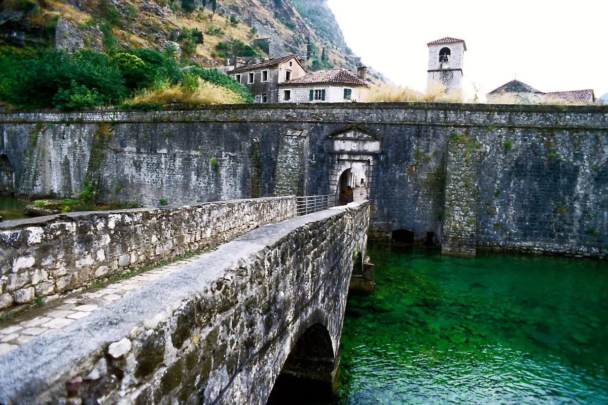
    This is the North Gate, also called the River Gate. In front of it flows the Škurda, a river that meets the bay right here. It served the town as a natural moat. The gate was built in fifteen forty, a year after the attack of Hayreddin Barbarossa. In August fifteen thirty-nine his fleet attacked Kotor, and the defenders drove it off. The inscriptions on the gate remember that defence. In the same year as the gate, the Bembo bastion was built, just west of it, along the river. Today it is an open-air summer stage. Walk out through the gate and stand on the bridge. Look at the walls from the river. When cannons came into use, the walls were strengthened on the outside with sloping buttresses. Parts of the walls along the Škurda are among the oldest in town. This is where the walk through the Old Town ends. You can be back at the Sea Gate in five minutes by walking west through the town. If you want to go up the walls, the entrance is close by, east of Saint Mary's church, at the foot of the hill. In twenty twenty-six the ticket is fifteen euros, and residents of Montenegro go in free. It takes about an hour to reach the fortress at the top.

    On to the next stop (⁨230 m⁩): For the extension: go back through the gate and head east, behind Saint Mary's, to the ticket gate at the foot of the steps. From there climb for about ten minutes to the small church with a bell tower halfway up the slope. To finish: walk west through town to the Sea Gate, about three hundred metres.

  13. The walls and Our Lady of Remedy13
    Stop 13text onlyOptional

    The walls and Our Lady of Remedy

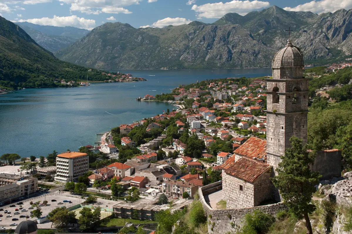
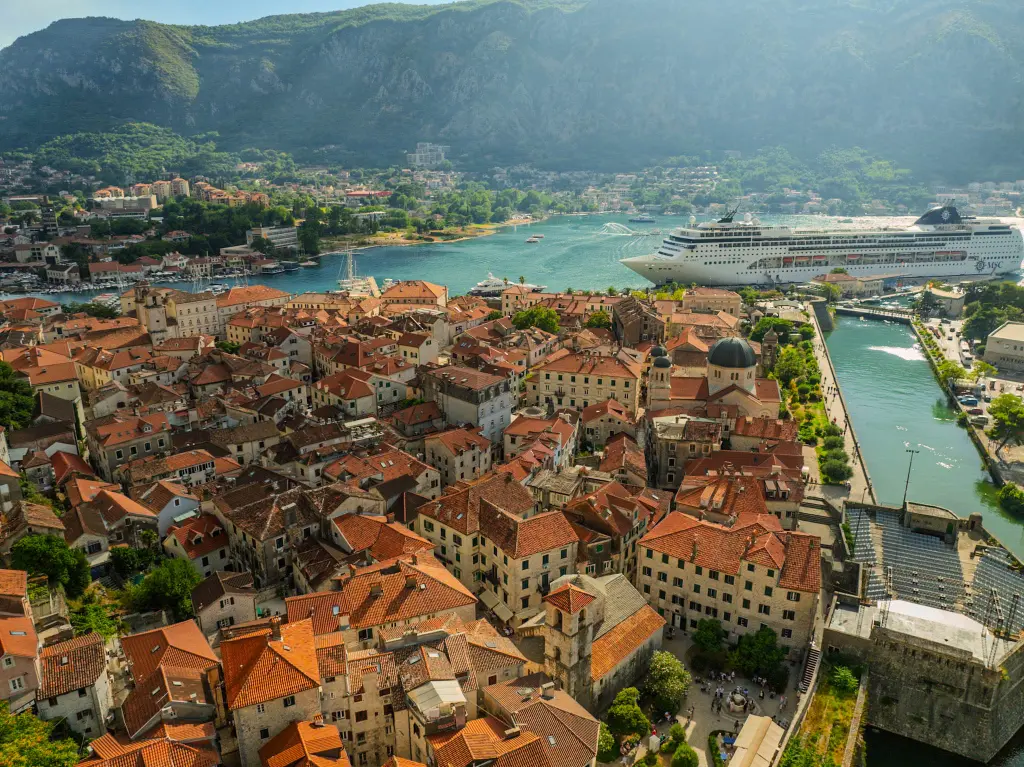
    Pause at the church of Our Lady of Remedy. You have climbed about a third of the way. The church was built in fifteen eighteen, as a vow after one of the plague epidemics that struck Kotor. It was also called Our Lady of Rest. Soldiers of the upper fortress garrison came here to pray. Turn towards the town. From here you can see Kotor's triangle: the sea to the west, the river Škurda to the north and the cliff to the east. You can see the rooftops, the cathedral towers and the harbour where cruise ships dock. The walls zigzag up, following the rock. They are about four and a half kilometres long, up to twenty metres high in places, and between two and sixteen metres thick. Illyrians, Byzantines, Venetians and Austrians all built fortifications here, but most of the walls you see were raised by Venice. Kotor was added to the UNESCO World Heritage List in nineteen seventy-nine. Since twenty seventeen it has also been listed as part of the Venetian Works of Defence. If you are tired, this is a good place to turn back. Further up the path is steeper and there is almost no shade. The steps are uneven and polished, so take care coming down. The fortress is about another half hour away.

    On to the next stop (⁨280 m⁩): Continue up the steps along the walls. The path is steep and unshaded; the fortress at the top is about seven hundred metres and about half an hour away.

  14. St John's Fortress (San Giovanni)14
    Stop 14text onlyOptional

    St John's Fortress (San Giovanni)

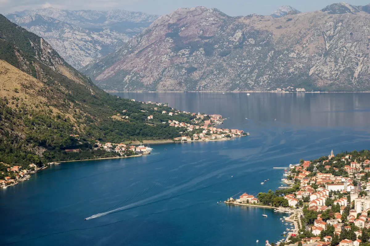
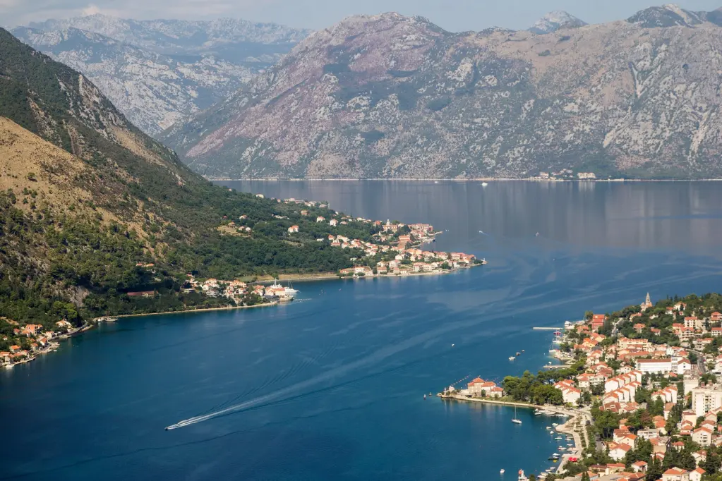
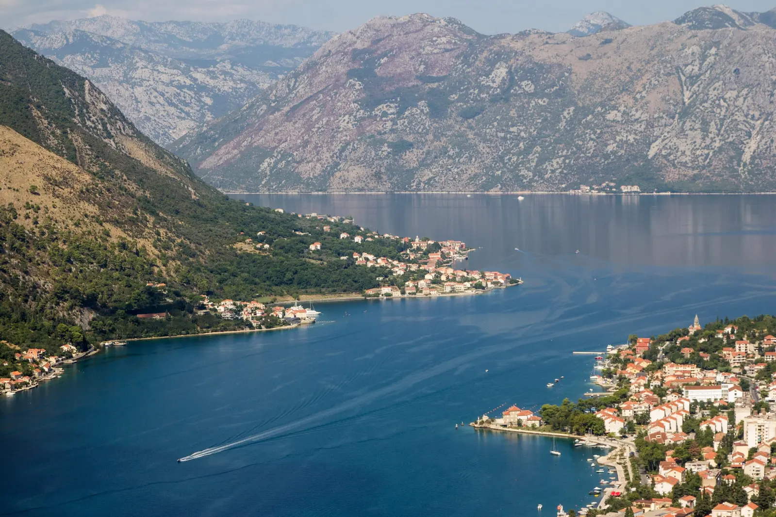
    You have reached St John's Fortress, which the people of Kotor call San Giovanni. You are about two hundred and sixty metres above the sea. The hilltop was already fortified in Illyrian times, and in the sixth century the Byzantine emperor Justinian rebuilt the fortress. Its present form is mostly Venetian, with later additions by the Austrians. Look down the bay. Below you is the Old Town, and to its right, along the shore, is Dobrota. On the opposite shore are Muo and, further on, Prčanj. In nineteen seventy-nine a devastating earthquake struck the Montenegrin coast. That same year Kotor was added to the World Heritage List, and because of the damage also to the list of heritage in danger. It was taken off that list in two thousand and three, after the town was restored. The fortress also saw an unusual siege. Early in eighteen fourteen, British sailors hauled cannons up to positions above the fort. The French garrison surrendered on the fifth of January. When the Austrian army left in nineteen eighteen, the fortress was abandoned. Rest and drink some water. Go down slowly, the same way you came, because the steps are most slippery on the way down. Thank you for climbing with us.

    On to the next stop: Return the same way to the entrance by Saint Mary's, then walk west through town to the Sea Gate. The descent takes about thirty to forty minutes.

At the end

Farewell

This is where our walk through Kotor ends. You have passed through two of the town's three gates, crossed squares named after arms, flour and firewood, and walked past churches from the twelfth to the twentieth century. The third gate, the Sea Gate, is waiting on your way back. If you still have the energy, the climb up the walls to St John's Fortress takes about an hour. Go early in the morning or towards evening, take water and wear sturdy shoes. Kotor is at its best during its own celebrations. In February there is the feast of Saint Tryphon, with the Boka Navy dancing its kolo in front of the cathedral, and there are carnivals on the Square of Arms in winter and summer. You will find dates, and more about Kotor, the fortress and the museums of the bay, on the Travel to Montenegro website. Thank you for walking with us.

Good to know

Before you set off

Every word as text

The full narration of each stop is on this page and in the player, with the spoken sentence highlighted – for noisy streets and for deaf and hard-of-hearing visitors.

Works with the screen locked

Once you have pressed play, the narration keeps going with the screen off; use the lock-screen or headphone buttons for pause and next.

Your location stays on your phone

Location mode is optional and works only while this page is on screen. We never receive or store where you are.

Works offline

Download the tour before you go and it plays without mobile data.

Practical notes

Start: the Sea Gate, the main entrance to the Old Town. Length: about 1.6 km loop (Sea Gate → North Gate → back), 60–75 min with listening. Extension up the walls to St John's Fortress: about 2.5 km more and about 240 m of ascent, 90–120 min. Best time: Early morning (before 9 am) or late afternoon (after 5 pm), especially on cruise-ship days; the Port of Kotor publishes the cruise schedule. Spring and autumn are the most comfortable. In summer, climb the walls only early or towards evening, with water. Accessibility: - The Old Town is mostly flat, but paved with polished limestone that is slippery when wet. - There are odd steps and narrow passages between stops; buggies and wheelchairs can manage with care, but not every shortcut. - The South Gate (Gurdić) has several passages in a row and an uneven floor. - The wall extension: steep, uneven and in places polished stone steps, about 240 m of ascent, almost no shade; not wheelchair accessible and not advised with heart or knee problems or vertigo. - Paid public toilets are on the Square of Arms and by the Sea Gate (OSM). Tickets: Walls and fortress: €15 (2026), free for residents of Montenegro; ticket gates near the North Gate (behind St Mary's) and above the cathedral (OSM). The cathedral, Maritime Museum and Cats Museum charge entry; check prices and hours on site.

Narration: AI-generated voice from our editors' scripts · Map © OpenStreetMap contributors, OpenFreeMap. Map data and sources →

Zora

Your Montenegro travel guide

Hi, I'm Zora

Ask me about places, beaches, food, events or a trip plan — in any language.