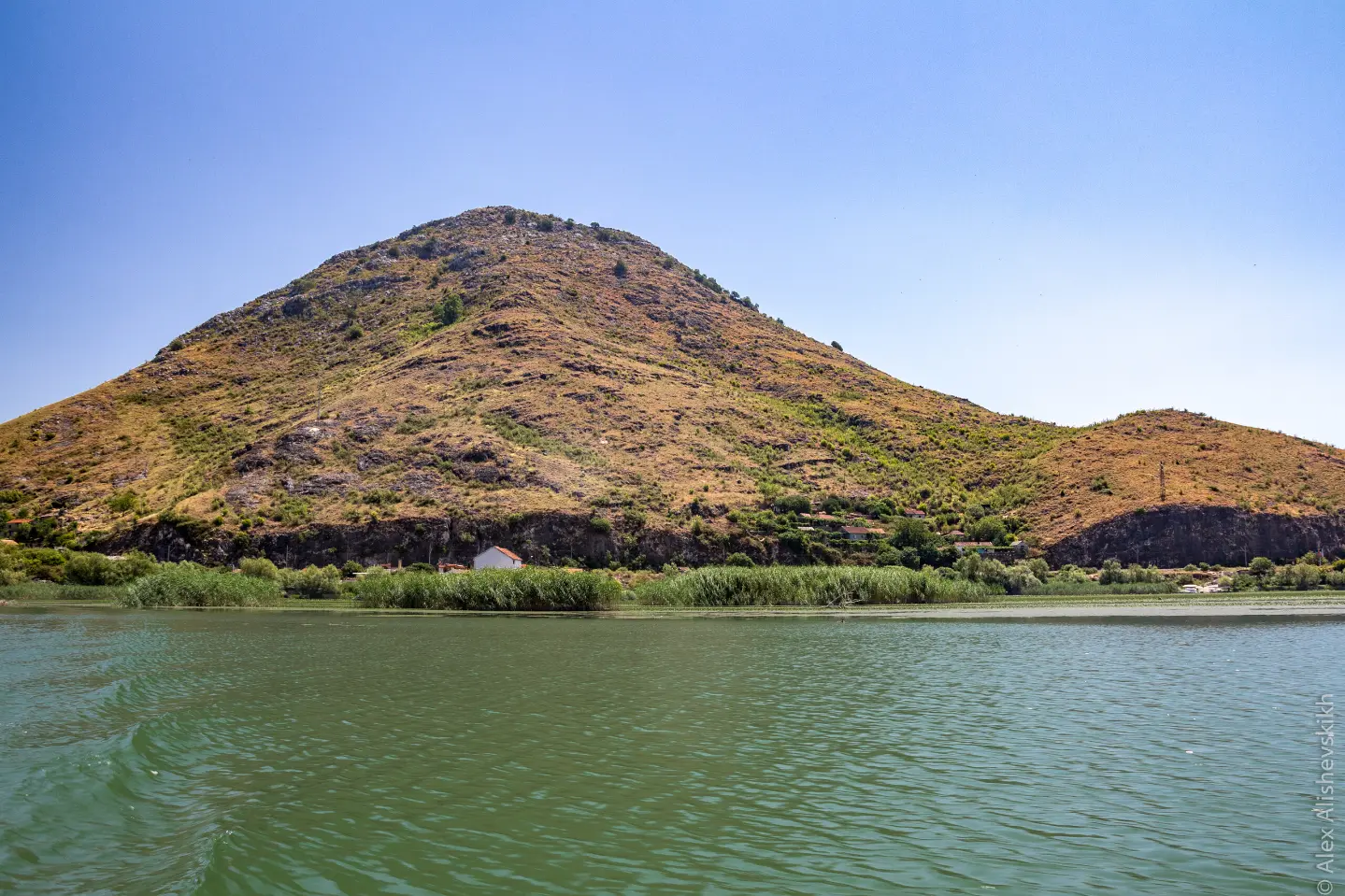
A short but demanding trail to the summit above Lake Skadar with impressive views.
The 1.4 km trail leads from Mala Venecia to Velji vrh (303 m a.s.l.) through Skadar Lake National Park. An ascent of 276 m over a short distance makes it demanding, but the reward is panoramic views of the lake.
The trail begins at the parking lot in Mala Venezija and immediately heads uphill through rocky terrain that dominates the entire route (82% of the surface). The first 600 metres lead to a viewpoint at 113 m above sea level – a good opportunity to catch your breath and take in the views of Lake Skadar.
From the viewpoint, the trail continues more steeply upward, and the rock becomes increasingly pronounced underfoot. Finally, after 1.4 km and a total ascent of 276 m, you arrive at Velji vrh (303 m a.s.l.), from where a view of the lake and the surrounding landscape of Skadar Lake National Park unfolds.
The trail is marked with red-and-white waymarks and runs in one direction only – return by the same route or by organised transport. According to the SAC scale it is rated T3, meaning it requires hiking boots and basic experience on rocky terrain.
It is suitable for more experienced hikers and mountain enthusiasts looking for a short but physically demanding challenge with attractive views.
What this difficulty means
Steep, rocky or exposed passages and a long day out. For fit, sure-footed hikers with mountain experience.
Mountain hiking grade SAC T3 (scale T1–T6).
Move along the profile to follow the route on the map; switch on 3D for the terrain.
↑ 276 m · ↓ 0 m · highest point 297 m
Along the way
The endpoint of the trail and its most important goal. From the summit, a view of Lake Skadar and the surrounding national park opens up.
Halfway along the route there is a viewpoint at 113 m above sea level – an ideal spot for a short break and first views of the lake.
The entire trail passes through the protected area of Skadar Lake National Park, one of the largest lakes in the Balkans.
The trail starts directly from the parking lot in Mala Venezija, allowing easy access without any additional walk to the starting point.
Wear hiking boots with a good sole – rocky terrain is dominant and can be slippery.
Bring enough water, as there are no known water sources along the trail.
Set off in the morning to avoid the midday heat, especially in summer.
The trail is one-way – plan your return in advance (same route or organised transport).
Keep a light windproof jacket handy, as it can be windy at the summit.
In an emergency, call the emergency services on 112.
Rocky terrain and a steep ascent require caution at every step, especially in wet weather. In the event of a sudden thunderstorm or fog, stop your ascent and return safely. In emergencies, call 112.
Emergency number in Montenegro: 112.
Good to know
Best season
The trail is accessible for most of the year. Spring and autumn are recommended due to moderate temperatures, while in summer you should account for intense heat on the rocky terrain.
Getting there
The trail begins at the parking lot in Mala Venezija. The closest landmark is Lesendro Fortress, located about 1.2 km from the start of the trail.
The trail is 1.4 km long and runs in one direction only, from Mala Venezija to Velji vrh.
The estimated walking duration without breaks is about 1 h 5 min. The total ascent is 276 m.
The trail is rated as demanding, and according to the SAC hiking scale it is classified in category T3. It is recommended for more experienced hikers with appropriate equipment.
Yes, the trail is marked with red-and-white markings along its entire length.
Hiking · Lesendro Fortress · Lake Skadar
Hiking · Lesendro Fortress · Lake Skadar
Cycling · Žabljak Crnojevića · Lake Skadar
Cycling · Rose, Luštica · Lovćen National Park

Hiking · Petrovac Beach · Lake Skadar
Hiking · Lesendro Fortress · Lake Skadar
Cycling · Lake Skadar
Cycling · Besac Fortress · Lake Skadar
Times and grades are estimates. Conditions change: check the weather and local information before you set out. Map and data sources →

