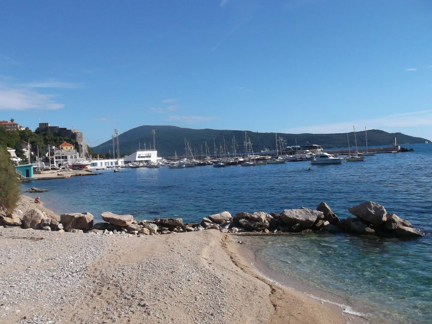
A leisurely coastal walk past fortresses, viewpoints, and the Bay of Kotor.
The 7.1 km trail runs from Igalo through Herceg Novi to Zelenika along the shore of the Bay of Kotor. It is easy, mostly on asphalt, and suitable for the whole family throughout almost the entire year.
The Pet Danica Promenade is one of the most beautiful coastal walkways in Montenegro. The trail starts in Igalo and leads towards Herceg Novi, passing directly alongside the fortresses of Forte Mare and Kanli Kula and through the very centre of the town. The ascent is gentle — 128 m in total — so the trail requires no special physical preparation.
Around the 2 km mark there is a viewpoint overlooking the bay, and not far from it is the Tinturija spring. On the section between km 3 and km 3.5, the trail reaches its highest point (93 m a.s.l.) and offers another viewpoint, ideal for a rest and photography. This section also has two drinking-water fountains.
After the descent, the trail continues towards Meljine and Zelenika, where it ends. The surface is mainly asphalt and concrete (72%), with shorter gravel and dirt sections. The trail is one-way, so it is advisable to arrange transport to the starting point or a return from Zelenika.
It is suitable for walkers of all ages, including older adults and families with children.
What this difficulty means
Well-made paths with gentle gradients. Fine for families and anyone used to walking a few hours.
Move along the profile to follow the route on the map; switch on 3D for the terrain.
↑ 128 m · ↓ 140 m · highest point 93 m
Along the way
The trail passes directly alongside the fortresses of Forte Mare and Kanli Kula, while the fortress of Španjola is approximately 0.5 km from the route.
At approximately km 2 and km 3.3 from the starting point, there are two viewpoints overlooking the Bay of Kotor.
At 2.1 km from the start of the trail is the Tinturija spring, an interesting spot for a short rest.
On the section between km 0.9 and km 3.1 there are three drinking-water fountains, which makes walking easier during the warm months.
Towards the end of the trail, the route passes right alongside Meljine beach, and near the finish point there is also Zelenika beach.
The trail is one-way — arrange your return from Zelenika in advance, or leave a vehicle at the destination.
There are drinking-water fountains along the trail, but bring your own bottle as well, especially in summer.
Wear comfortable walking shoes; trainers are perfectly sufficient for this trail.
Set off in the morning to avoid the midday heat during the summer months (July and August are outside the recommended season).
Wear sunscreen and a hat — most of the trail is exposed to the sun.
The trail is suitable for children and older adults, but watch out for traffic on the asphalt sections.
The trail is easy and mostly on asphalt, with no mountaineering risks. On gravel and dirt sections, be careful in wet weather. In an emergency, call 112.
Emergency number in Montenegro: 112.
Good to know
Best season
The trail is open and recommended almost all year round — from January to June and from September to December. In July and August, high temperatures can make walking more difficult.
Getting there
The trail begins in Igalo, near Igalo Beach, which is approximately 0.5 km from the starting point. Igalo is well connected to Herceg Novi and the surrounding area.
The trail is 7.1 km long. The estimated walking time without breaks is 2 h 10 min.
The trail is rated as easy. The total ascent is 128 m, and the highest point is 93 m above sea level.
The trail is suitable throughout the year except for July and August — January, February, March, April, May, June, September, October, November and December are recommended.
No — the trail is one-way, starting in Igalo and ending in Zelenika. You will need to arrange a return journey.

195 km↑ 3,259 m2–3 days
2.5 km↑ 145 m45–65 min
88.4 km↑ 4,606 m4–6 days

406 km↑ 10,191 m6–8 days
5.1 km↑ 16 m1½–2 h
14.8 km↑ 1,468 m7–10 h
0.5 km↑ 135 m25–35 min
1.1 km40–55 min
Times and grades are estimates. Conditions change: check the weather and local information before you set out.

Ask about Montenegro
Ask me about destinations, restaurants or activities.
