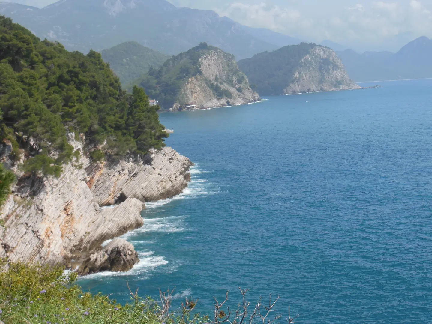
A short and easy walk from Petrovac to Perazića Do, with viewpoints and beaches nearby.
An easy one-way footpath 1.2 km long connects Petrovac and Perazića Do. In 35 minutes of walking it offers two viewpoints, a camp and passes by Petrovac and Perazića Do beaches.
An easy one-way footpath connects Petrovac and Perazića Do. It is 1.2 km long, with a total ascent of 73 m and a descent of 88 m. The lowest point is at 6 m above sea level, and the highest at 68 m above sea level. The start is near Petrovac (about 0.6 km), and the estimated duration without breaks is 35 minutes.
The trail mostly follows an asphalt or concrete surface (90%), while one tenth is walked on a dirt or forest path. The trail is marked. Already 0.1 km from the start there are two viewpoints and a parking area, and at 0.2 km there is the “Place for tent” camp. The trail passes by Petrovac Beach and Perazića Do Beach.
Nearby are also Lučice, Drobni Pijesak and Buljarica beaches. Due to the short section and gentle terrain, the trail is suitable for recreational walkers and easy strolls. The end of the trail is not at the same place as the start, so the return should be planned in advance.
What this difficulty means
Well-made paths with gentle gradients. Fine for families and anyone used to walking a few hours.
Move along the profile to follow the route on the map; switch on 3D for the terrain.
↑ 73 m · ↓ 88 m · highest point 68 m
Along the way
At 0.1 km from the start there is a viewpoint at 25 m above sea level.
At 0.1 km from the start there is also a viewpoint at 6 m above sea level.
At 0.2 km from the start, at 57 m above sea level, there is a camp.
The trail passes by Petrovac Beach, about 0.6 km from the trail.
The trail passes by Perazića Do Beach, about 0.3 km from the trail.
Bring enough water, especially in the warm months.
Wear light and comfortable footwear for asphalt and dirt surfaces.
Protect yourself from the sun and bring a cap or hat.
Check the weather forecast before setting off.
The trail is not circular – plan your return or transport in advance.
Parking is available at 0.1 km from the start, and the “Free Parking” car park at 1.2 km from the start.
The trail is short and easy, but in case of bad weather stop walking and take shelter in a safe place. Follow the markings and do not leave the trail. The emergency number in Montenegro is 112.
Emergency number in Montenegro: 112.
Good to know
Best season
The trail is at low elevation, so it is suitable from spring to autumn. In summer it is hottest, so an early start or late afternoon is recommended.
Getting there
The trailhead is about 0.6 km from Petrovac. At 0.1 km from the start of the trail there is a parking area.
The trail is 1.2 km long.
Estimated duration without breaks is 35 minutes.
The difficulty is easy, with a total ascent of 73 m and descent of 88 m.
No, the trail is one-way – the start and end are not at the same place.
Walking · Petrovac
Hiking · Kosmač Fortress
Hiking · Sveti Stefan
Hiking · Buljarica Beach
Hiking · Miločer Beach
Hiking · Haj-Nehaj Fortress
Walking · Miločer Beach
Hiking · Pržno Beach
Times and grades are estimates. Conditions change: check the weather and local information before you set out. Map and data sources →

